
The walk from Dunwich to Kessingland has potential to be amazing. That is, if the tide is out. If the tide is high when you reach Southwold, you are faced with a very long, arduous road detour. I did this detour, and highly regret it.
This post uses affiliate links. You can read the privacy policy or disclaimer for more info.
What to expect on the walk from Dunwich to Kessingland
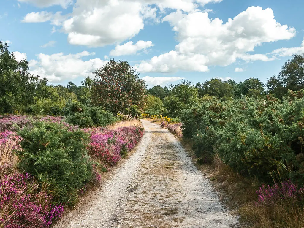
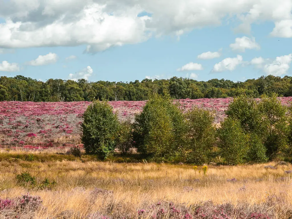
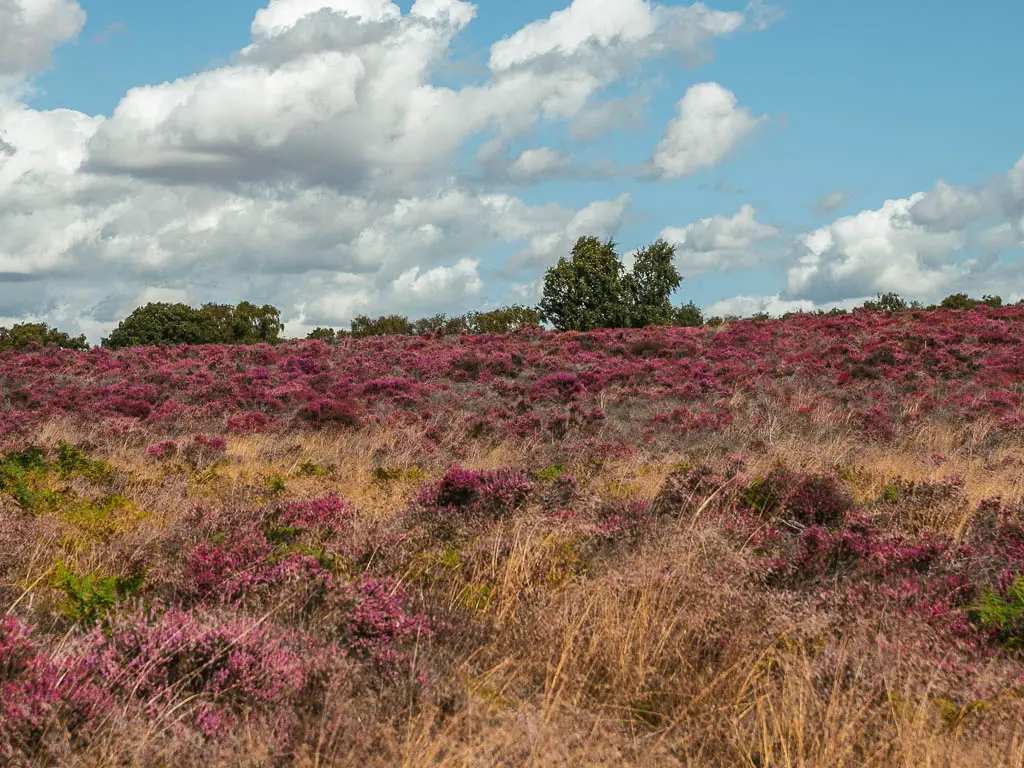
I actually started the walk from Dunwich to Kessingland from Westleton, about 3 miles inland. It was worth it for two reasons. First, the cheapest accomodation in Dunwich at the time was about £600. Second, is the heather.
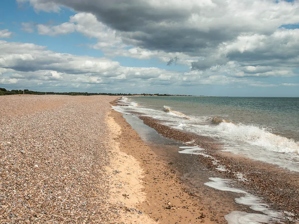
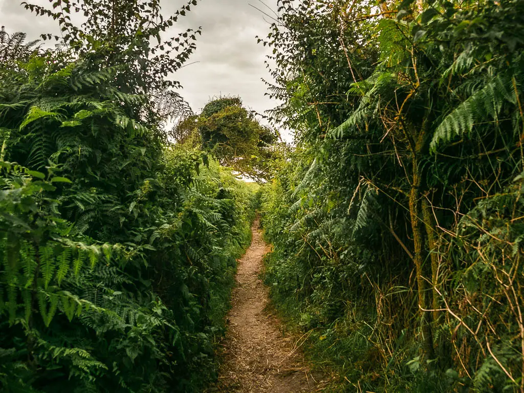
From Dunwich itself, the walk starts on either grass or shingle beach. You can pick the grass, but the shingle will soon catch up to you. If the tide isn’t too high you will have a bit of sand to walk on though.
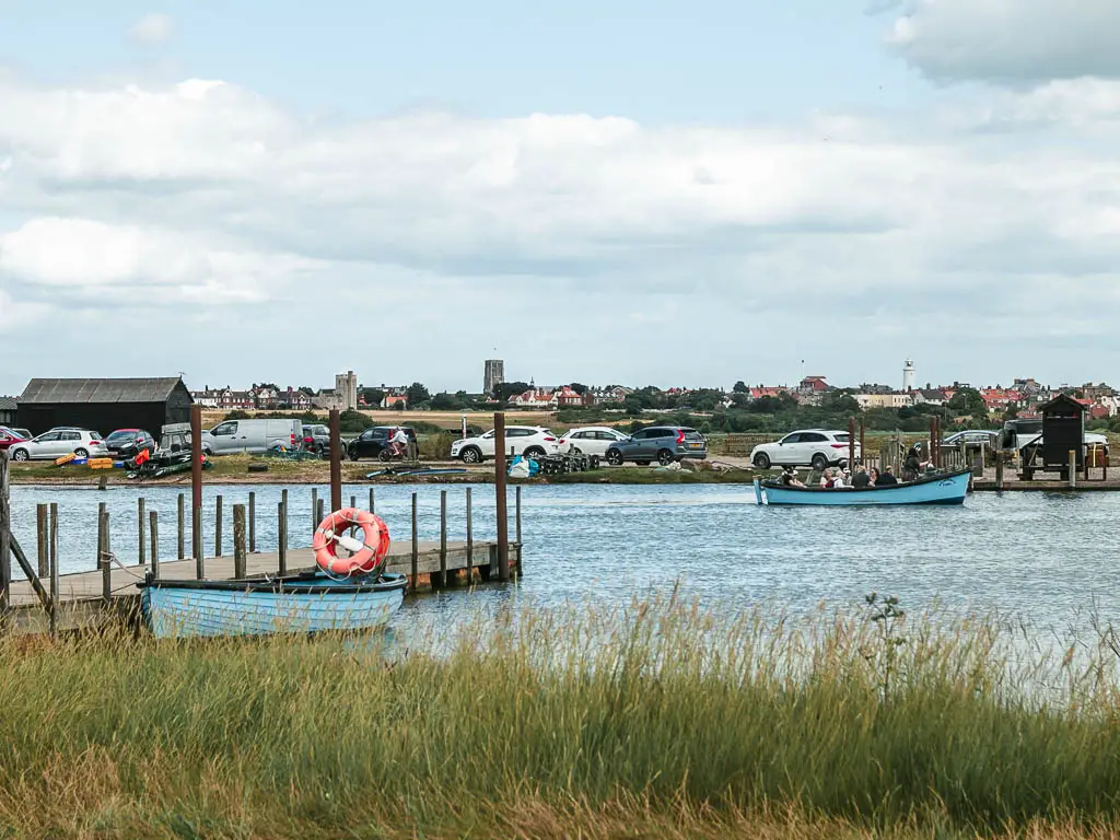
The first stop is Walberswick. From here you need to catch a ferry across to reach Southwold. It’s either a row boat, or motor boat depending on weather conditions and volume of people.
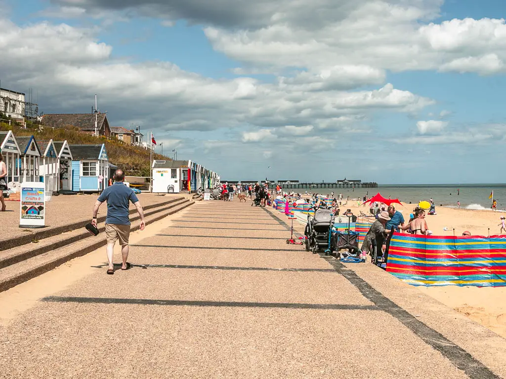
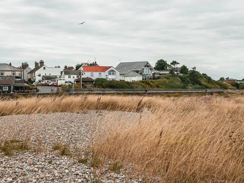
Southwold is busy. Very busy. It’s a sandy beach, and felt very typical British seaside with chippies and beach huts.
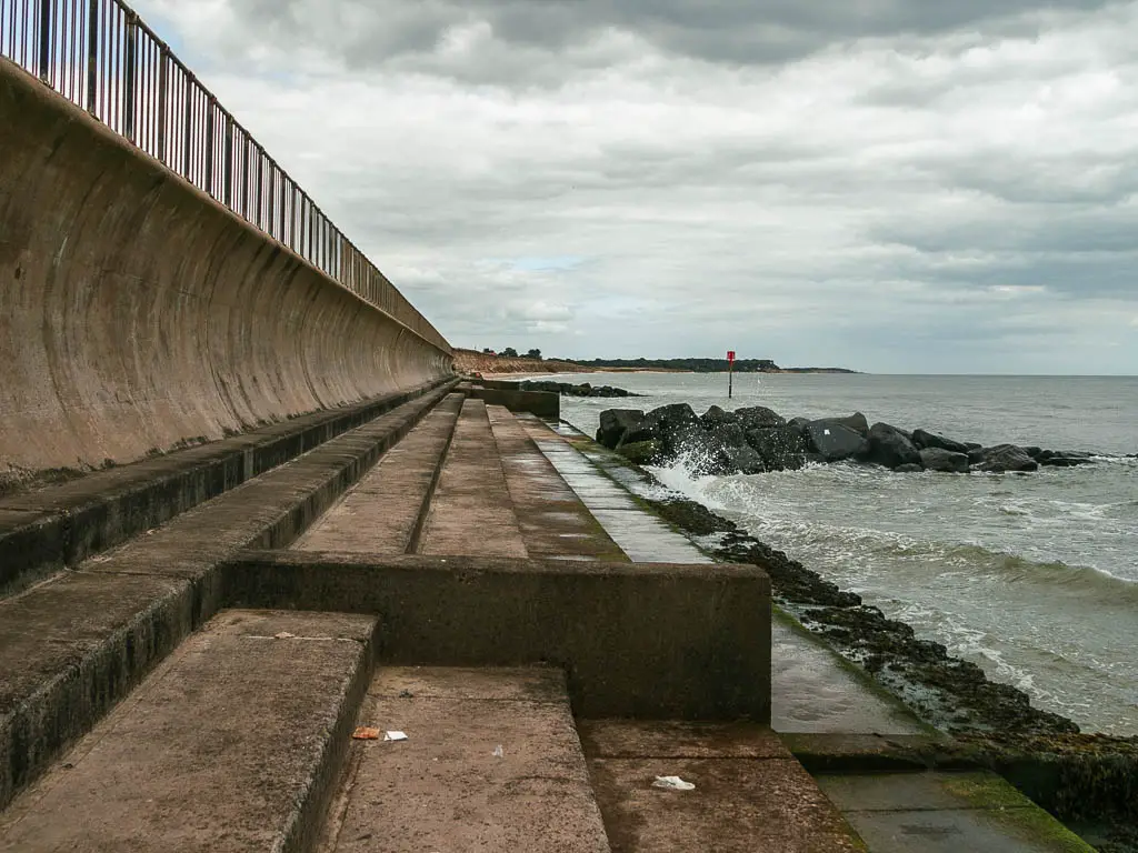
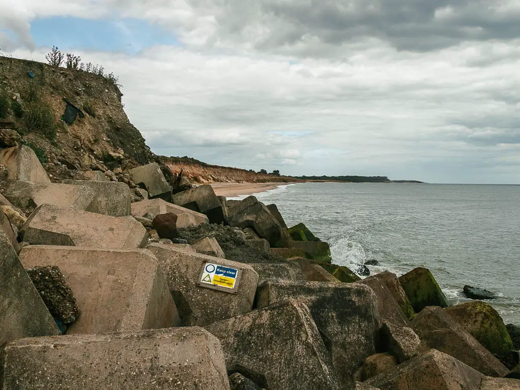
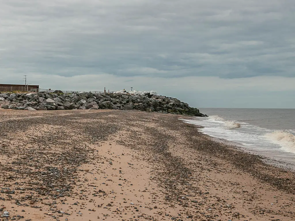
If the tide is out, you can then get past the rocks* to continue on beach for the rest of the walk to Kessingland. If it’s high, then this is where you detour. The detour is horrendous, and I highly recommend just waiting for the tide to go out again instead of taking it.
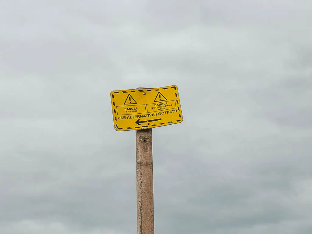
* I have been told by a local you can climb over the rocks, and there is a rope. There are many danger signs saying don’t cross the rocks. I couldn’t see the rope when I was there, but in hindsight, wish I’d looked harder. I have also been told by other people that you can’t walk across when the tide is out. So I’m not even sure anymore.
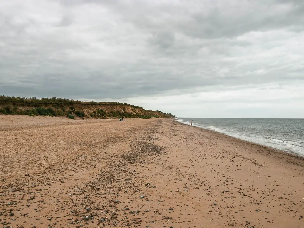
Whichever way you go, you will eventually reach Clovehithe, which is a lovey sandy beach, stretching for as far as the eye can see. Then when you reach Kessingland, the beach is shingle with a grass walking option.
Logistics
- Start: Dunwich, Suffolk. IP17 3DT.
- Finish: Kessingland, Suffolk. NR33 7SB.
- Distance: 14 miles with the high tide detour, 11 miles without + 3 miles if coming from Westleton.
- Time: 4h 30 min +1h if coming from Westleton.
- Difficulty: Moderate due to lots of shingle, and possibly road.
- Terrain: Sand, shingle, grass, road, boat.
- Time of year: I walked from Dunwich with Kessingland in early August.
Amenities
In Westleton there is a coffee shop, and the Westleton Crown is a pub.
In Dunwich there is the Flora Tea Rooms right next to the beach.
In Walberswick there is the highly rated Anchor Pub, and the Black dog Deli. Across the other side of the river in Southwold the Solebay Fish company, which is a highly rated fish and chips. Not like a normal chippy though. It’s a smokehouse which catch it’s own fish daily. Then as you head towards the pier there is a bunch of other stuff. More chippies, cafes, food kiosks.
In Kessingland, there is a Coop, or a pub and restaurant next to eachother by the beach.
Public transport
Nothing in Dunwich or Westleton.
In Kessingland there is the 99 coastal clipper which runs to Lowestoft.
The boat crossing in Walberswick coasts £2 and runs on demand, from March to Jan. Check here for up to date info and times.
Accommodation
I didn’t stay in Dunwich because it was very expensive when I did the walk. Having a look now, there is actually something affordable. It’s the Ship.
I stayed in Westleton about 3 miles inland, at the Westleton Crown. This was a gifted stay, and it is one of the nicest places I’ve stayed in.
In Kessingland I stayed in someone’s garden shed which cost £30. It was well worth it. Host was lovely, and anything i needed was provided. You can find it here on Air BnB.
Map for the walk from Dunwich to Kessingland
Read the previous day: Snape to Dunwich and Westleton day 4
Route Description: How to walk from Dunwich to Kessingland
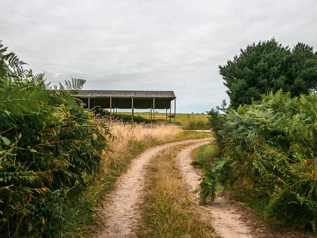
As I was starting from Westleton, I made my way back to Dunwich through Westleton Heath, seeing all the wonderful heather again.
When I reached Dunwich I wasn’t paying attention and went the wrong way. It was when I was partway up a hill I realised this wasn’t familiar. I don’t remember any hills. Checking my map I realised I was a walking in completely the wrong direction. I think this was an omen of what would transpire today.
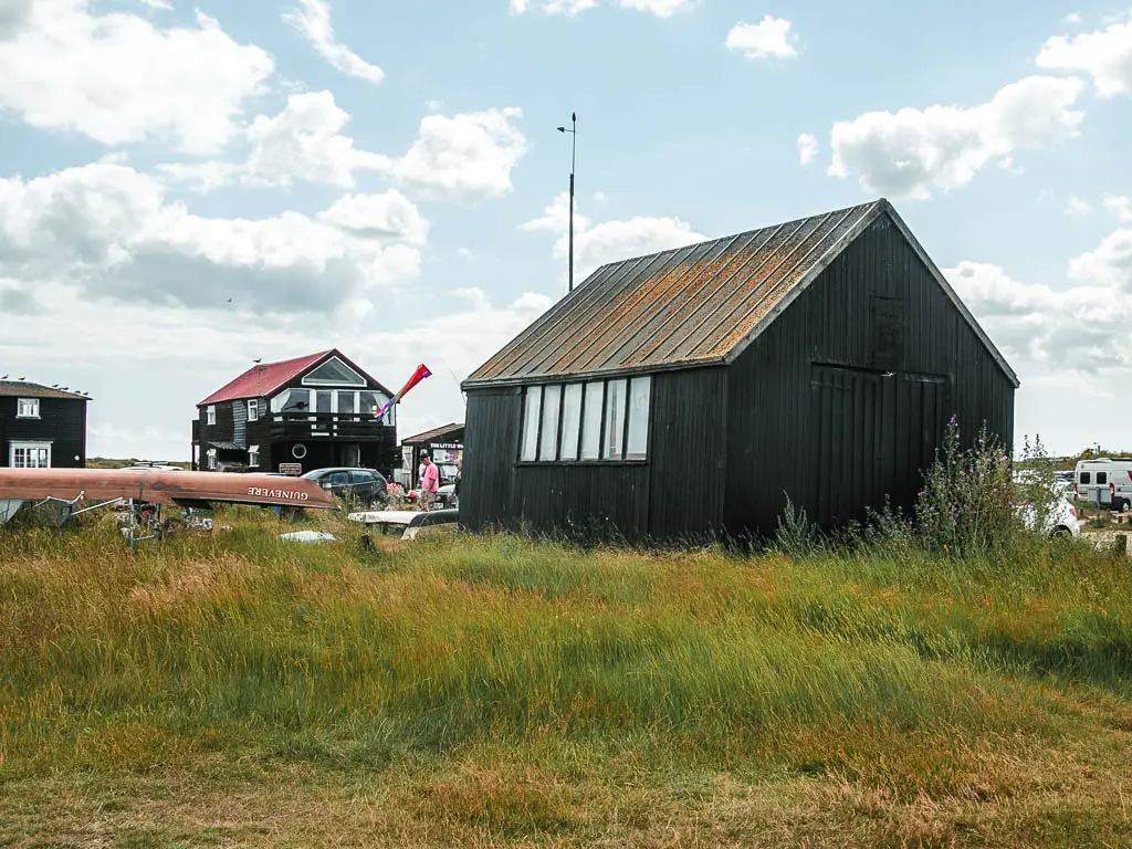
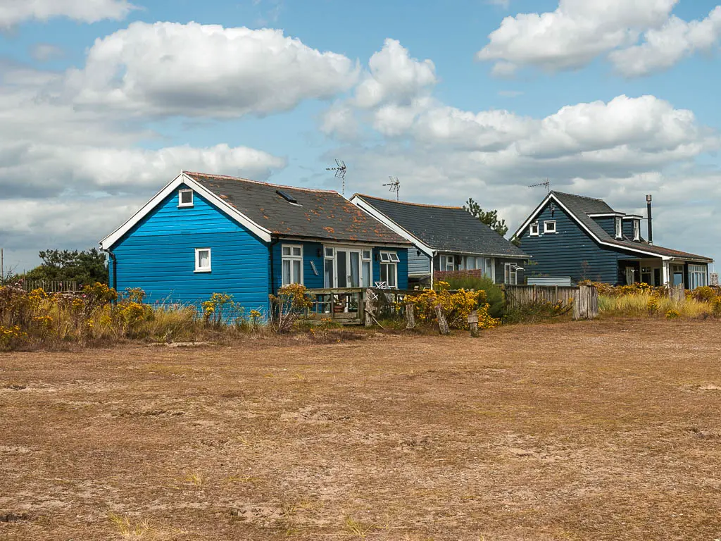
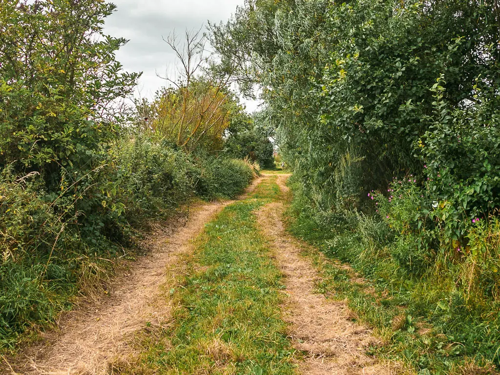
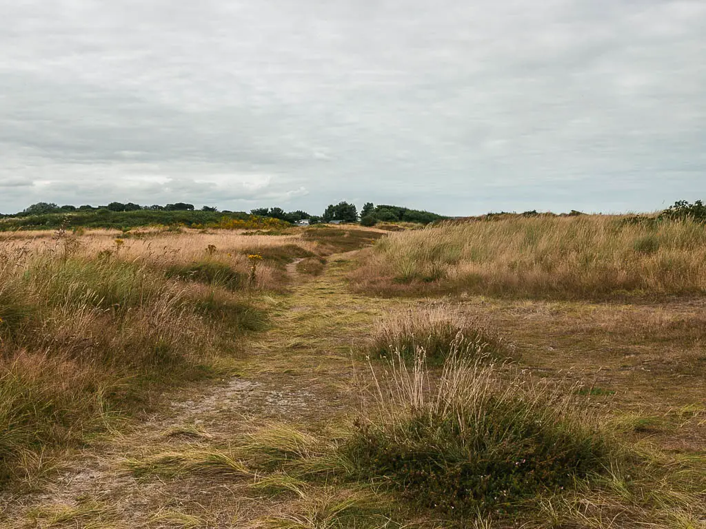
The start of the walk from Dunwich
Once I reached the beach, I chose not to walk on it, because you know, shingle. There is a lovely large patch of grass to walk on.
This doesn’t last though, and I eventually had to walk on the shingle.
Luckily the tide was out far enough that a strip of nice wet hard sand was uncovered, so I took that.
You follow this beach all the way to Walberswick.
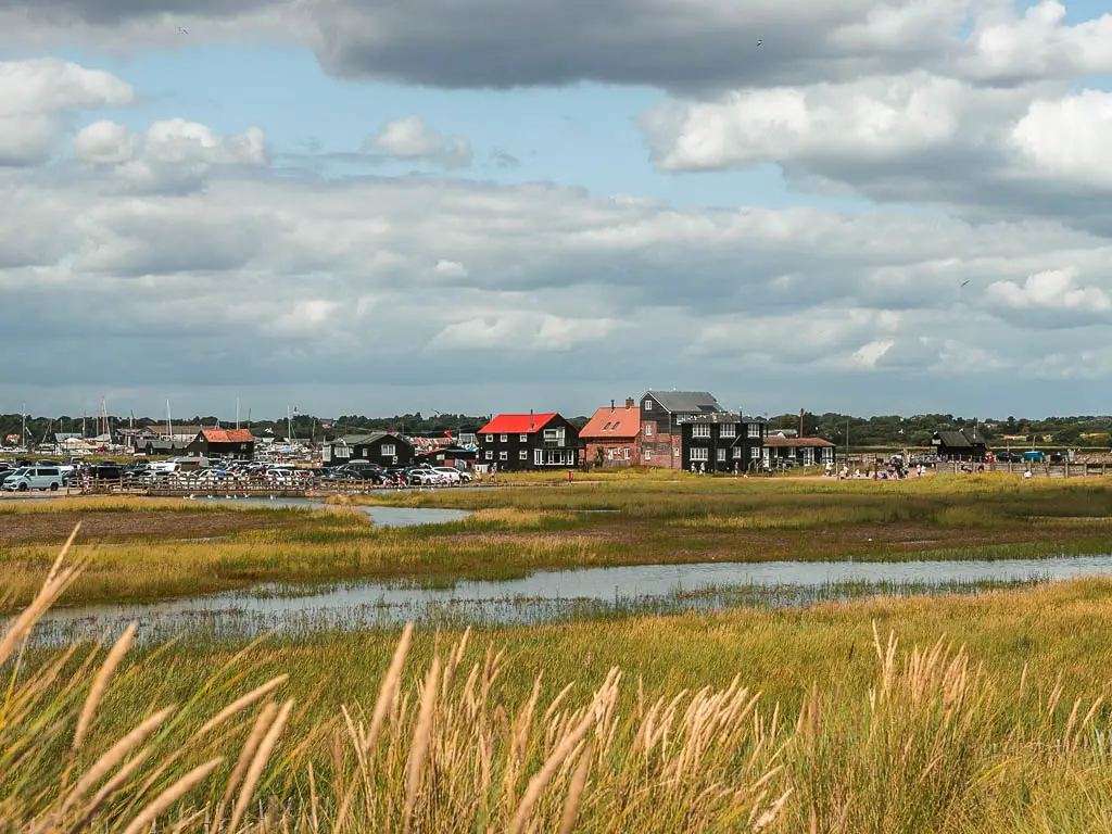
Walberswick and Southwold
At the end, turn left across the green, then you will need to get across the water…in two places.
The first one took me by surprise. There is a walkway bridge thing that doesnt lead right to the other side. Maybe if the tide was lower it would. But right now I had to jump across to get onto land.
Once across, keep following the main river, and this will lead you to the ferry crossing.
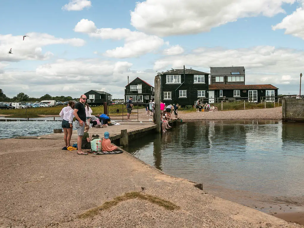
This boat was much busier than the previous boats I’ve gotten. In general, there were more people here than I’ve seen on the whole trip combined.
On the other side, you want to head back to the coast and follow it along. I was surprised to see it was a sandy beach. It amazed me how two beach’s separated by a river are complete different.
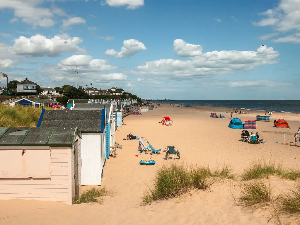
It was way too busy to hang out on though, so I continued on.
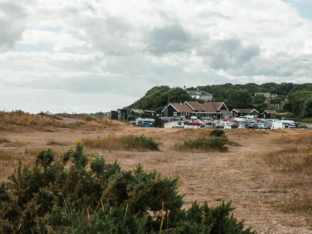
The dead end
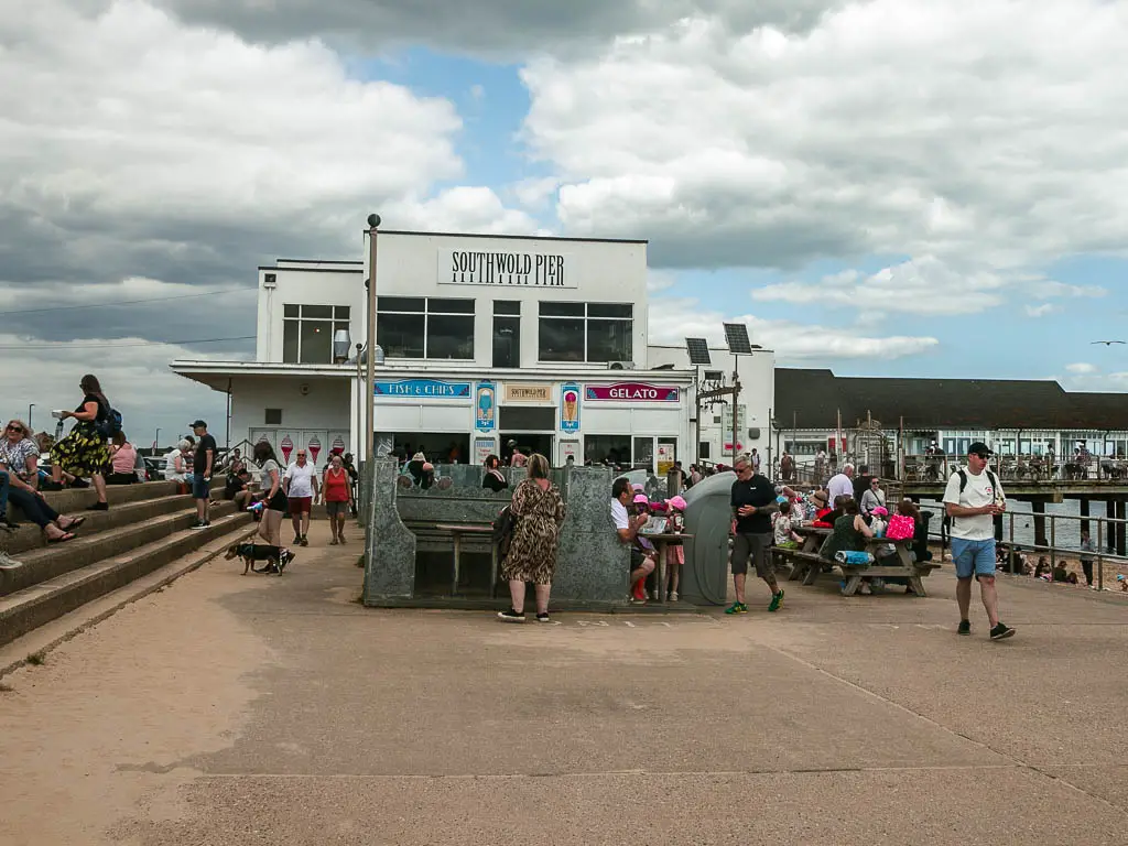
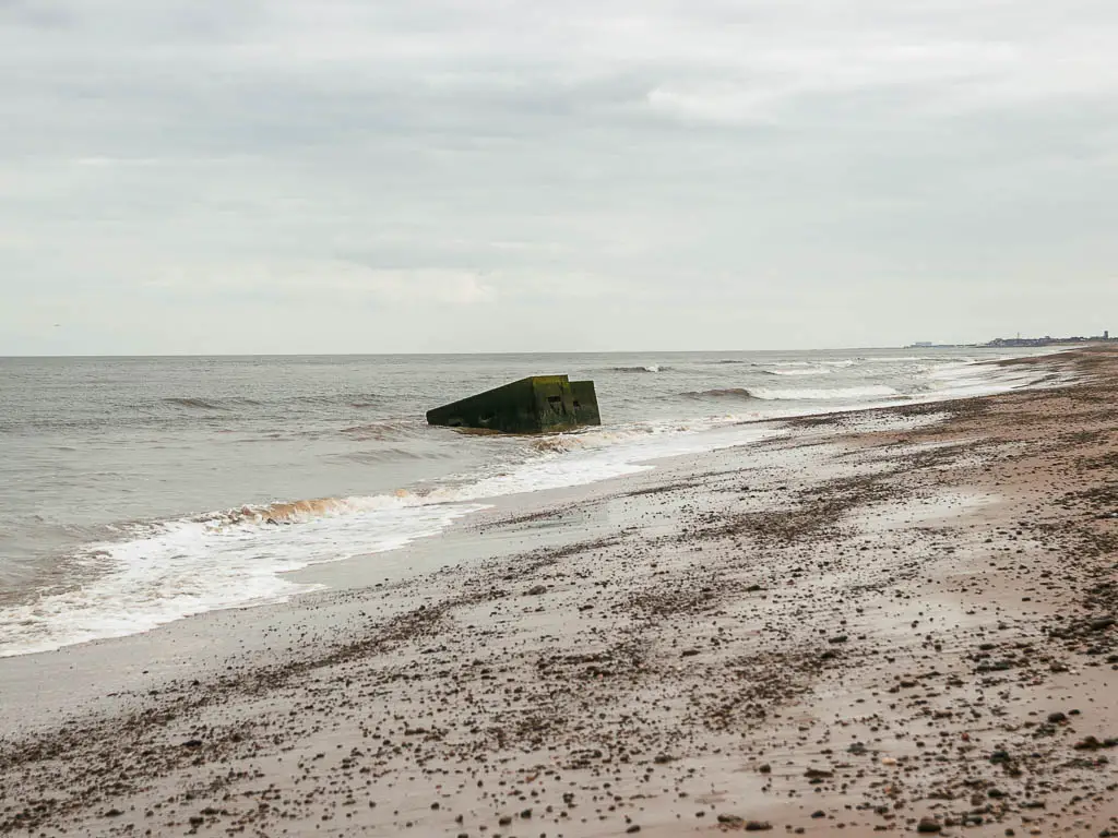
At the pier, I walked around and through the car park. There was no more beach as the tide was now too high.
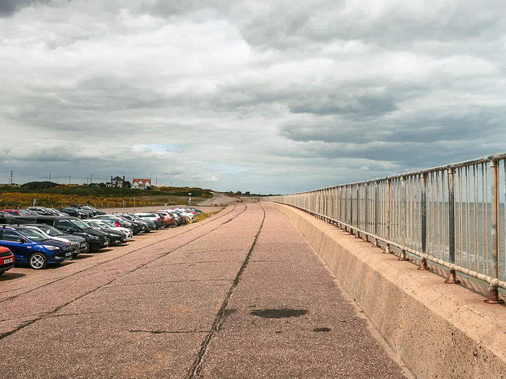
At the other end, the way I wanted to go was no entry. There was a trail to the left though. I looked at the map and saw the awful detour ahead of me, so instead I went down to the walkway by the sea to see if I could get across.
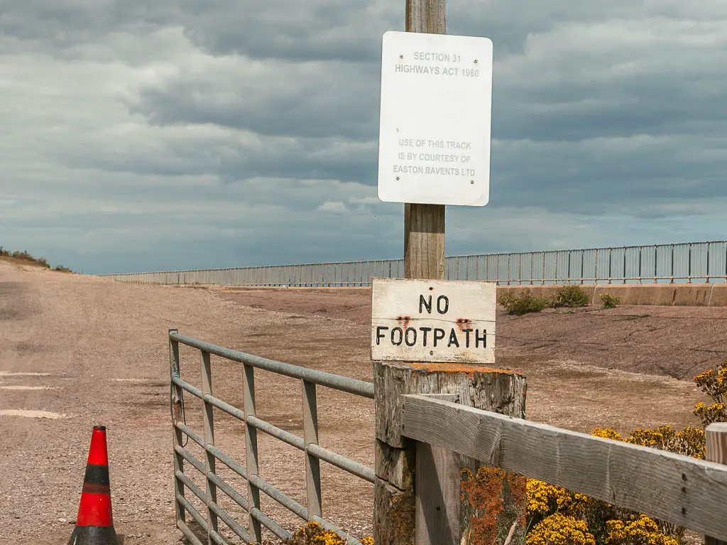
There was a mass of rocks at the end, with the beach I needed to get to just on the other side. I contemplated climbing over them. But there were so many danger signs about, I thought best not.
In hindsight, I should have just waited for the tide to go out again. Go and hang out on the beach for a few hours. What I chose to do instead, I highly regret.
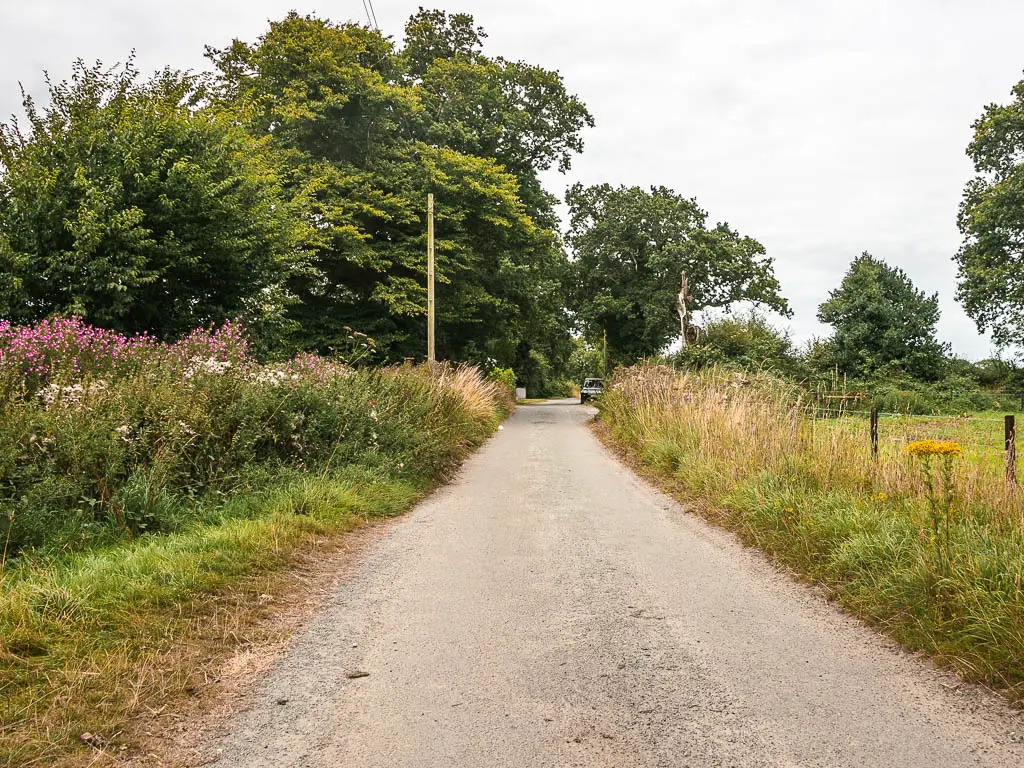
The road detour
I went back up to that trail, and my fate was sealed. I had seen a few places on the map where I could potentially get to the beach. So this was my plan.
This trail leads to the road, where I saw a Suffolk Coast path sign pointing left, or back the way I came. I didnt understand the left. That would take me on an even bigger detour, so I turned right.
I soon found out why.
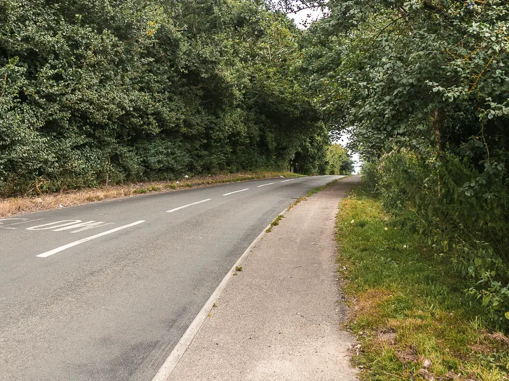
This right road very soon loses any walkway. So I needed to be on alert. I made sure to walk in the direction of oncoming traffic.
The first turn I came to which I thought might get me back to the beach was private. That was ok, because there was another turn further ahead. When I reached that turn it was also private no entry. My heart sank. I had no option now but to walk all the way to Clovehithe on road.
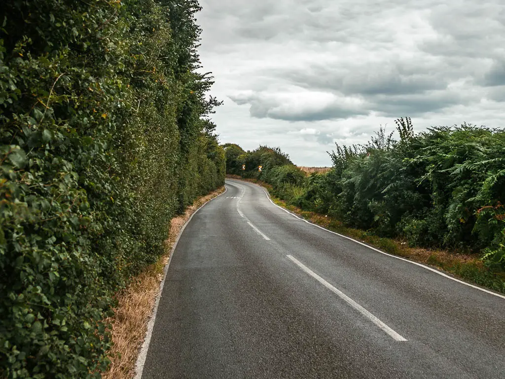
At times the road has blind bends, making it even more risky. And it just went on forever. I was really flagging. I passed a bus stop and considered taking it…but that would be cheating.
When the bus passed me later, I cursed myself for not taking it.
Walk to Clovehithe
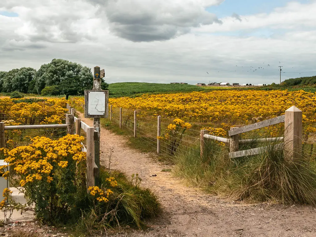
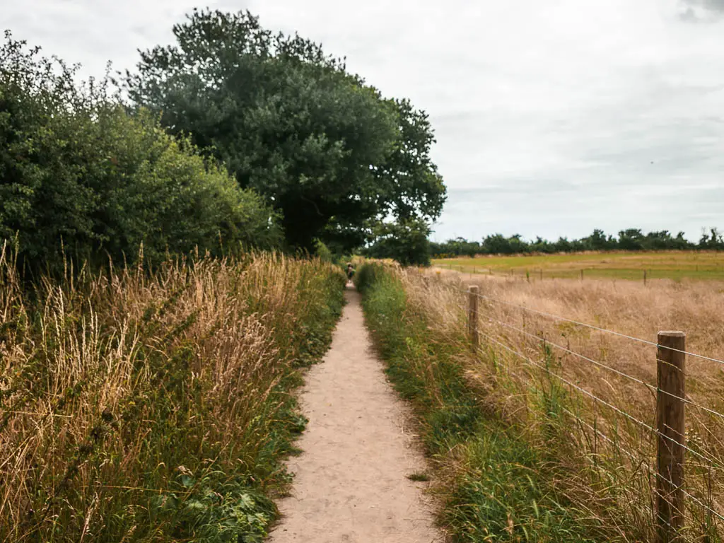
Eventually, after an eternity, there was a trail on the right. Which would lead me to Clovehithe. Still a way to go though.
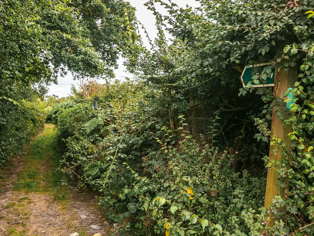
It’s first bush lined trail, then along the edge of field.
At the junction, I stuck to the left trail to reach the farm. Turned right at the farm, then left at the next junction.
When I reached the house, I took a right, and a long long road lead to Clovehithe.
Once I made it to Clovehithe, I realised the trail to get down to the beach would take me in the opposite direction. I was not happy. Extra walking.
When I made it to the beach, I stopped, had a snack, thought about how much my feet were hurting, then continued on.
Walk to Kessingland
It’s now beach all the way to walk to Kessingland. The silver lining was the tide was going out, revealing the wet hard sand to walk on. I might have cried if I had to walk on soft sand.
It’s a long way still. Or at least it felt long, after all that walking I had already done.
At the very end, of this beach I thought about taking a dip. Kessingland was just on the other side, and I didn’t want to break tradition of getting into the sea at the end of each day. But it looked pretty rough and uninviting. Then I saw a sign warning of danger. That’s all the convincing I needed.
At the end of the beach, I got up onto the road, to walk around the right side of some building, then there is a nice stretch of grass to reach Kessingland.
When I reached the point of turning in for the day. I thought about going back to the sea. Give the dip another attempt. The problem is, the beach on this side was shingle. Did I want to walk on shingle?
Before I knew it, my feet were taking me across it.
The sea was still rough, but it felt a bit safer here. People about, and no sinking sand.
Read next: Kessingland to Lowestoft Day 6 The final day!