
This walk follows the coast, from the *Seal spotting hotspot of Blakeney, to the large seaside town of Cromer.
*I did not spot any seals
The walk is arguably easy ( I will explain more in a moment), and you do have options to shorten it, as it’s well connected by bus.
If you would like more info on planning the whole coastal walk, you can read my Norfolk Coast Path guide here.
In this guide, I’m first going to give you a little overview of the walk between Blakeney and Cromer. This will be followed by logistics, a map, and accommodation, parking, and public transport info, and tips. I will then go on to describe the route step by step with photos.
This post uses affiliate links. You can read the privacy policy or disclaimer for more info.
What to expect on the walk from Blakeney to Cromer
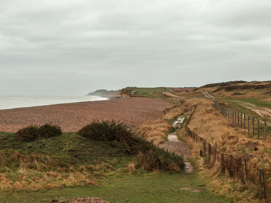
Shingle. Lots of it. This is why I hesitate to call the walk easy. If you have ever walked on shingle, you will know. Apart from that, you have a little bit of marshland, some windmills, a golf course, and some cliffs.
Yes, the cliffs. Now, Norfolk is known for being flat, but this bit of the coast would have you think otherwise. You do have to hike up to the top of them, but it’s not too bad (if you compare it to the South West Coast Path). Plus you get some great views from the top.
Despite the shingle, I did enjoy walking this section of the coast from Blakeney to Cromer.
Logistics
- Start: Blakeney, Norfolk. NR25 7NQ.
- Finish: Cromer, Norfolk. NR27 9AT.
- Distance: 15 miles
- Time: 5h10min
- Difficulty: Let’s go with moderate
- Terrain: Lots of shingle. Grass, dirt trail, concrete beachside walkway.
- Elevation: Flat for the first half, then some cliffs to walk up, then back down again.
- Dog friendly: Yes
Public Transport
Blakeney and Cromer are connected by the CH1 Coasthopper bus, which are hourly 7 days a week. Check the timetable here for up to date information. Journey time between the two is 45min. If at any point you want to shorten the walk, every so often there will be a trail leading you off the coast path to the main road where you can pick up a bus.
Comer is on a train line which goes to Norfolk. This train also goes to Sheringham (which is 11 miles into the walk between Blakeney and Cromer), if you want to stop the walk a bit earlier.
If you are coming from Hunstanton, or Kings Lynn (which is on a train line), you would first need to catch the 36 Coastliner bus to Wells next the Sea, then change onto the CH1 Coasthopper to reach Blakeney or Cromer.
Parking in Blakeney and Cromer
There is a free car park in Blakeney which is located conveniently next to the bus stop. Post code:NR25 7PG. It’s next to the Blakeney Parish Council.
If you want to pay for parking (why?), there is a car park next to the river right next to the trail (post code: NR25 7ND). It can flood though, so it’s risky. At least check the tide times. It’s National Trust, so free for members. If you are not a member, you have to pay.
In Cromer you have car parks or free street parking in places. Meadow Road car park, NR27 9DX. Cadogan Road car park, NR27 9HU. They are pay and display using cash, contactless, text message, or app. The cost is incremental up to 6h then 24h. As an example, at the time of writing it’s £6.30 for 5h.
Amenities
Blakeney has a number of places for refreshments. For good coffee you have the Folks Coffee Co. For baked goods you have the Two Magpies, and for more substantial pub food you have the White Horse Gastro Pub. There are also public toilets and a Spar.
In Cley, about 2.5 miles into the walk, there is a deli selling fresh local produce, and the Cley Smokehouse selling artisan smoked fish and meat.
11 miles in, you will reach Sheringham which is a bigger town with all the usuals. There is a nice little tea shop called the Whelk Copper Tea Rooms, and a food stall selling street food called Fat Teds Streat Food.
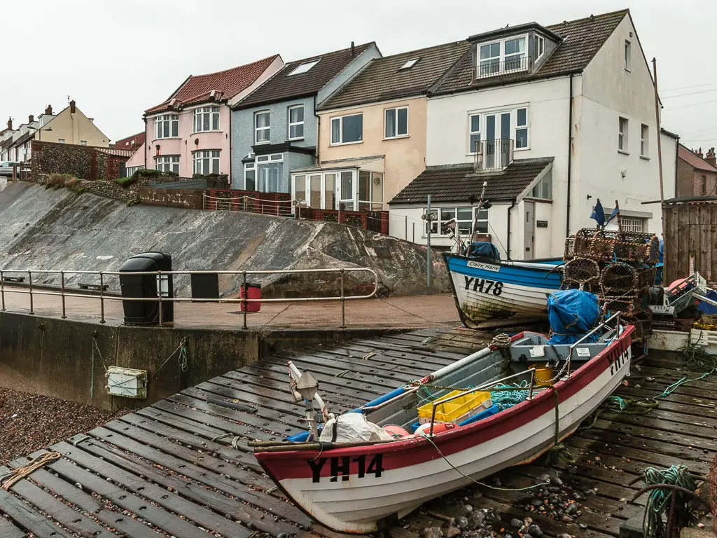
Then of course, you reach Cromer which is also a bigger town which also has lots of options, including a big Morrisons if you need more stuff. For some Cromer Crab to go, you could stop at the J Lee Crab Stall which is known for the dressed crab served in the shell.
Accommodation
If you are walking the whole coast path, and need somewhere to stay, both Blakeney and Cromer have numerous options. Cromer has more and you will find cheaper places to stay compared to Blakeney.
I actually stayed in Hunstanton, which has more budget friendly options than both.
Once I reached Cromer, I got the bus back to my car in Blakeney and actually drove down to spend the night in Great Yarmouth. Very long winded, but I had a good reason for it. I won’t go into the details here, but will explain why in by bigger guide on walking the coast path which I will write soon. If you are not doing the Blakeney to Cromer walk (or rather the whole coast) by car, then you don’t need to worry about it, and can ignore.
Map for the walk from Blakeney to Cromer
Tips for the walk between Blakeney and Cromer
- If you can time it for when the tide is out, you can avoid the shingle. Check the tide times here.
- Later on in the walk, after Sheringham, the official route goes along the clifftop. If the tide is out, you can walk along the beach all the way to Cromer. Make sure the tide is not on its way in though. You can get cut off along here. Check the tide times here.
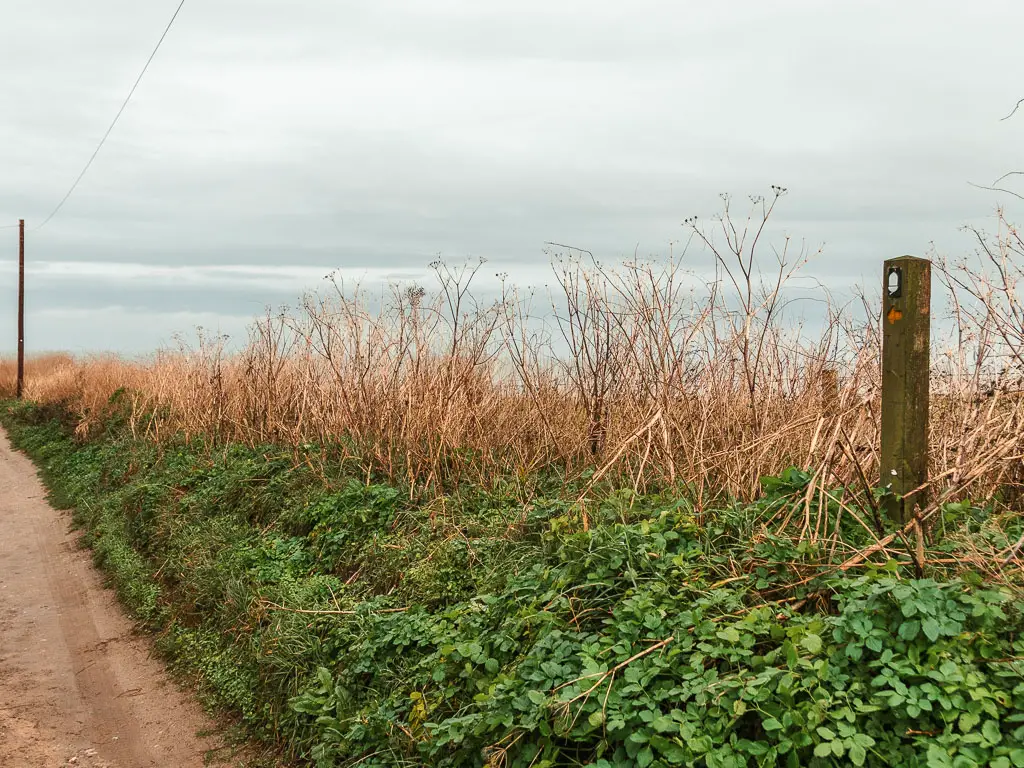
- Signposting wasn’t always obvious, and I missed it later on.
- If you want to try to find some seals, there are various tours that take you from Blakeney. Alternatively, you might find some if you walk along the beach in the opposite direction to this route. I was told before heading out that they were there. I did not fancy the extra walking on shingle though.
Read about yesterday: Day 2 Burnham Overy Staithe to Blakeney
Route Description: Walk from Blakeney to Cromer
I set off early today to walk from Blakeney to Cromer. There was a lot of rain forecast from about midday, so I wanted to cover as much ground as possible before that happened.
I didn’t tape my toe, but the turmeric and volterol gel must have worked, because I was in no pain (yet). My feet were actually feeling pretty good, considering how much I had walked so far. I had been making sure to stretch at the end of each day, including foot stretches. It seems stretching really does work.
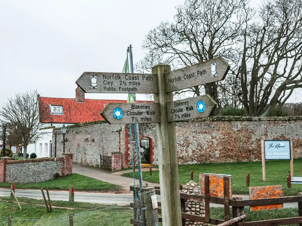
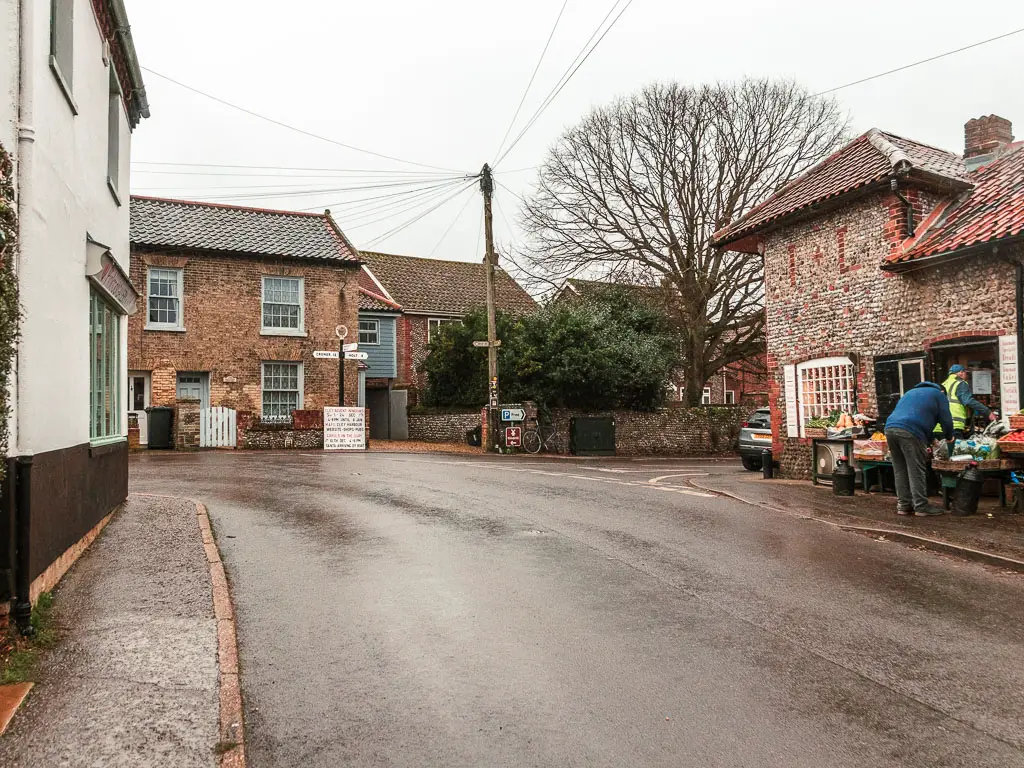
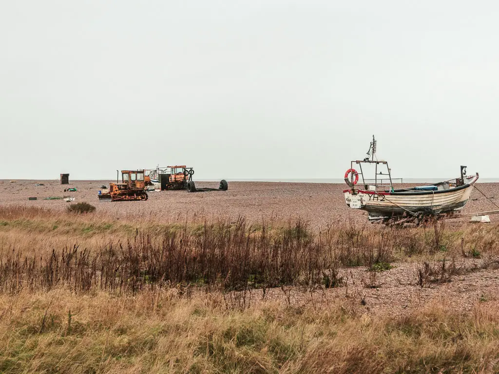
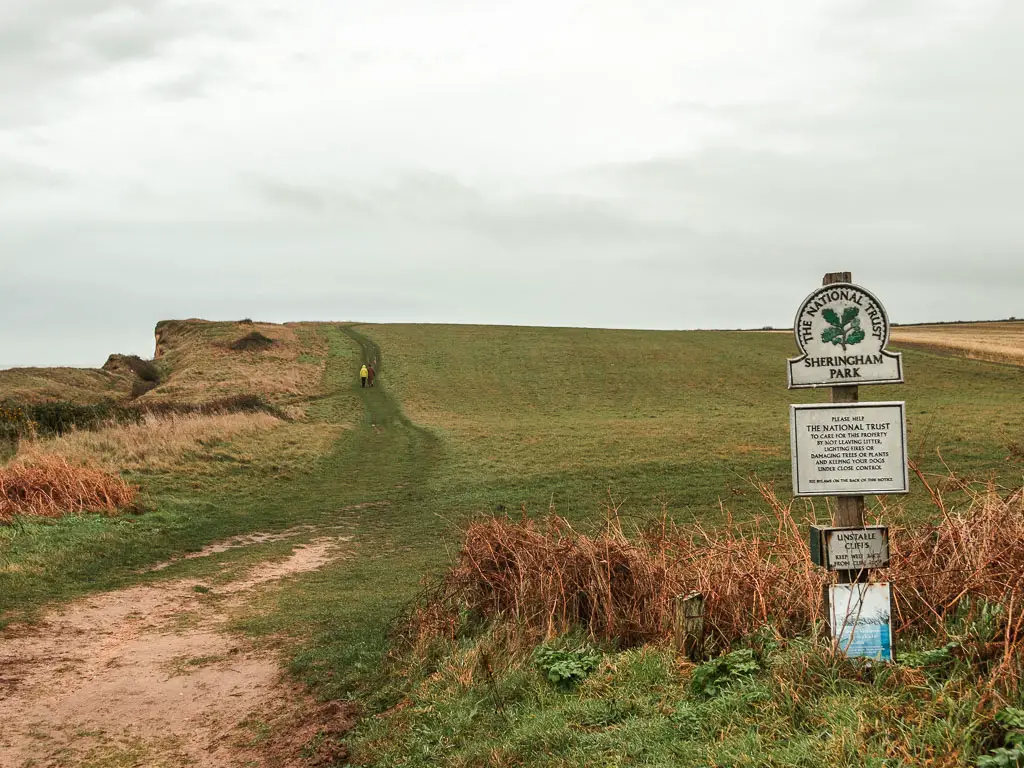
Start the walk from Blakeney to Cromer
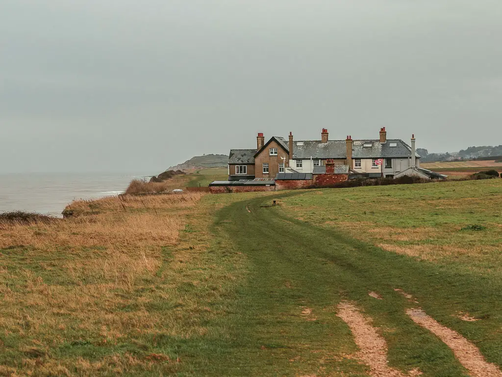
From the main road in Blakeney, walk along Westgate Street (it’s near the bus stop) to reach the river.
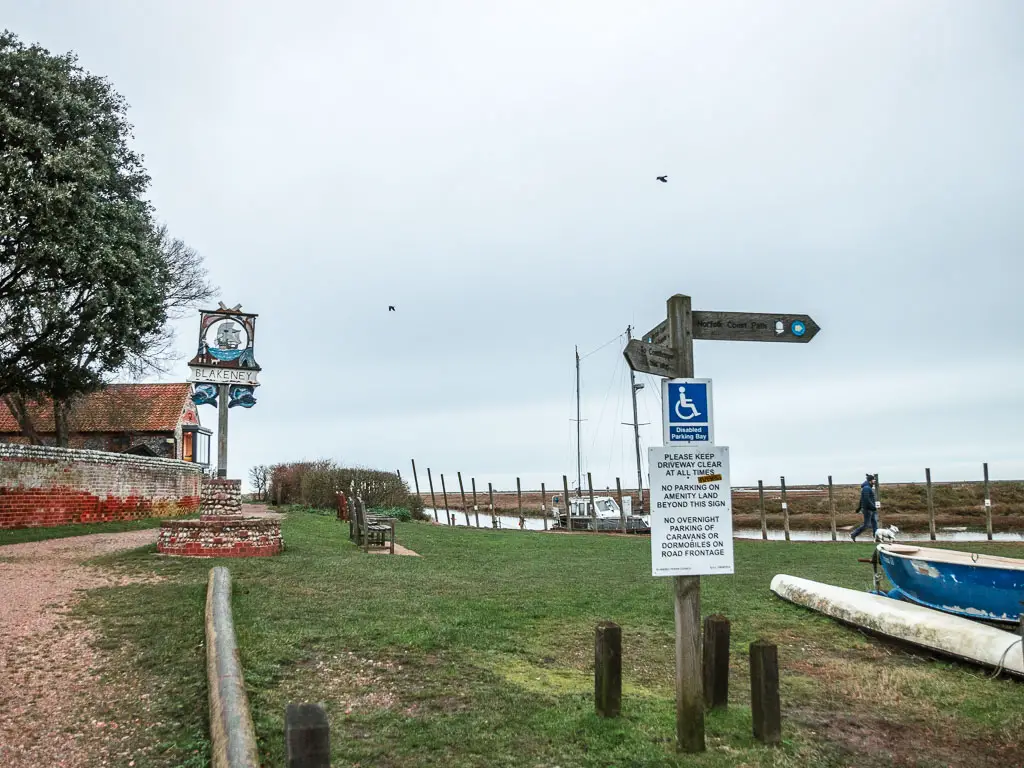
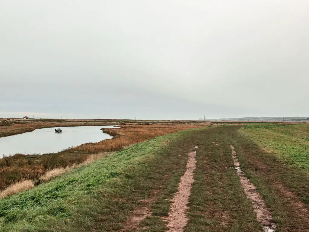
Turn right here and continue to follow the water line to reach the ridge.
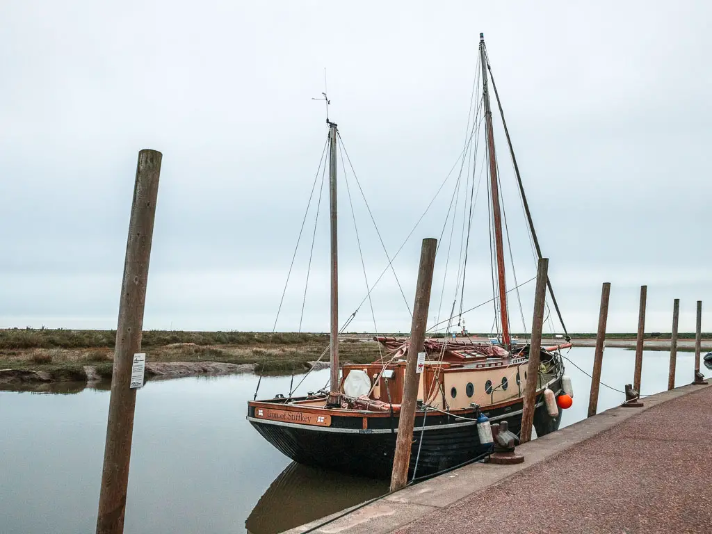
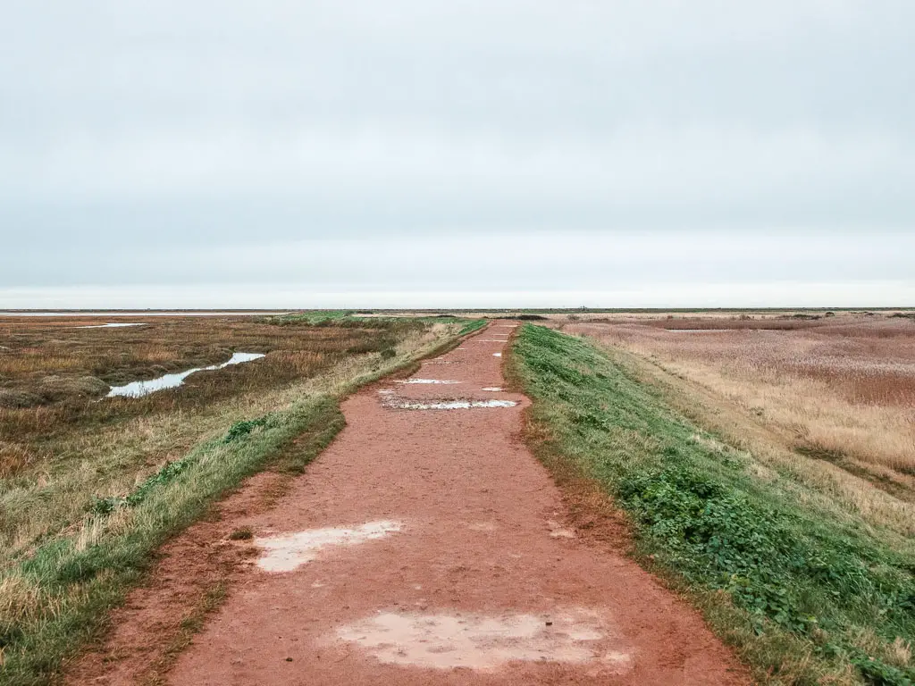
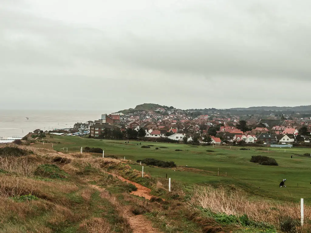
From here you do a big loop, surrounded by the marshes, all the way to *Cley-Next-the-Sea.
*pronounced Clie (or Cl-eye. Like eye ball).
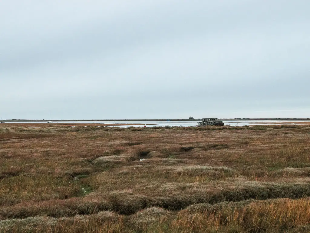
You will get a bit of a view to the beach from here. I had a strong look to see if I could see any seals. I had heard that right about here, there were so many baby seals that they had to close the beach off recently.
I didn’t see any.
I managed about a mile before I started to feel my toe again. I cursed myself for not taping it, and hoped for the best. It was also around here that it started to rain. A few hours earlier than expected.
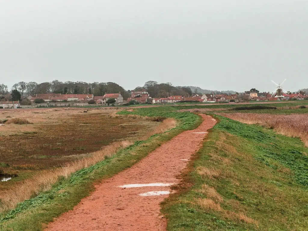
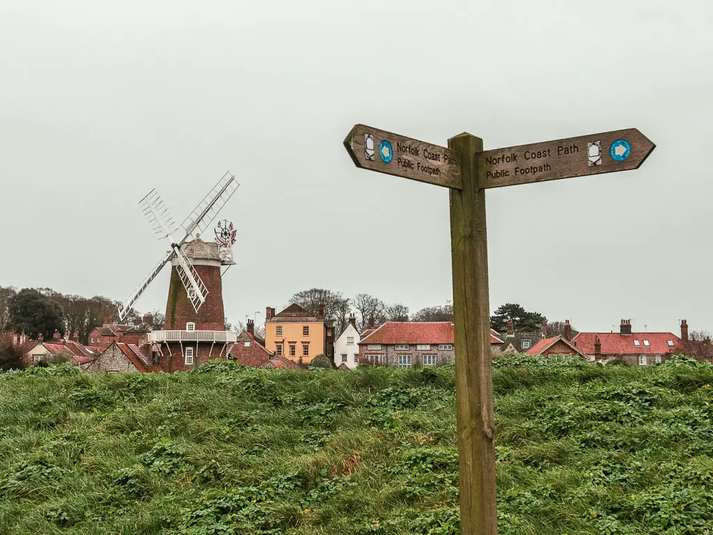
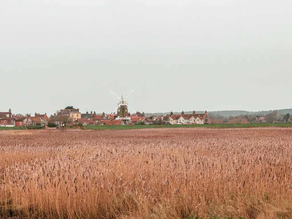
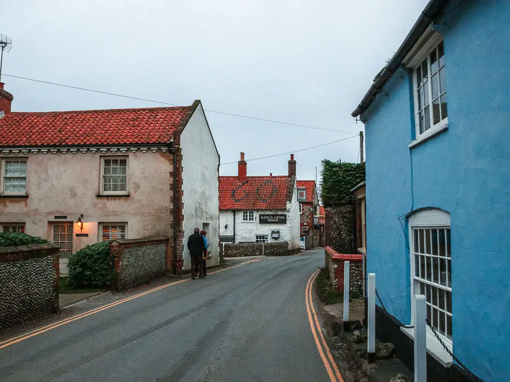
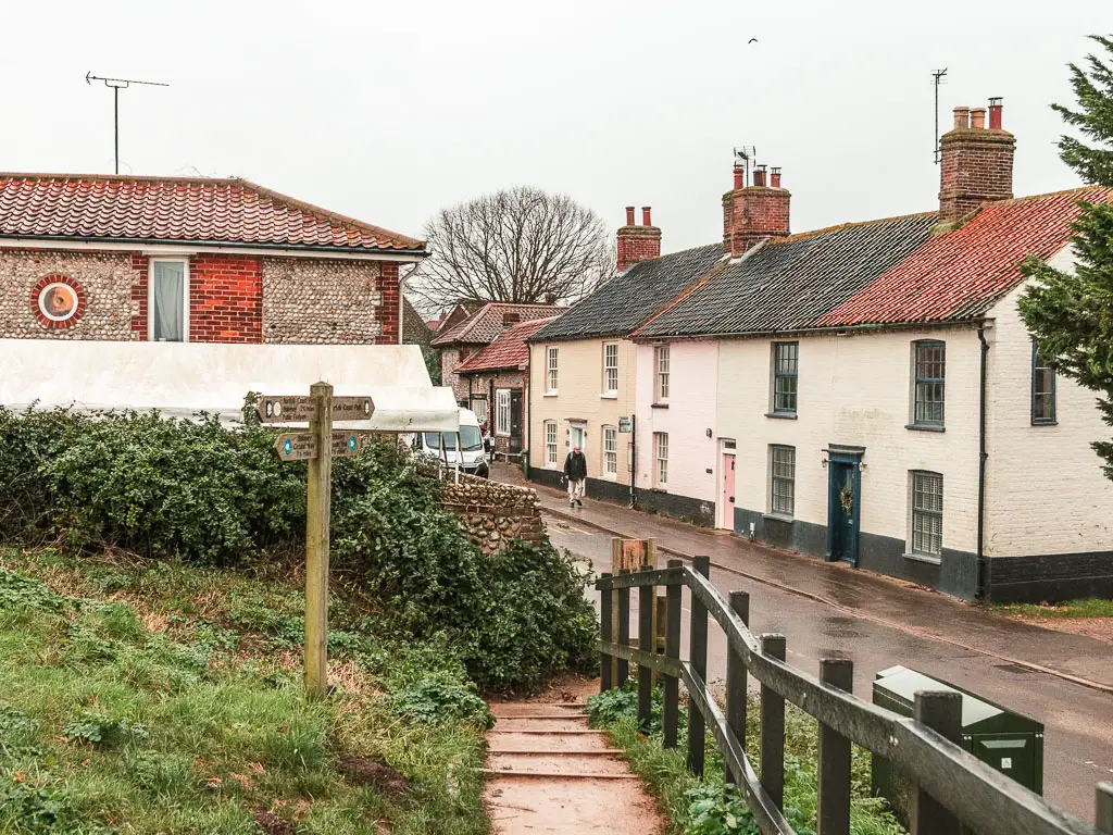
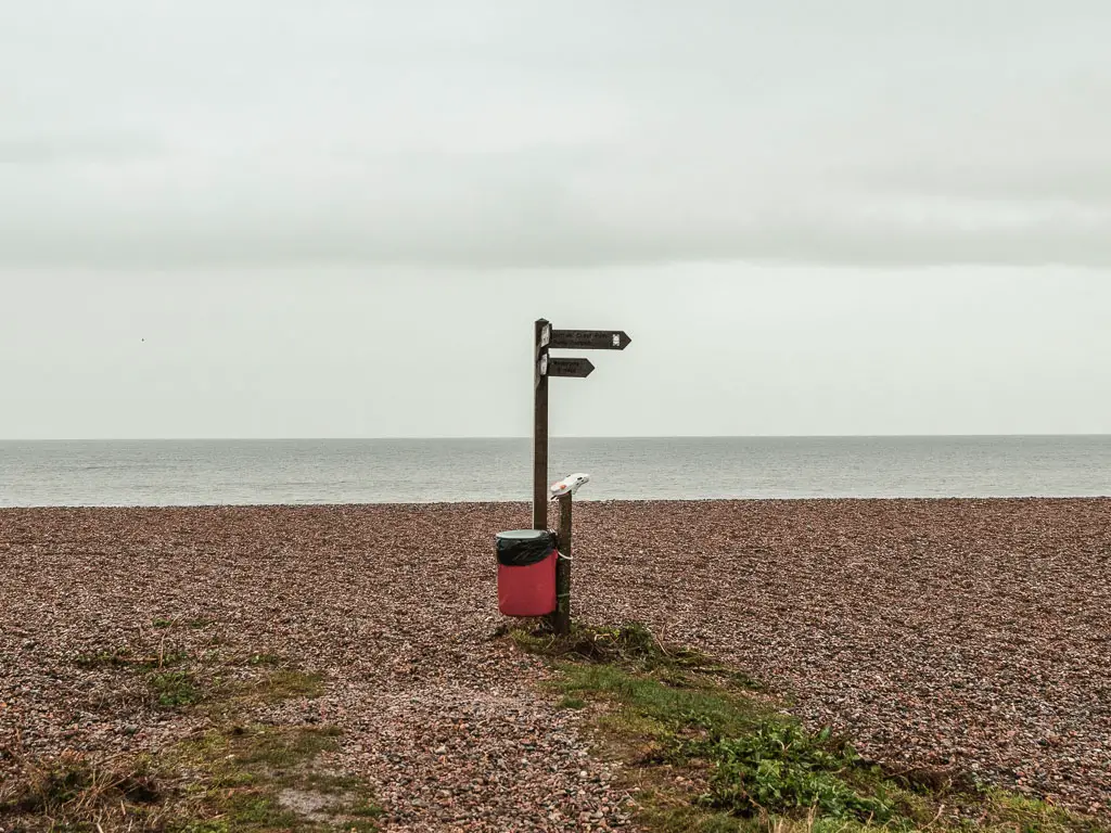
Once you approach Cley-Next-the-Sea, the signs will direct you into the village, and then you turn left at the road junction.
Some way along here, there will be a trail to reach the windmill (it’s signposted). I considered taking it, but there wasn’t a coast path sign, so I kept going along the road….Realising soon later that I should have gone that way. That’s the way. It’s just not signposted as the coast path.
Instead I found another trail to get me off the road to rejoin the coast path trail.
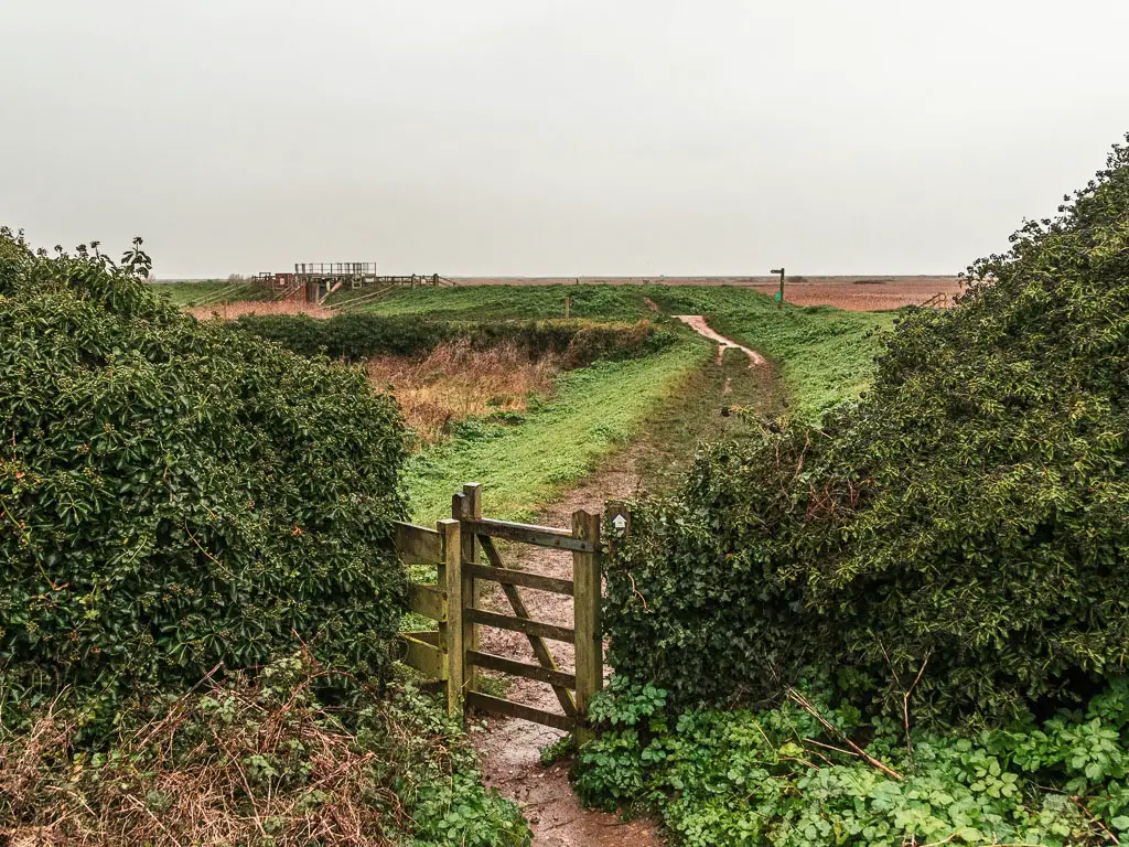
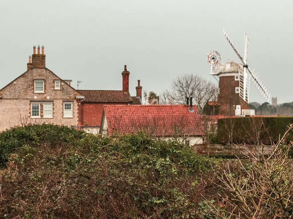
Once you are past the windmill, you should be on a ridge type trail again, which will lead you all the way to Cley beach.
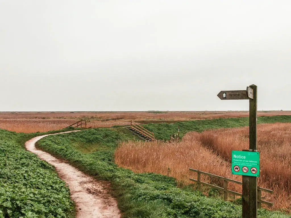
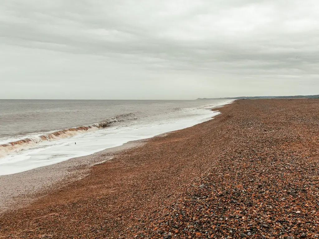
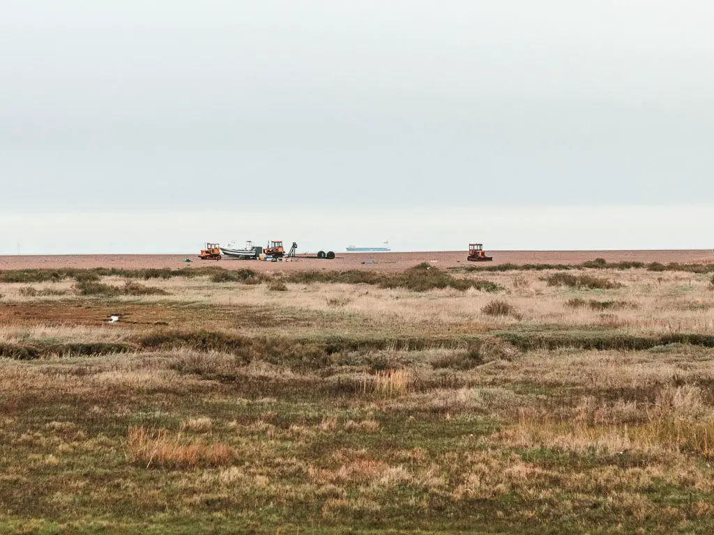
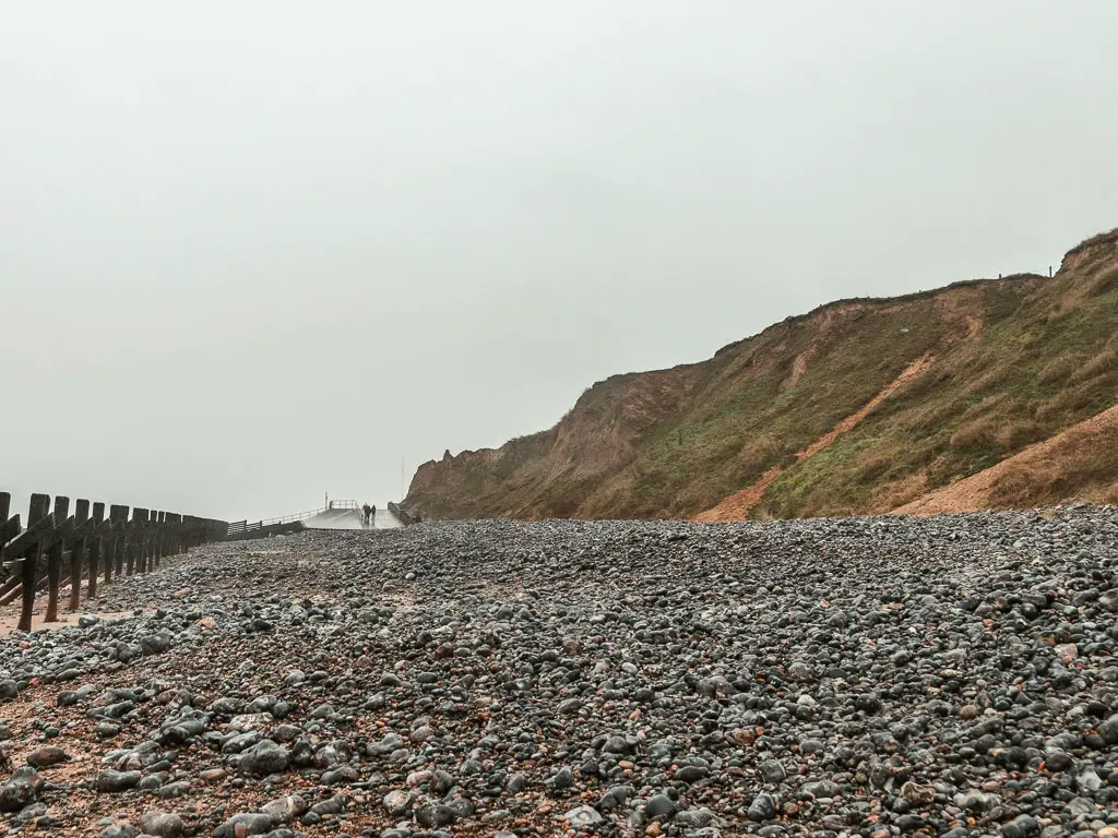
The shingle
It was raining pretty hard by this point. So once I reach the beach, I headed over to the shelter joining a few birdwatchers. I needed to regroup, and have a snack. Prepare myself for what was to come.
The shingle.
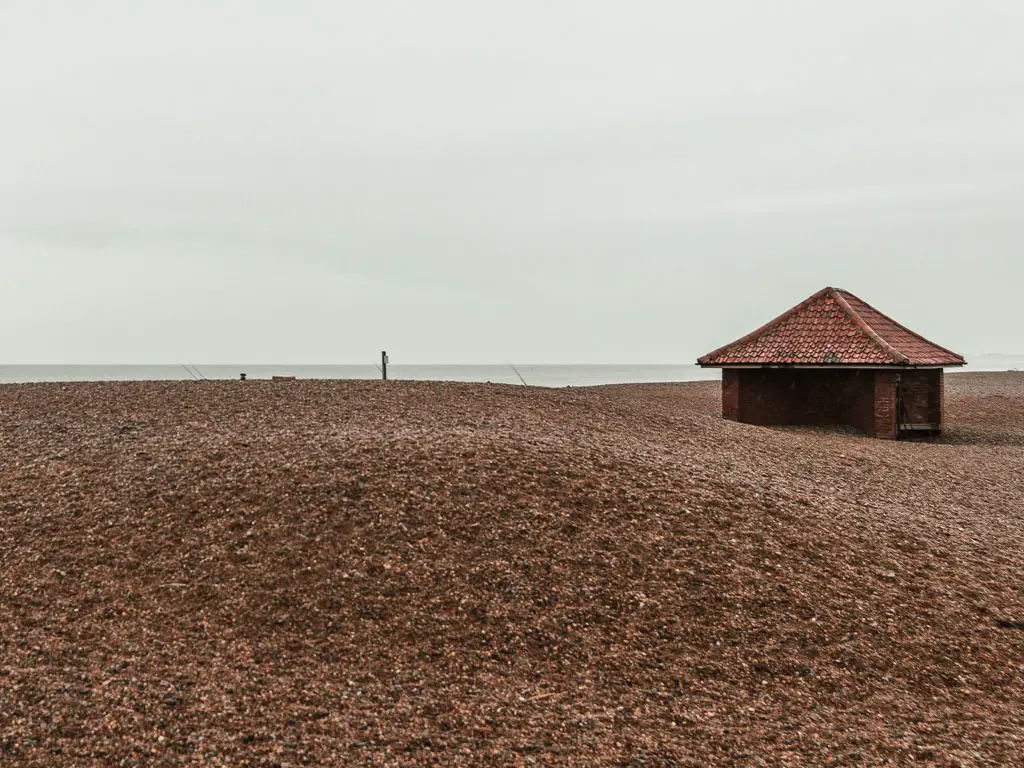
I had heard about the shingle from Cley. I didn’t yet know how far I would have to walk on it (and I’m glad I didn’t). If you don’t want to know, then skip the next section…
I ended up walking on the shingle for about 1.5h.
The birdwatchers asked me where I was heading. I said Cromer. They then asked me if I liked shingle. I said no. They said good luck.
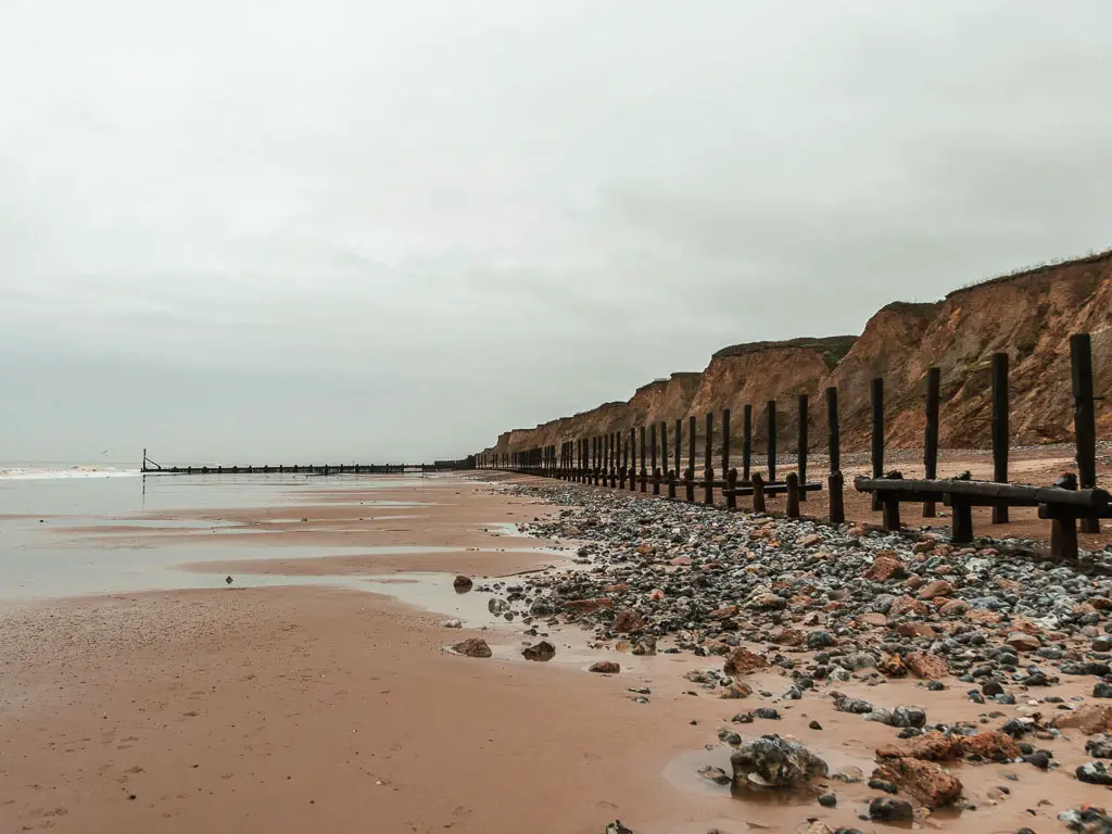
And with that I headed off on the long arduous trek across arguably the worst walking terrain. If you look way into the distance, to that land you can barely see ahead. The shingle goes on until there.
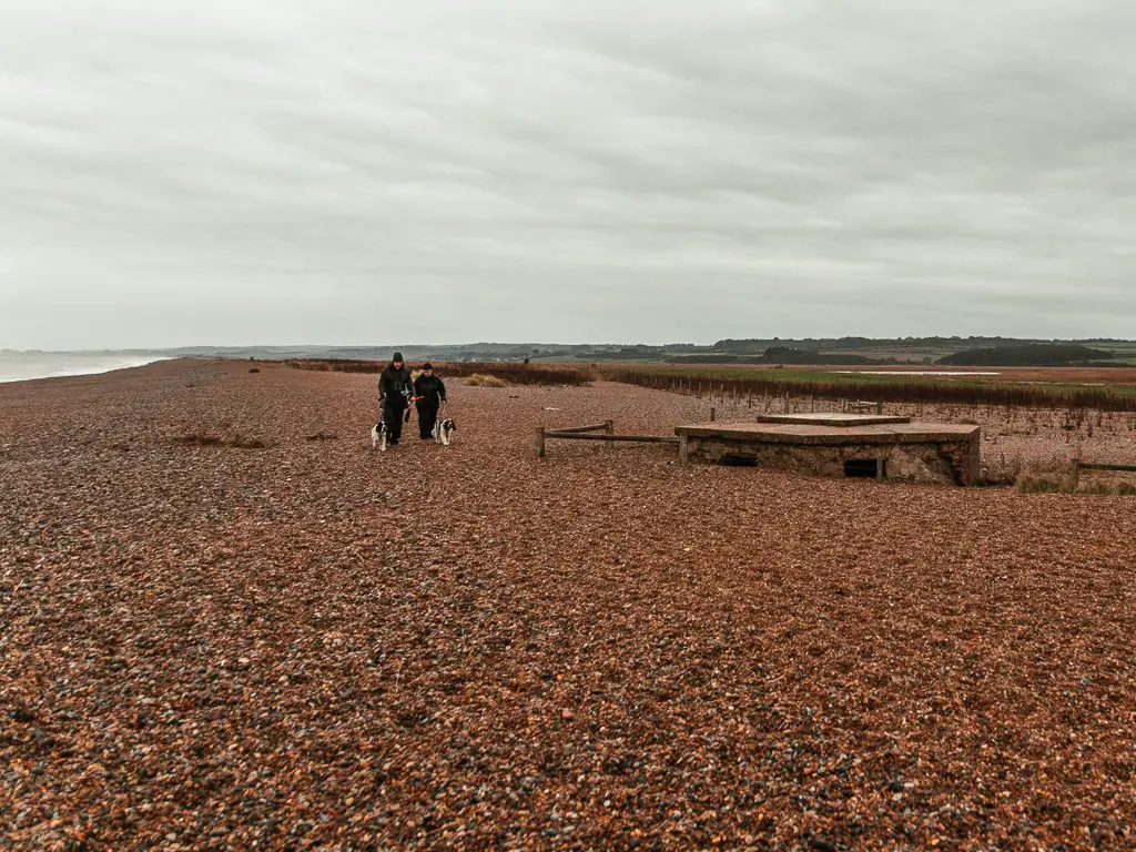
On a positive note, my toe stopped hurting. The shingle turned out to be good for it.
Reaching hard ground
Near the end of the beach, there will be an option to get onto some solid ground. I immediately took it.
After 1.5h of walking on shingle, it was a strange sensation. I became very aware of the weight of my body. The shingle had been absorbing it.
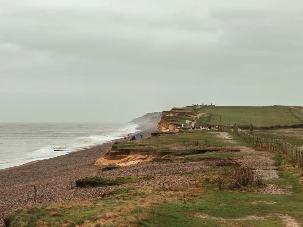
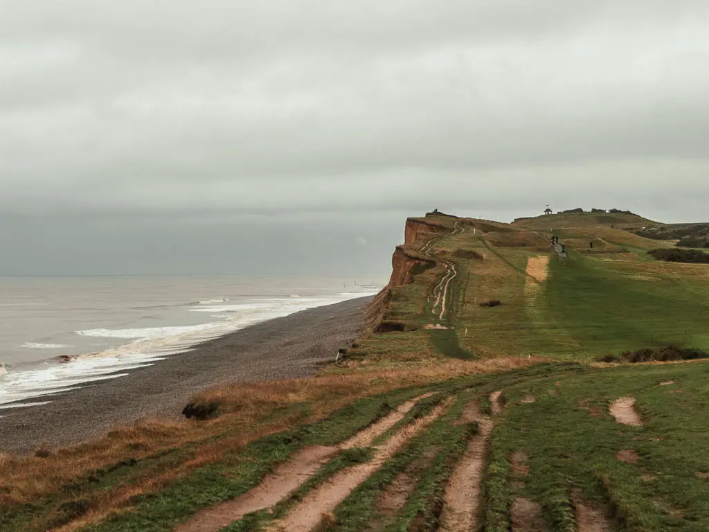
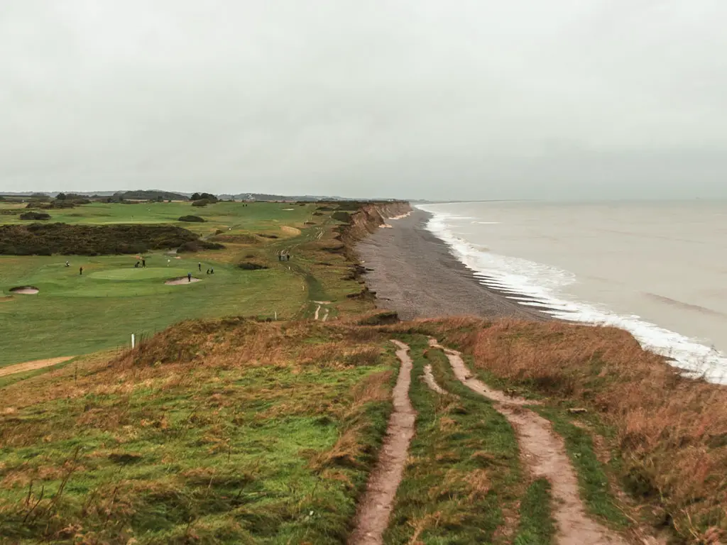
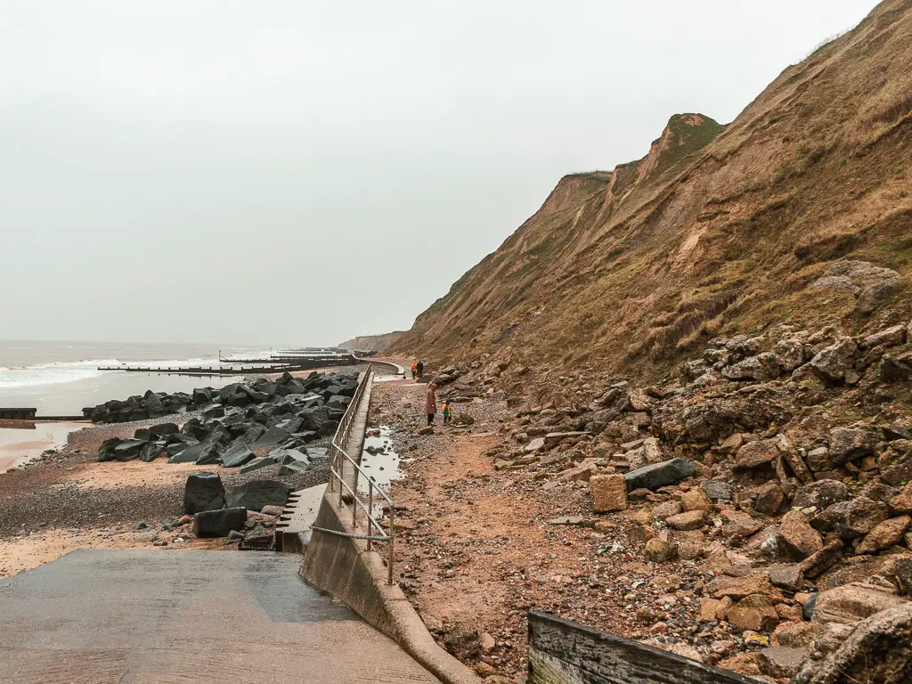
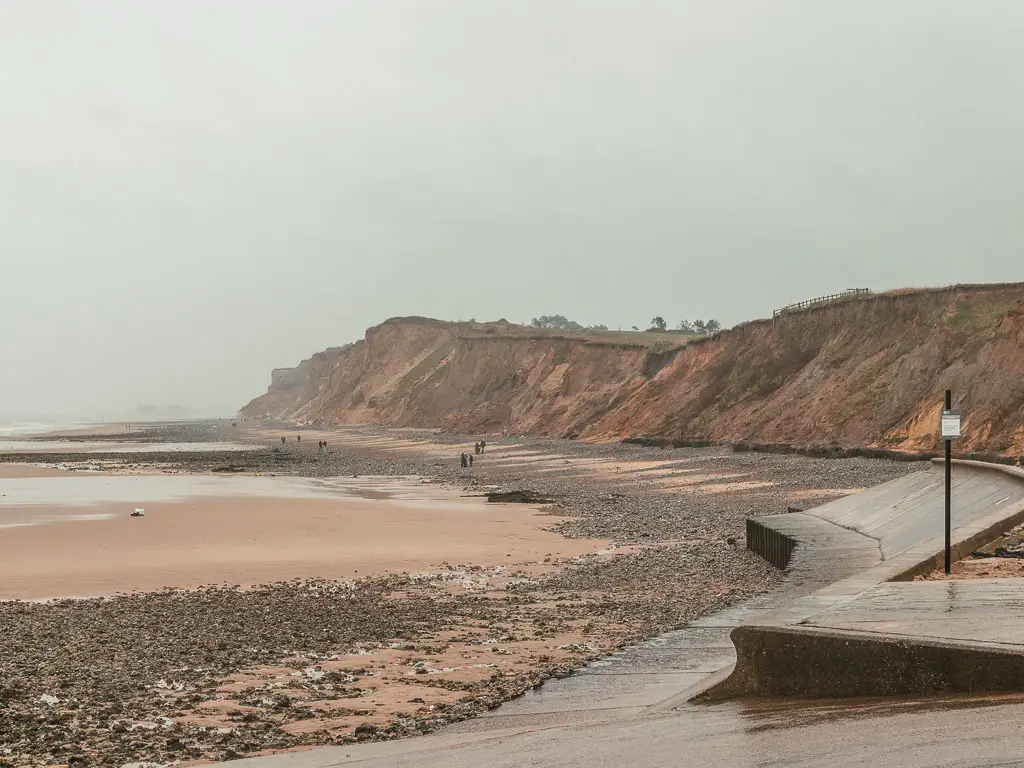
The cliffs and golf course
Next you will have the cliffs to walk across, next to a golf course. It’s also a bit hilly. I chose to walk the Norfolk Coast Path because it wasn’t supposed to be hilly.
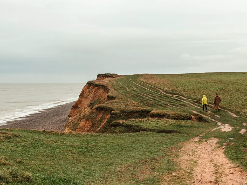
When you go up the hills, make sure to look back for a breathtaking view of where you came from.
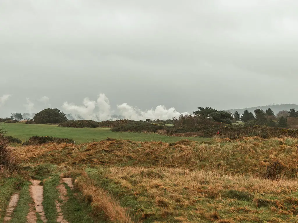
I saw a lot of smoke. Not your normal smoke. Then I realised it was steam train smoke. I couldn’t see the train though. It was hidden behind the bushes.
After some undulations along the cliff top, you will reach the coastguard lookout. Walk straight past it, and you will suddenly be presented with a view of Sheringham.
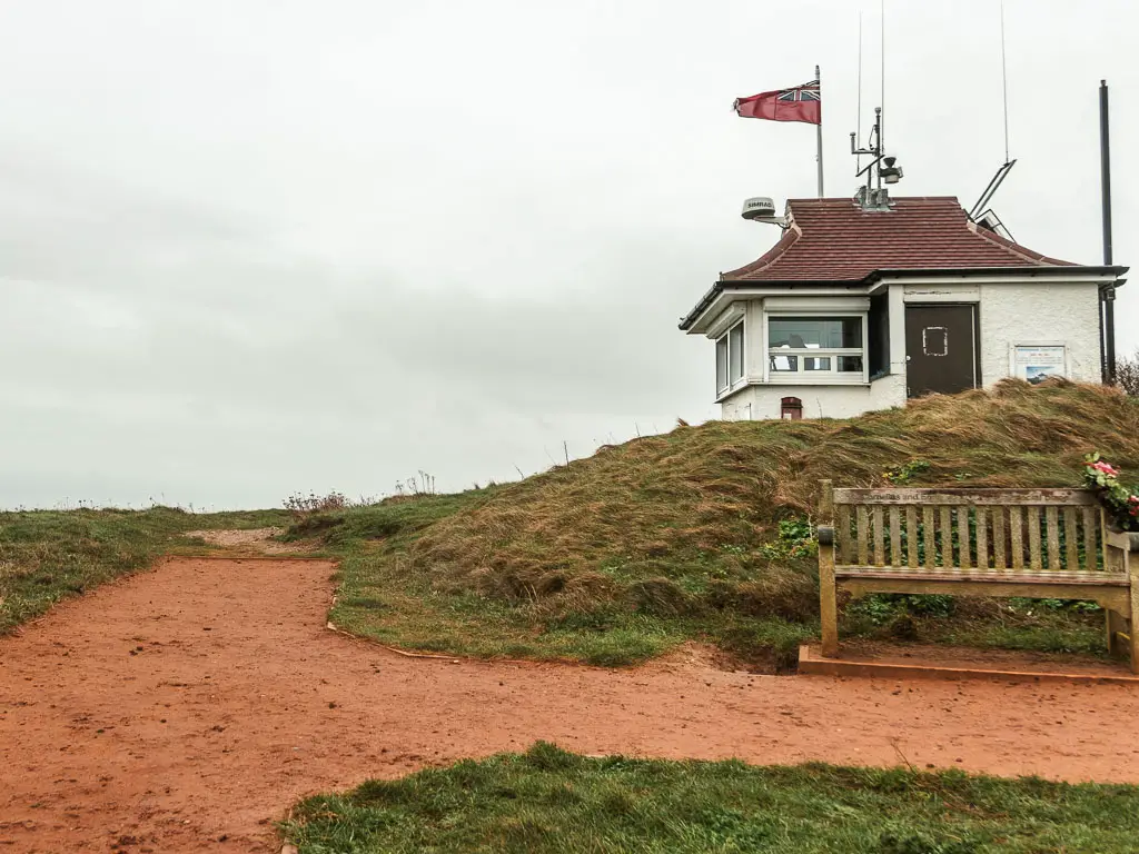
I needed a wee at this point. Except I had a problem. There were too many golfers about, and no where to hide without also being in view of the coastguard. I would have to wait until I passed Sheringham. I wasn’t in the mood for looking for a public toilet.
Sheringham
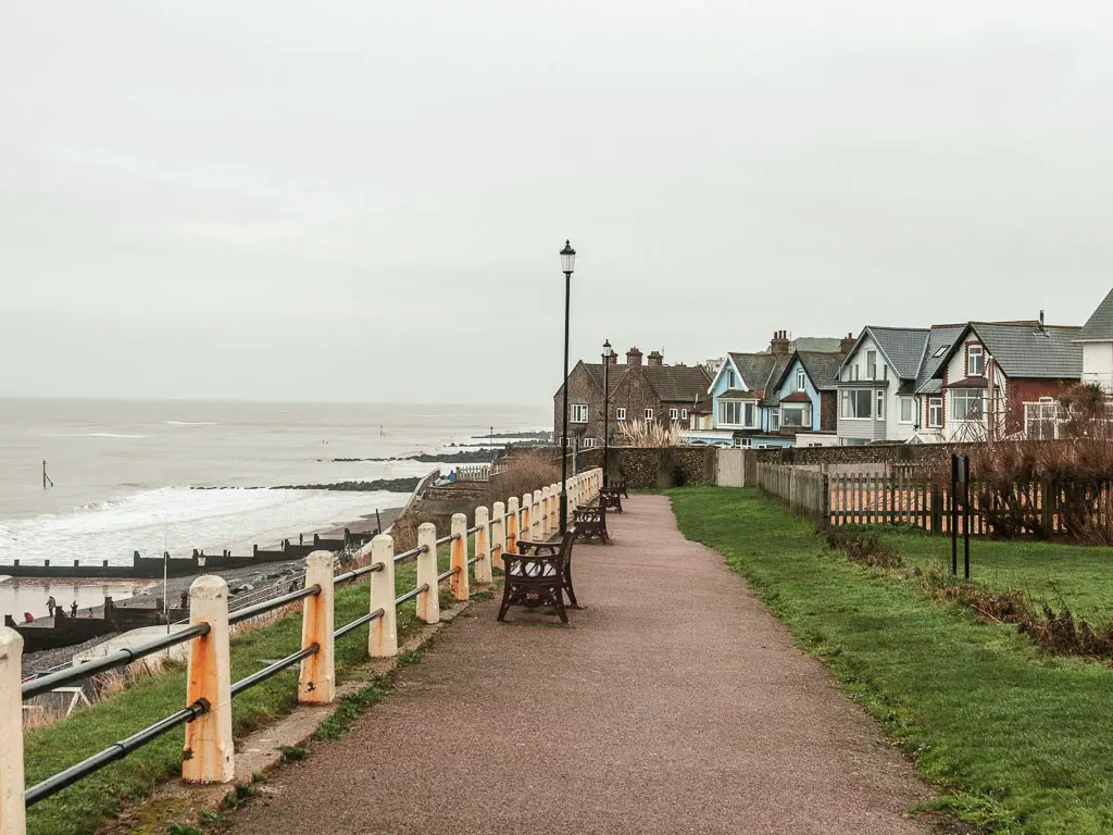
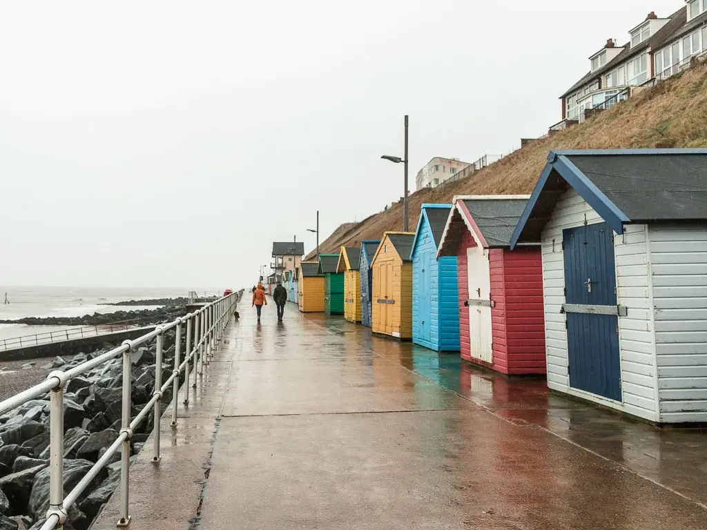
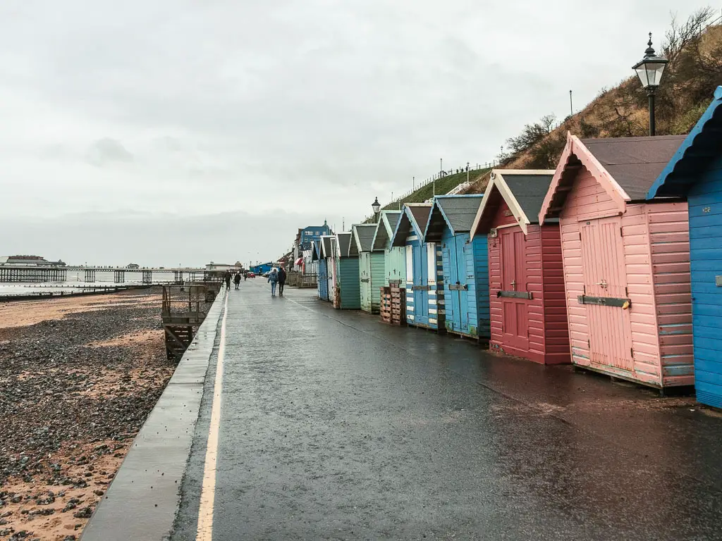
Continue along the coast, and you will be led passed Sheringham on beachside concrete type path.
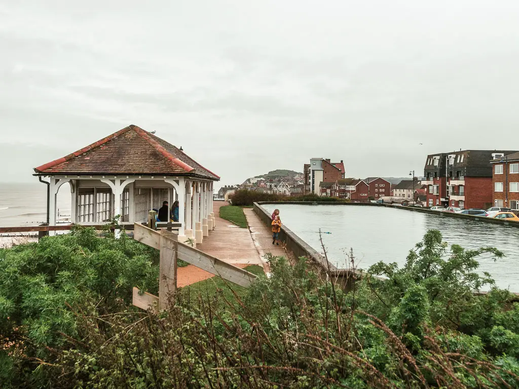
I noticed a few people taking dips in the water and was horrified.
Now, you must look out for a coast path sign along here, which directs you up….
Once I passed the beach huts and was on rocky beach, I realised that this bit of beach is definitely underwater for part of the day. This can’t be the coast path. I took a look at my map and saw that there is indeed a trail along the clifftop. Although, I could have sworn the coast path signs had directed me this way. Obviously not.
Not wanting to turn back on myself, I decided the beach would do for now. Then I had a moment of panic. Despite walking along the coast for some hours now, I still wasn’t sure which way the tide was going. I didn’t want to risk getting trapped down here, which is a very real possibility if the tide is coming in. I got out my phone to look it up, and tripped over a rock in the process.
Lying on the ground, I quickly looked around to see who might have seen me. Luckily not many people come out in this type of weather, so I was good, and quickly got up to continue one. The tide was also on its way out. I was safe for now.
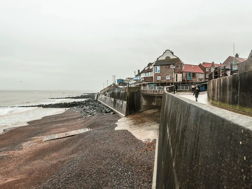
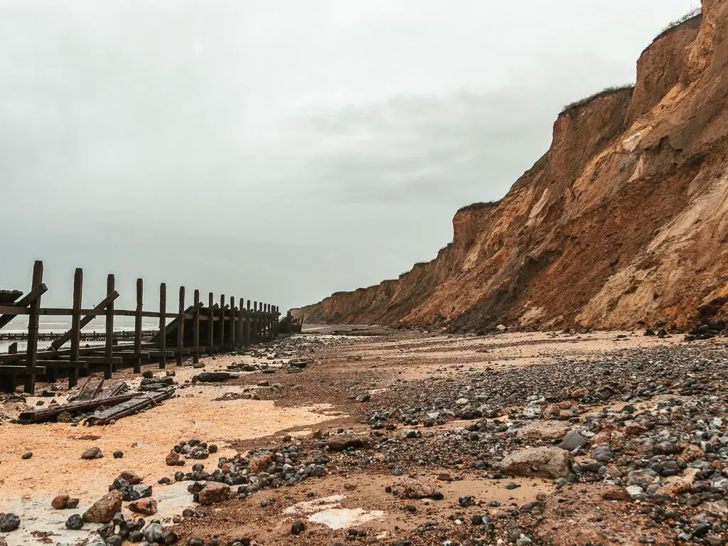
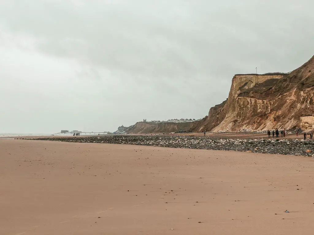
The long beach walk to Cromer
The rockiness soon gives way for nice firm sand….
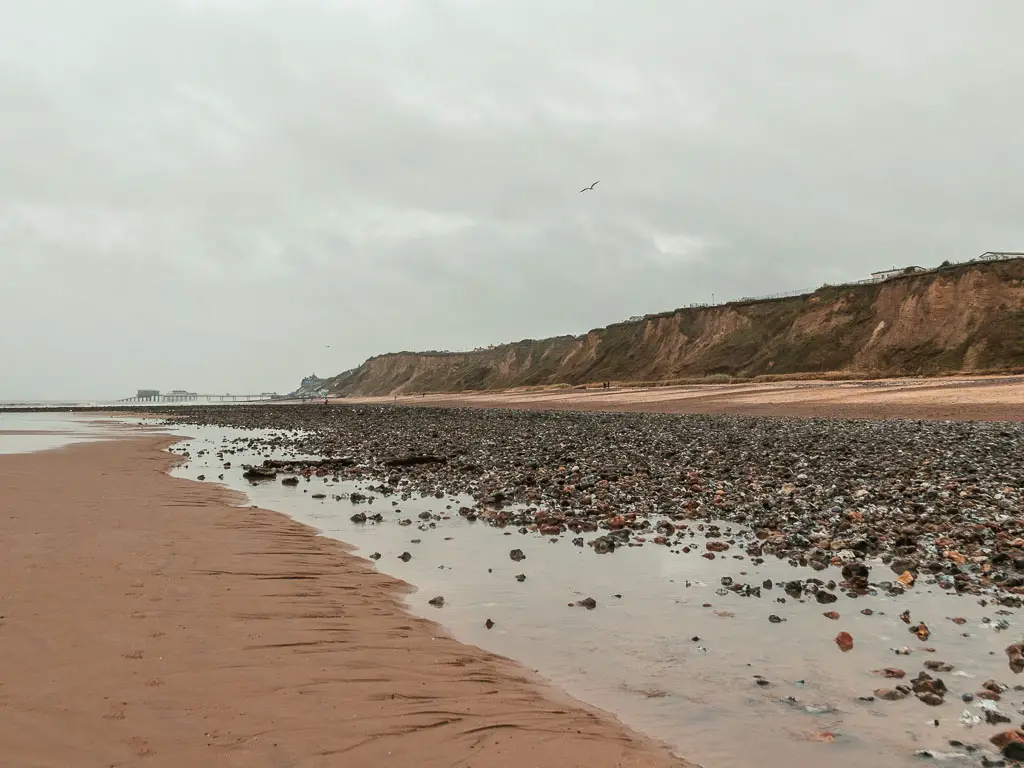
Then some horribly uncomfortable rocks to reach a junction.
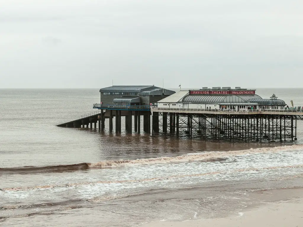
Once I reached the road junction, I thought about whether to walk up to join the official coast path, or stay on the beach which continued on for forever ahead. I could see what looked like a pier, way into the misty distance. I figured that must be Cromer (it is).
Looking on my map, it seemed the official coast path involves some road walking to reach Cromer. So I decided it was more sensible to stay down here on the beach.
If you do take the beach route, then make sure that as you approach Cromer, you are not on the wrong side of this strip of rocks. They become impossible to cross without getting your feet wet. I ended up having to walk back on myself to get across.
As I made it into Cromer, I was severely limping. Not my toe. This time is was my right ankle. I wasn’t sure what was wrong yet, but it felt like sever boot rub. But that’s problem for tomorrow…
Read next: Day 4 Cromer to Mundesley
2 comments
Brings back some memories those photos do, a friend and myself walked from Hunstanton to Cromer raising sponsorship money for Keech Children’s Hospice, that shingle beach ripped our blistered feet apart towards the end – we did Hunstanton to Cley, stayed with my step son overnight and did the rest the following day, being met by our partners and other friends at Cromer Pier, with VERY sore feet 🙂
That sounds great! ah yes, the shingle. It’s pretty torturous, and never ending. I hope I dont ever encounter something like that again