
What a day this was. I was up at 3am, travelled for 4 hours to reach Hunstanton, then walked 16+ miles along the coast to reach Burnham Overy Staithe. The day started out glorious. It was nice and sunny. Very windy, with the wind being behind me and pushing me along….
Then I went the wrong way. How does one go wrong when walking a coastal path? I walked nearly 2 miles more than I needed to, then faced relentless headwind. I was so fed up that I cheated for the next bit( I will explain more later), and gained myself back those 2 miles.
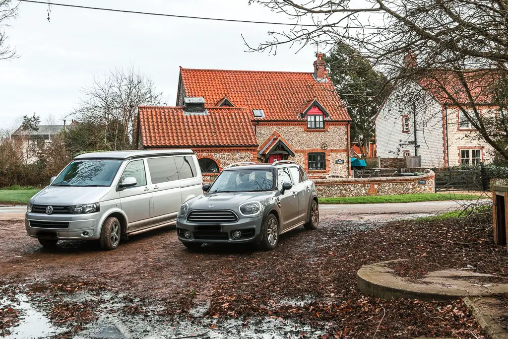
Because I cheated, and due to a current diversion on the coast path route, I ended up walking a solid 4 miles along the road. Once I reached the coast path again, I was filled with joy, which was short lived as I was soon battered by rain and more headwind.
What to expect when walking from Hunstanton to Burnham Overy Staithe
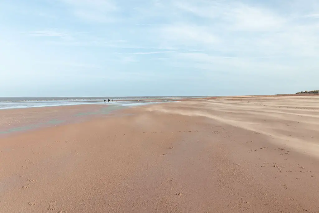
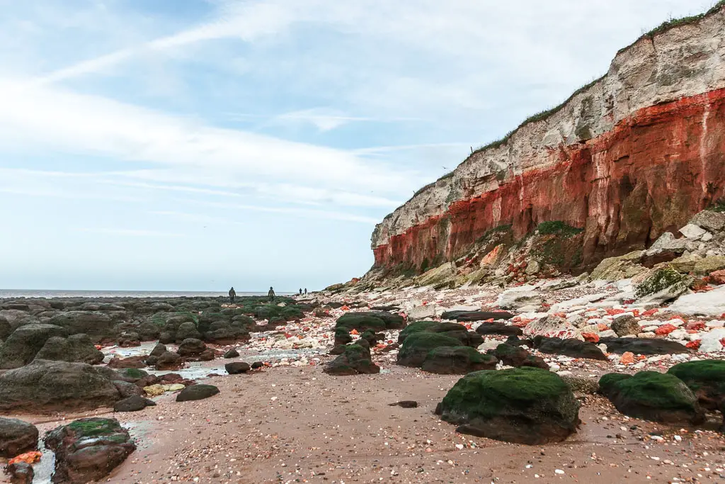
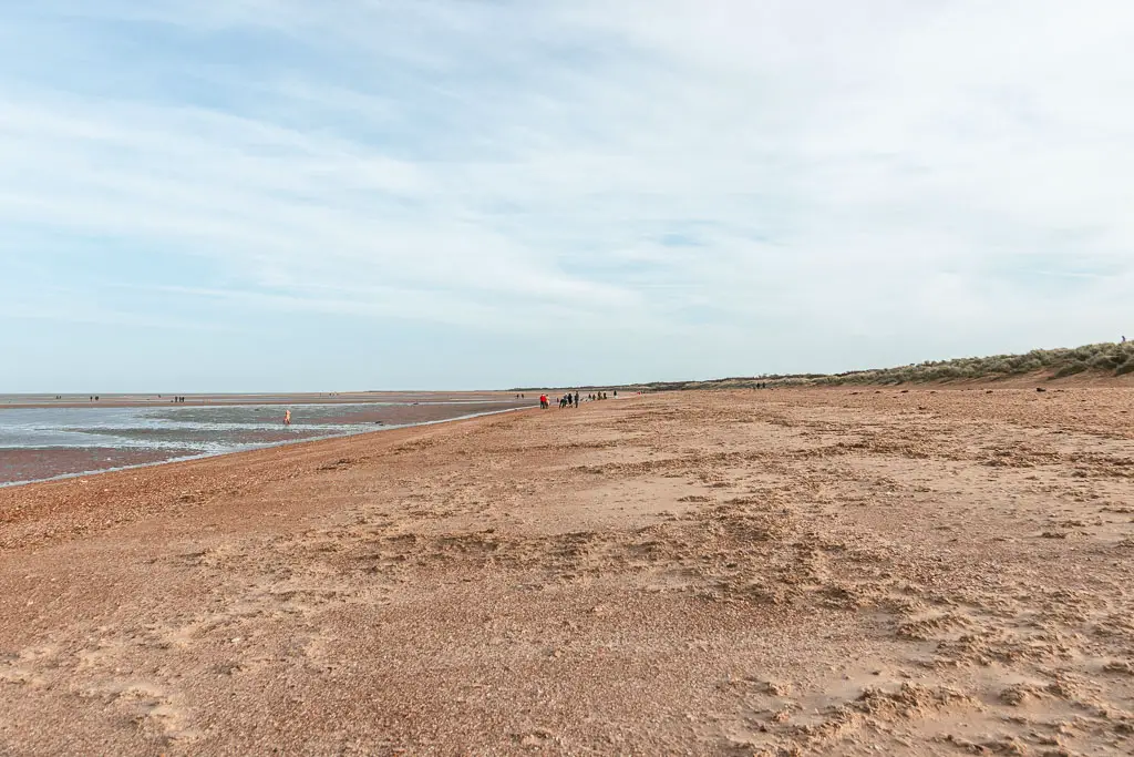
Starting from Hunstanton, the official Norfolk Coast Path route doesn’t quite go along the coast. It runs parallel to it instead. This seemed silly too me. I traveled all this way to walk along the coast, and I was going to do just that. If the tide is out, you have masses of beach, stretching as far as the eye can see. Plus, you also get to walk under the impressive Hunstanton Cliffs
You will have numerous options to get off the beach, through the sand dunes to reach the official coast path, if you want to change things up.
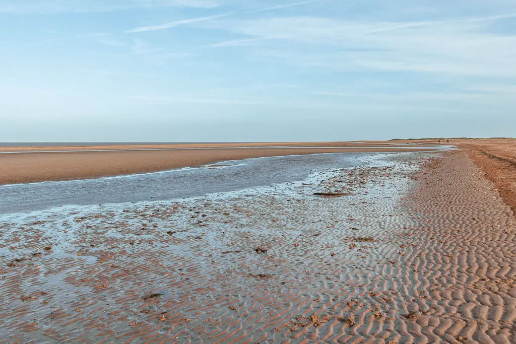
You can walk along the beach for about 4 miles, before you need to turn in. This is very important. With the tide out, it will look like you can walk forever. This is trick. One that I fell for. Keep an eye on either a trail app map, or even google maps will do. Make sure to turn it (at the latest) when you are next to the Holme Bird Observatory, or nearing Thornham.
The coast path trail will then take you on a loop inland, to avoid the main road. This is where I cheated. I stayed walking on the main road to make back the time I lost on the sand.
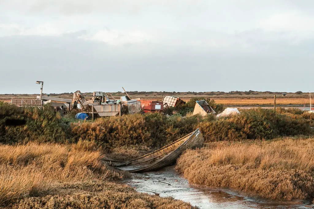
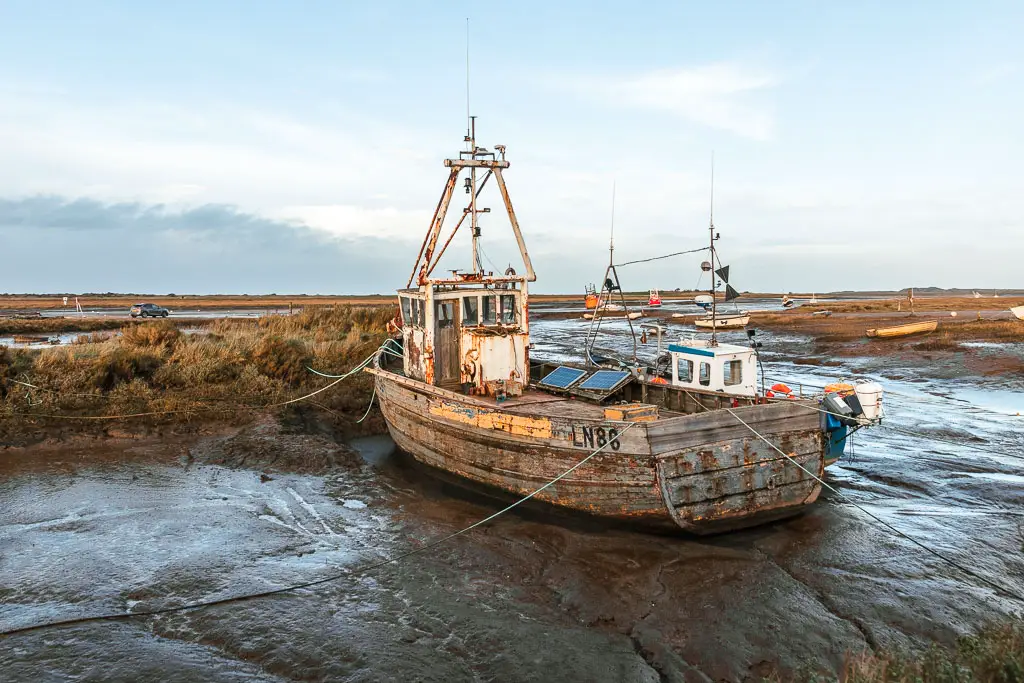
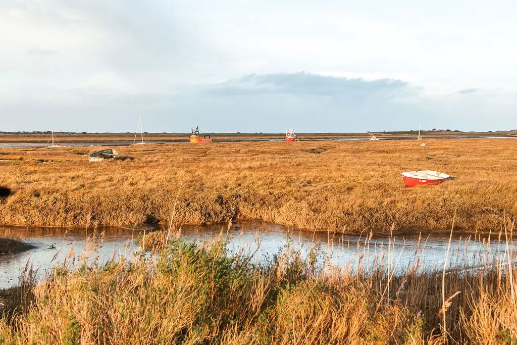
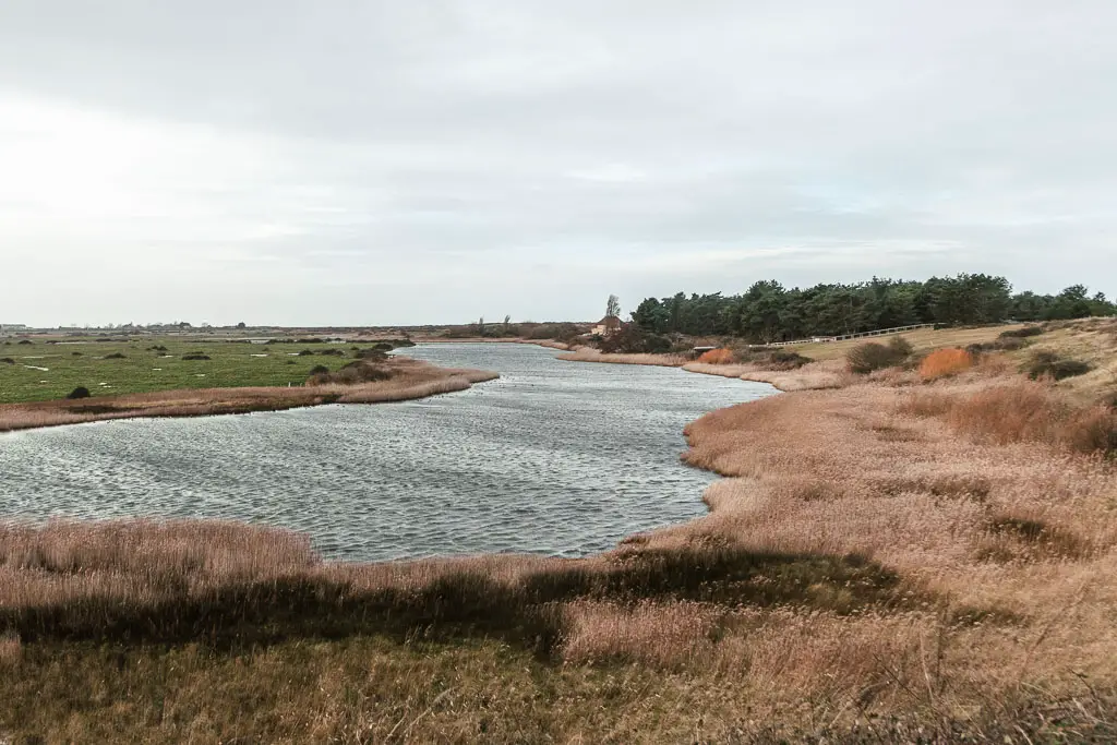
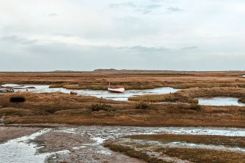
When you are back on ‘coastal trail’, it’s quite lovely. With views of the marshes and resting boats all around.
Tips and other things too know
- To walk along the beach from Hunstanton, make sure the tide is out (or on its way out) when you plan to do the walk. Check the tide times here.
- Following on from above, be careful if the tide is on its way in. People have been caught out in this. It can be quite dangerous.
- The Norfolk Coast Path isn’t signposted at some key junctions. I will show you which way to go when I describe the route further down.
- Check the weather before heading out. Specifically the wind direction. If it’s coming from north, it will be very cold (it’s arctic wind), and you will have headwind for a solid chunk of the walk. Wind coming from the west is best. It will be behind you mostly, and give you a little push. South west wind is also good. It will mostly be behind you, however, there are a couple of section where you turn to face it.
- If I was to do this walk from Hunstanton again, I would make it shorter. I think if there was no headwind, it didn’t rain, and the daylight hours were longer, the walk from Hunstanton all the way to Burnham Overy Staithe would have been fine. Battling all these things took away some of the enjoyment.
To see an overview of the whole of the Coast Path and everything you need to know about walking it, planning, logistics etc, you can read my Norfolk Coast Path walking guide.
This post uses affiliate links. You can read the privacy policy or disclaimer for more info.
Logistics
- Start: Hunstanton, Norfolk. Post code: PE36 5BQ.
- Finish: Burnham Overy Staithe, Norfolk. Post code: PE31 8JE.
- How to get there: Bus 26 coastliner runs from Kings Lynn to Hunstanton, then all along the coast to Burnham and beyond. Kings Lynn is on a main train line, with direct trains from London Kings Cross.
- Distance: 16ish miles
- Difficulty: Easy trail, moderate due to the length. Can be challenging if there is headwind.
- Terrain: Sand, boardwalk, dirt, road, grass.
- Dog friendly: The beach is dog friendly, but they must be kept out of the roped off areas. No stiles or livestock. Some roadside walking.
- Option to shorten the walk: Yes. See below.
- Elevation: Flat
- Time of year: I walked from Hunstanton to Burnham Overy Staithe in the heart of winter
Public transport and options to shorten the walk
The number 36 Coastliner bus runs all along this stretch of coast, back to Hunstanton and Kings Lynn. So it’s easy to jump on it at any point to take you back to the start.
Options would be Thornham 6.5 miles, Brancaster 10 miles, Burnham Deepdale 12 miles.
Map for the walk from Hunstanton to Burnham Overy Staithe
I didn’t follow the official coast path for some of the walk. You see how early on I look like I am walking in the sea, this is the beach. The official path is parallel to this inland a little. Also notice the random bit where I go out and then back, this is the exact thing you should not do. Make sure you turn in if you choose to walk on the beach!
Then between Thornham and Brancaster, the official trail goes inland on a loop. On the map you can see I stayed on the road because I was fed up. When I describe the route for the walk from Hunstanton to Burnham Overy Staithe below, I will guide you on what you should do instead.
Amenities
Hunstanton is a bigger town, so will have lots of stuff. Lots of places to eat, a big Tesco etc. Along the walk there are a few pubs, or other eating options.
Places of note are the Thornham Deli with local produce, fresh pastries, and artisan coffee. The mussel pod in Brancaster Staithe is a 5 start rated stall serving fresh mussels. The Crab hut in Brancaster if you want a crap roll or seafood pot. Staithe Smokehouse behind the White Horse pub in Brancaster Staithe. It’s a little shack which apparently sells the best smoked fish. I didn’t try it, but I wish I had. The Ship Hotel Pub and Jolly Sailers pub in Brancaster, The Hero at Burnham Overy Staithe. For some good fresh coffee you have the Norfolk Coffee Pedlar. It’s a coffee stand on a bike also selling homemade cake and local honey. Located in Burnham Overy Staithe.
Parking
There is free street parking in Hunstanton. This is where I parked, then got the bus back from Burnham Overy Staithe at the end of the walk. There is also a paid car park (PE36 5EH), which has public toilets.
Accommodation
I stayed in Hunstanton at the Burlington Guest House. I would recommended it. It’s good value compared to everything else along the coast. It comes with a fridge, free coffee and milk, a dining/sitting room area, plus it was nice and warm and cosy inside. I spent three nights here, coming back after each day of walking.
If you are planning to spend each night along the coast, then in Burnham Overy Staithe I recommend The Hero. It’s a bed and breakfast style restaurant pub. The ratings are great. But it was out of my budget.
Route description: Walk from Hunstanton to Burnham Overy Staithe
Starting from Hunstanton, walk along the coastline to reach the cliffs. At this point you can walk on top of them or below them. I recommend below. You need the tide to be out for this though.
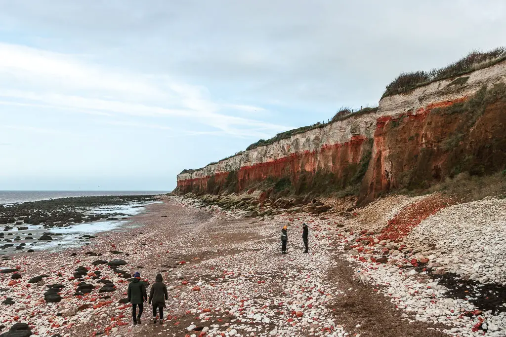
This bit starts of a little rocky, mixed in with patches of sand. As you walk further, with the gorgeous Hunstanton cliffs looming above to your right, you will be amongst some bigger rocks.
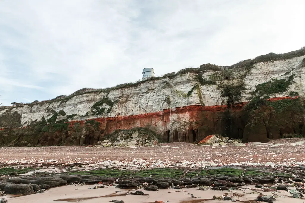
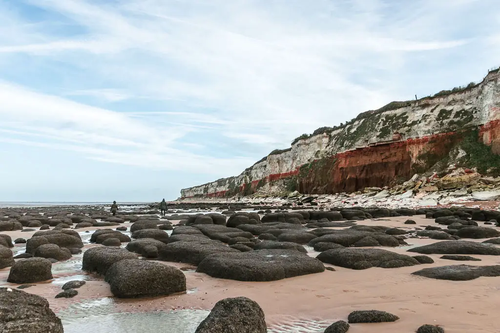
Navigating through them, you will be faced with pools of water here and there. To avoid them, you can walk nearer to the cliffs.
I chose to stay in them, as the sand was nice and soft. I was wearing my new barefoot hiking boots. Not the smartest idea to set off to walk 84 miles in barefoot shoes that your feet aren’t used to. I did have a spare pair of boots, with soft soles in my backpack to switch over to when my feet had had enough.
For now though, I wanted my feet to be on soft ground for as long as possible.
The long endless beach
The Hunstanton cliffs, are then replaced with grass covered sand dunes, and the beach becomes less rocky, until it’s pure sand. Stretching miles and miles ahead.
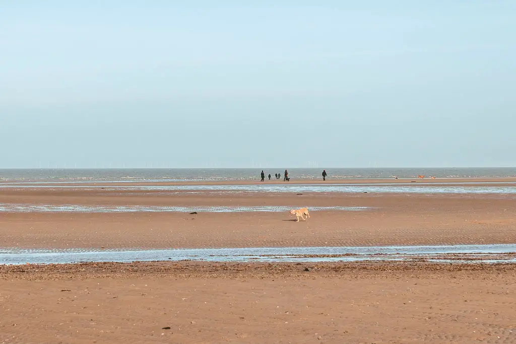
If you choose to stay on the beach, you may encounter a few strips of water. If you have waterproof boots on, you will be fine. If not, your feet will get wet.
Remember, you can get off the beach at various points. Look out for openings/little signs over by the sand dunes. These usually mark a way to get onto the path that runs parallel.
I really enjoyed this bit. There were quite a few people about, but the beach is so big that everyone is spread.
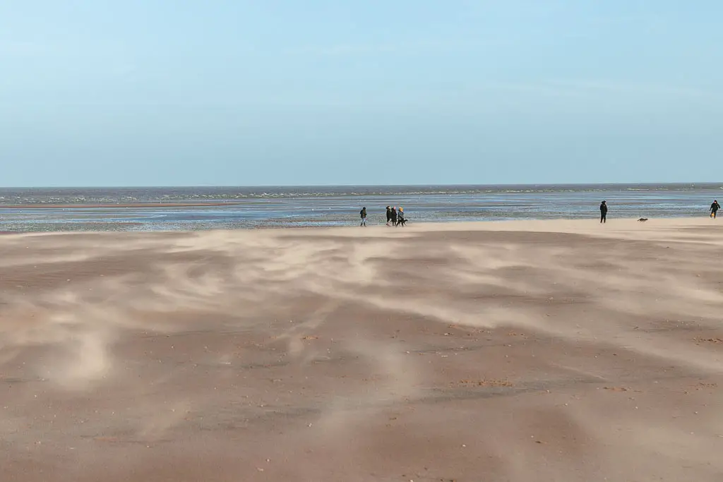
The issue I found was when I needed to pee. Out here on the sand, there is nowhere to hide. The wind was also pretty strong, so I didn’t feel safe that my pee wouldn’t be blown all over me.
When I couldn’t hold it anymore, I ventured over and hid behind the sand dunes to do my business.
Leave the beach
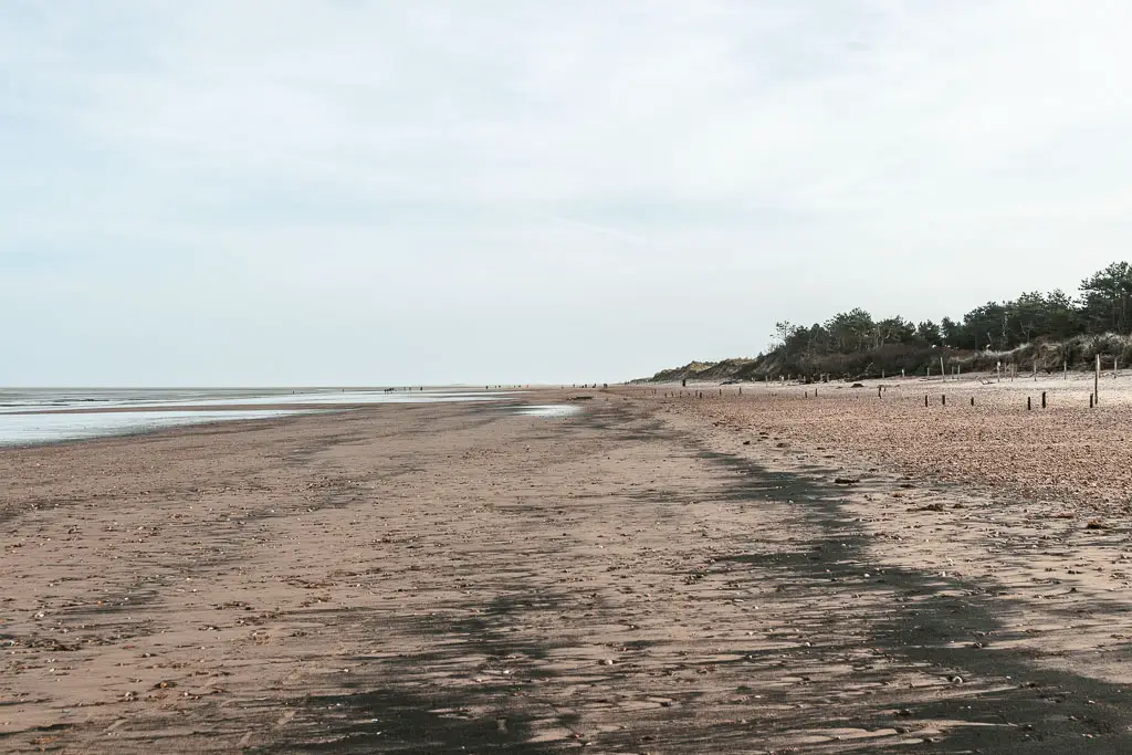
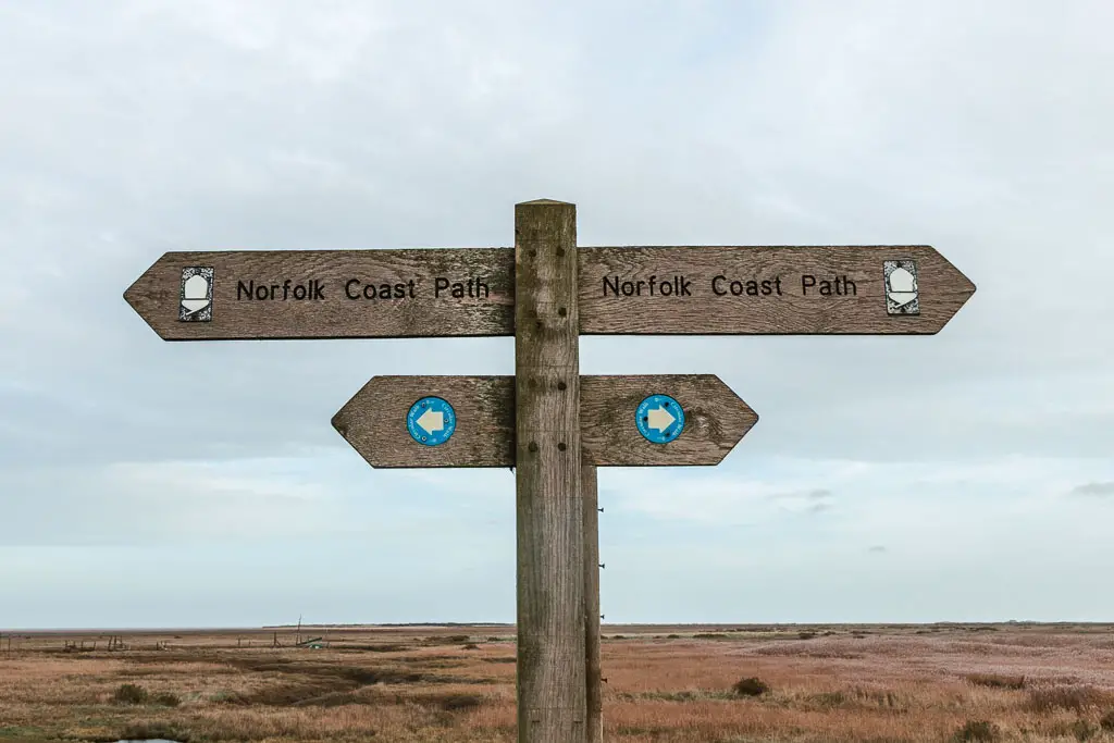
As I mentioned earlier, you need to make sure to come off the beach in time. It will look like you can walk forever, but you can’t. You need to turn it when you see these signs:
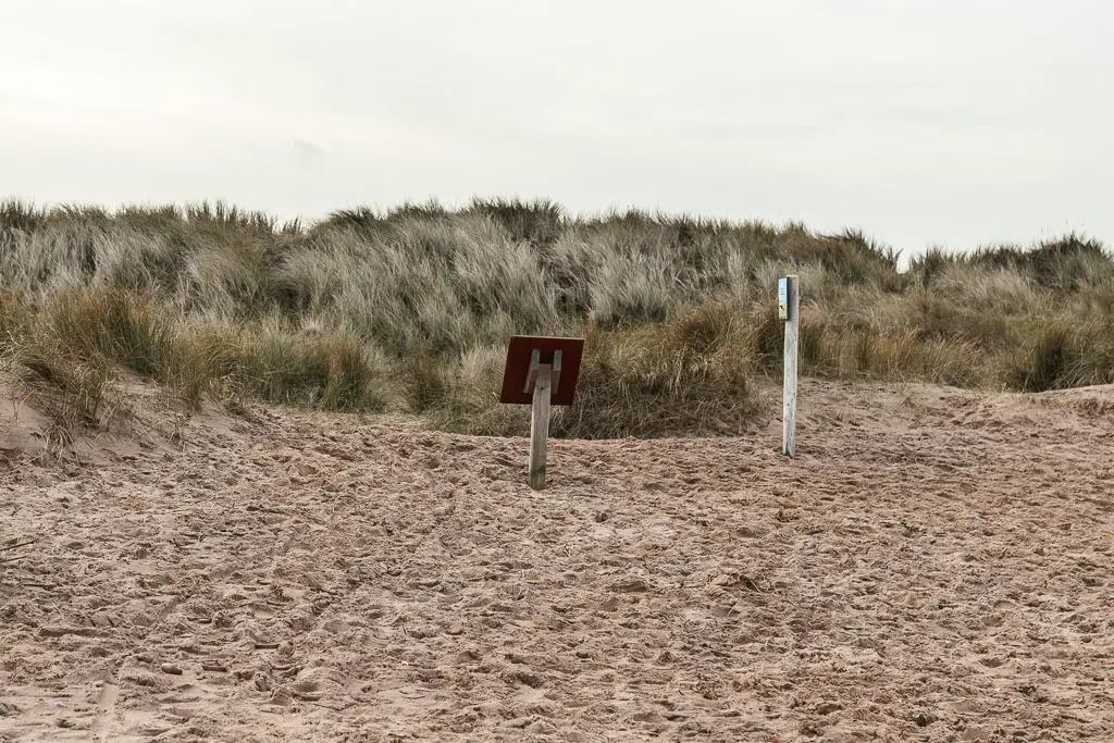
Note: There are multiple signs like this along the beach. If you are looking on Google Maps, these ones are just before Thornham.
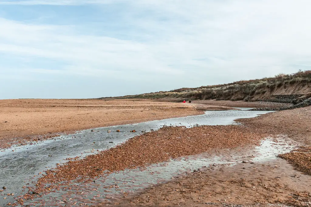
I made the mistake of staying on the beach. Once I hit a river, rather than turn back, I walked along it to find a way to cross.
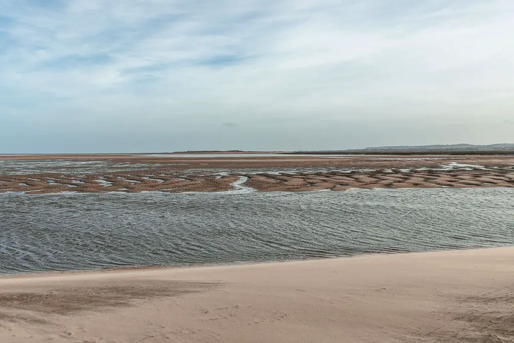
Up until now, the wind was behind me. It was wonderful. Changing direction, the wind was hitting me from the side and front. I persevered. Finding myself in sticky, sea bed mud. After spending far too long trying to get across the river, I begrudgingly turned back to find the path through the sand dune.
Now the wind was in front. It was horrible.
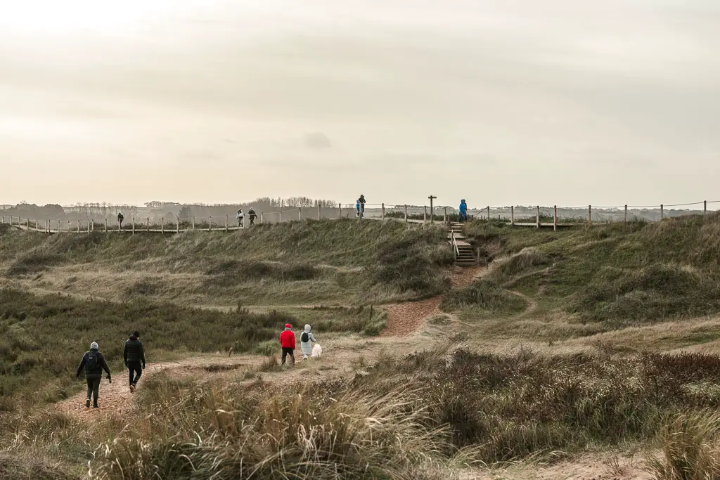
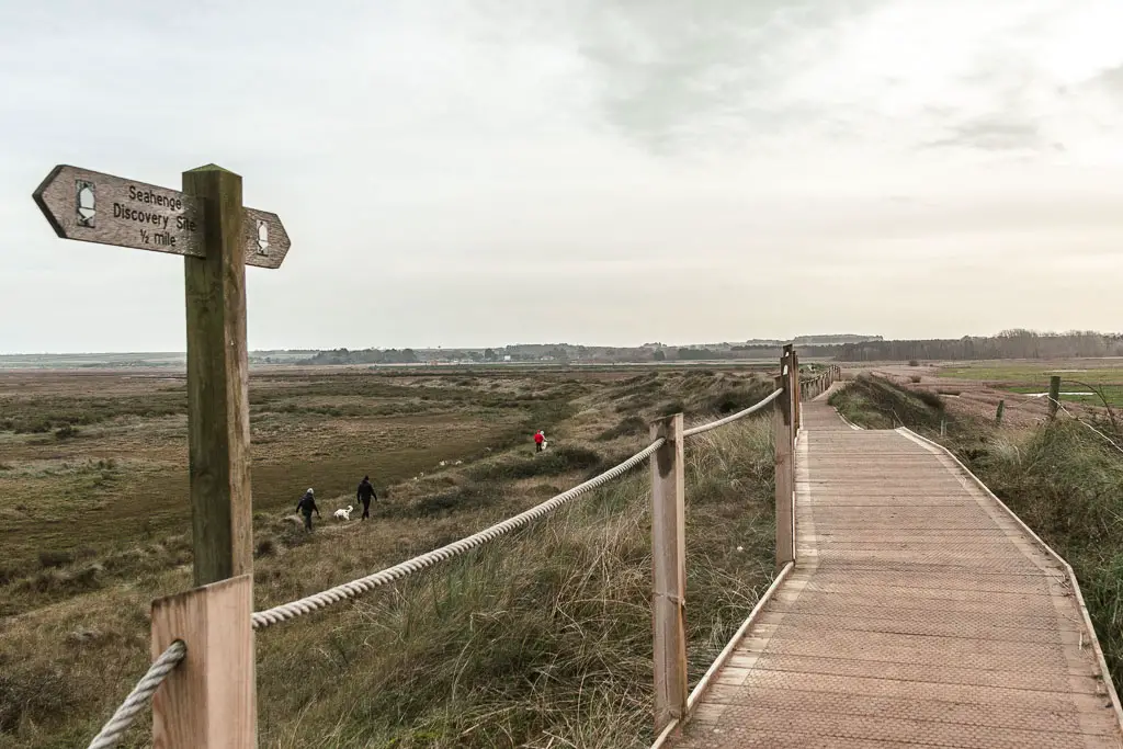
The official coast path
When you do walk through the sand dunes, you will be lead up some steps onto a boardwalk. This is where I saw my first Norfolk Coast Path sign. 5 miles in.
I also hadn’t escaped the headwind. Up here it was worse.
Pushing my way through, my hair was a big mess and all in my face, I was thirsty. I daren’t stop to drink though, as I’m pretty sure the wind would blow me over.
Keep following this main path, and you will be lead to a road, where you turn right.
Then a short way along, there will be a trail on the left.

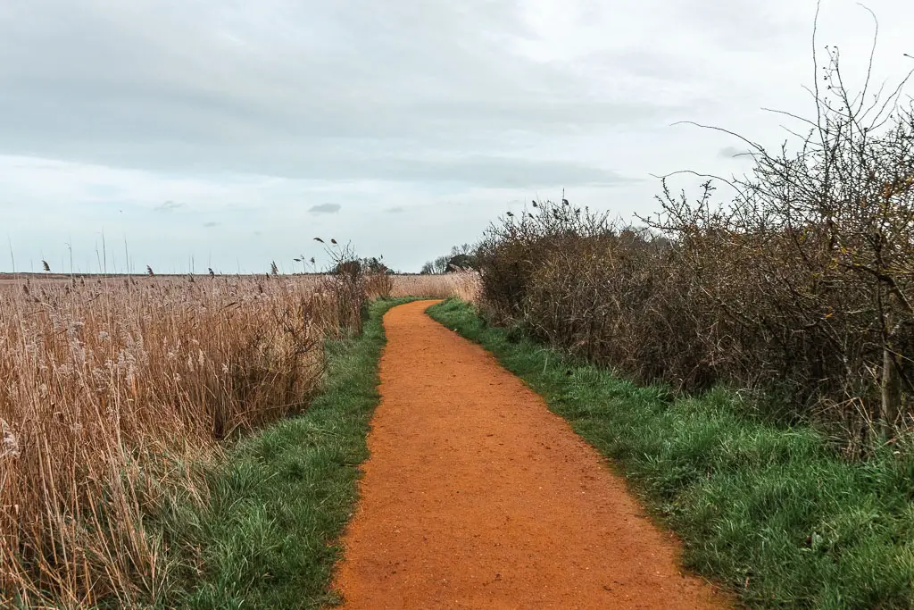
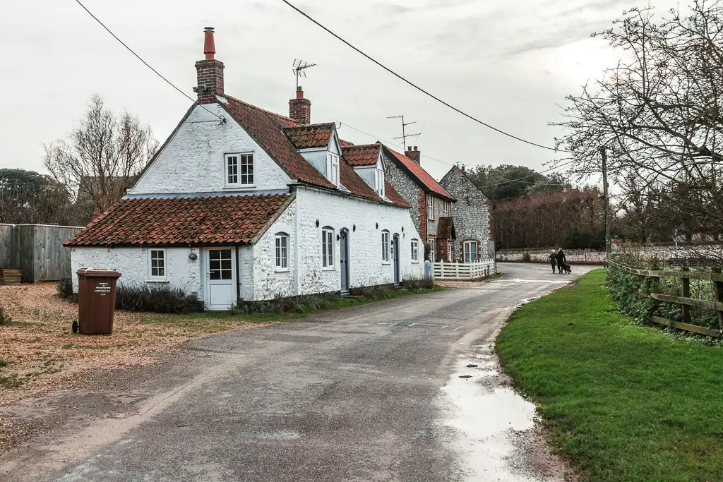
Walk to Thornham
Once on this trail, the wind calmed down (or rather, I was sheltered from it somehow). For the first time in a few miles, I wasn’t fighting against it, and I started to enjoy the walk again.

Stay following the trail, then over the bridge at the T-junction, turn right and you will reach Thornham.
Just before the houses, there is a an electricity thing. As there was no where else to sit, and my feet were now fed up with barefoot walking, I sat down on it. After having a snack, fixing my hair, and drinking some water, I changed into the other hiking boots.
When I set of walking again, it felt like I was walking on clouds. I decided that I would only wear these for the rest of the walk to Great Yarmouth.
Ok, so this is where there are no signs. When you reach the road with houses opposite, turn right, and stay on this road as it curves around.
When you reach the main road, with a grass triangle and red telephone box, turn left.

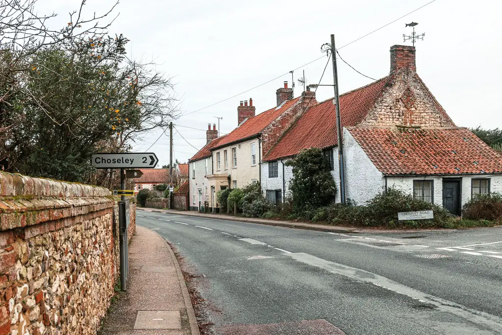
Walk inland….or not
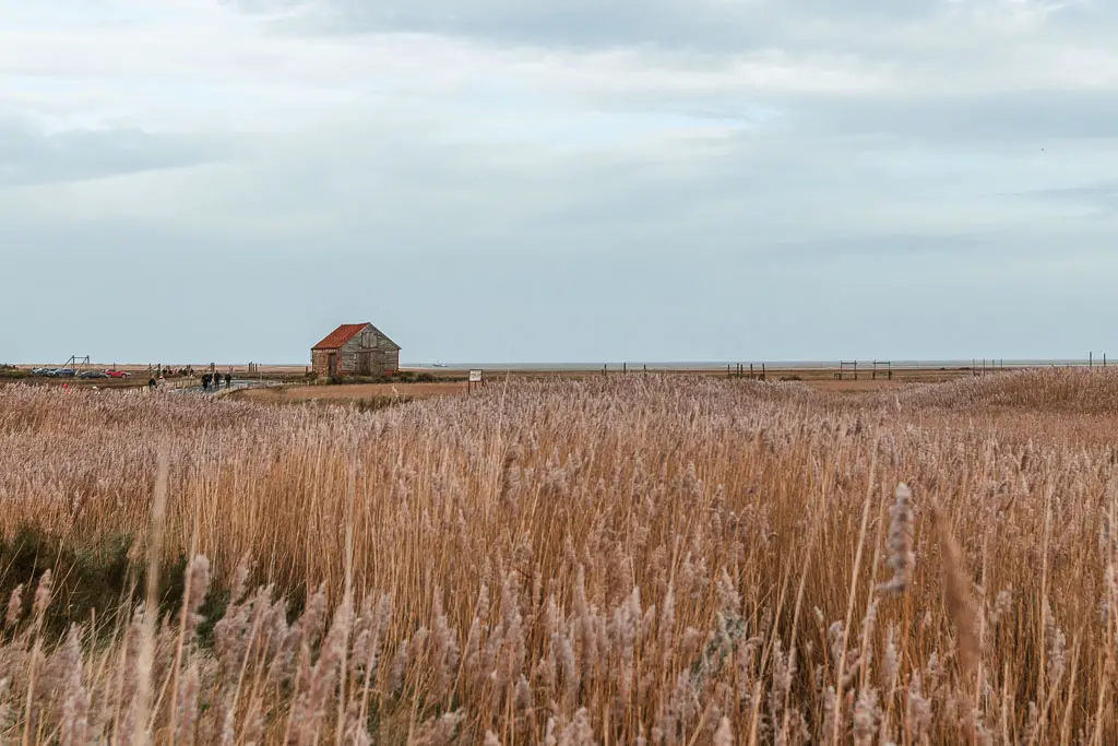
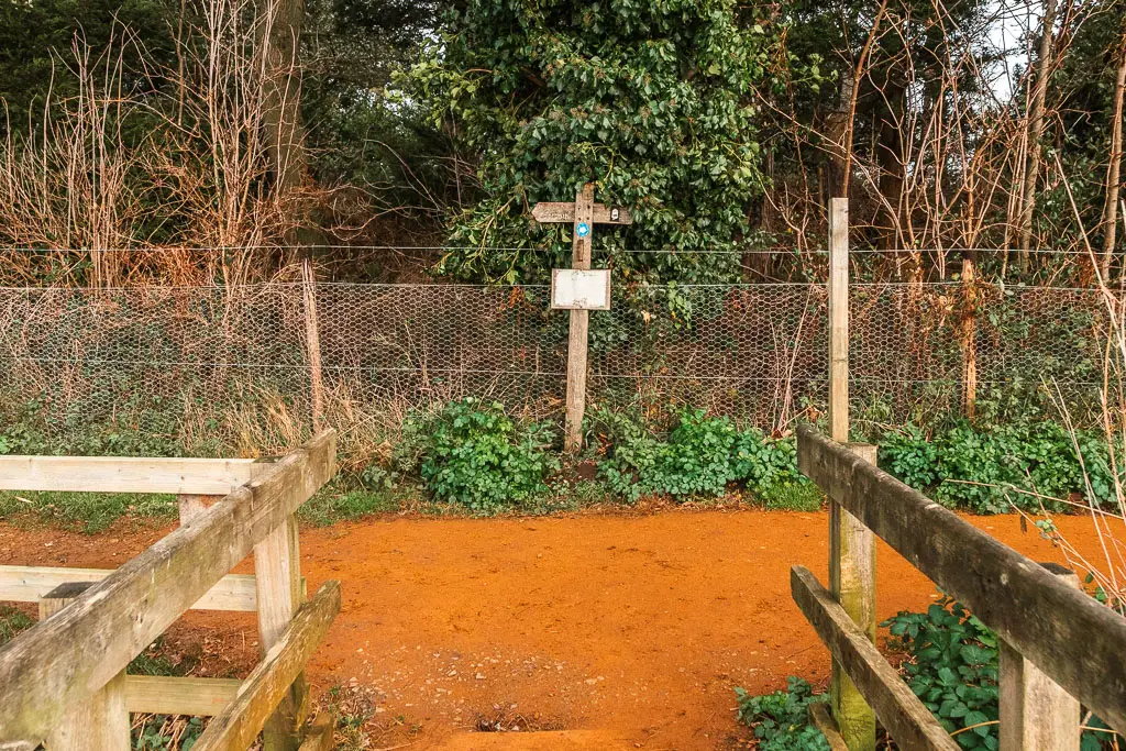
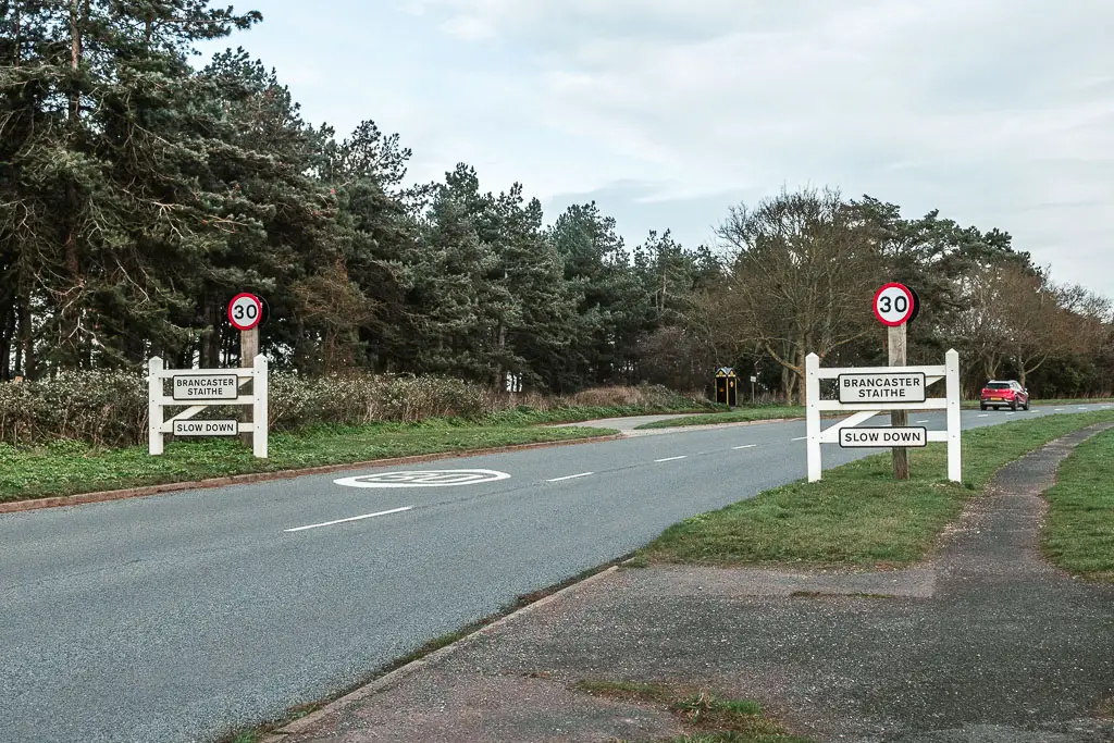
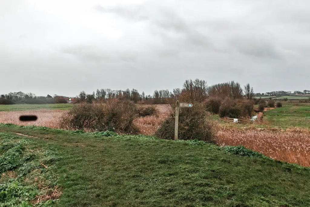
Stay on this road for a bit, then to follow the official trail, turn right onto Choseley Road (see photo below). You then need to walk along this road for a bit over 1mile to reach a trail on the left. Go along this, and keep going, over a couple of small roads. Then at the end turn left, and this will lead you to Brancaster.
I did not do this, but instead stayed on the main road, which is the more direct route to Brancaster….And I do not feel guilty one bit.
The road isn’t very interesting, but it’s easy. Which is what I wanted after fighting with the wind for so long. It does have the national speed limit, but at least there is a path running alongside it the whole way. So I was somewhat safe.

The Diversion
At the time of writing, the Brancaster Boardwalk is closed for repairs. This was not good for me, as it meant more roadside walking.
If you walked the official way to reach Brancaster, when you reach the main road, continue straight across onto Broad lane, and this should lead you to the official Coast Path on your right.
If the boardwalk is still closed, then just stay on the main road heading east, and you can join the official path at Brancaster Staithe.
Back onto the trail
If you had to divert, then once in Brancaster Staithe, take a left at the medieval looking Brancaster Staithe sign, and walk towards the boats.
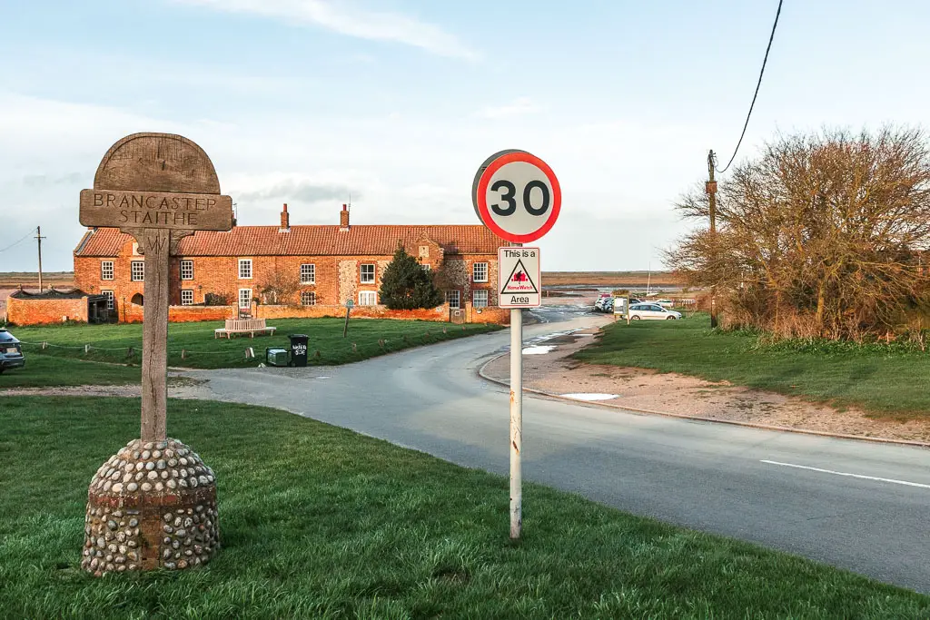
I needed to sit down again, and there is a lovely looking circular bench on the green, but the green had ropes and I wasn’t sure if I was allowed to pass. So I kept going and found a bench by the boats.
After another snack, and some more water, I set off for the final stretch.
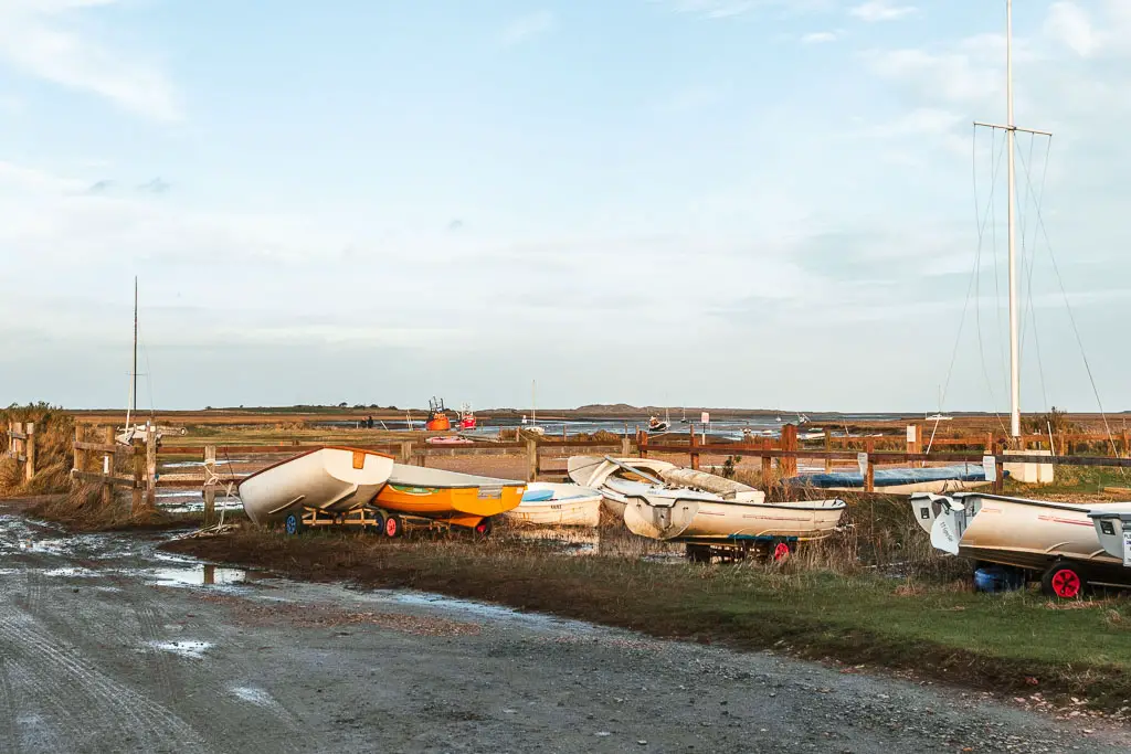
Just past the boats, there is a coast path sign directing you to the right. It told me than Brancaster Overy Staithe was 4.5 miles away. Further than I thought. I wish I hadn’t seen that.


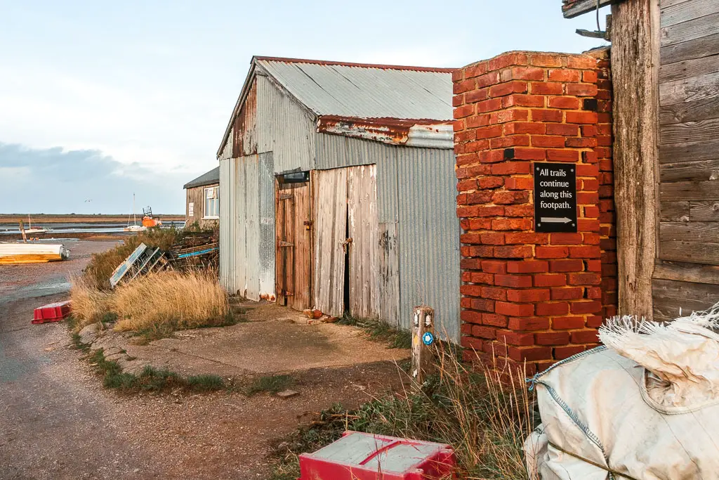
A short way along this path, at the end, turn left. Then look out for a sign on the brick thing which says ‘all trails continue along this path’. Follow it.

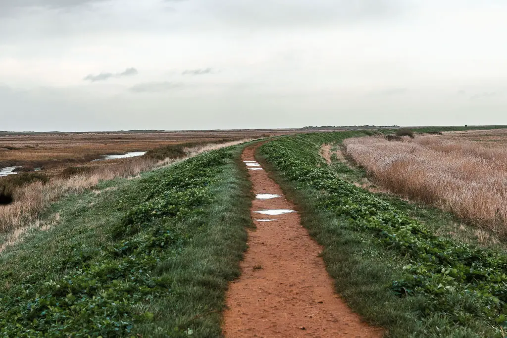
The final stretch of the walk between Hunstanton and Burnham Overy Staithe
The path along here is quite lovely. A dirt path, with marshes and old looking boats to the left. I was so happy to be off the road finally. 4 miles of roadside walking is too long.


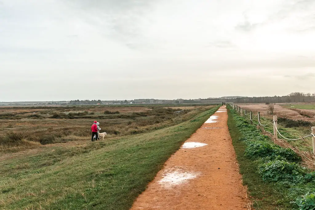
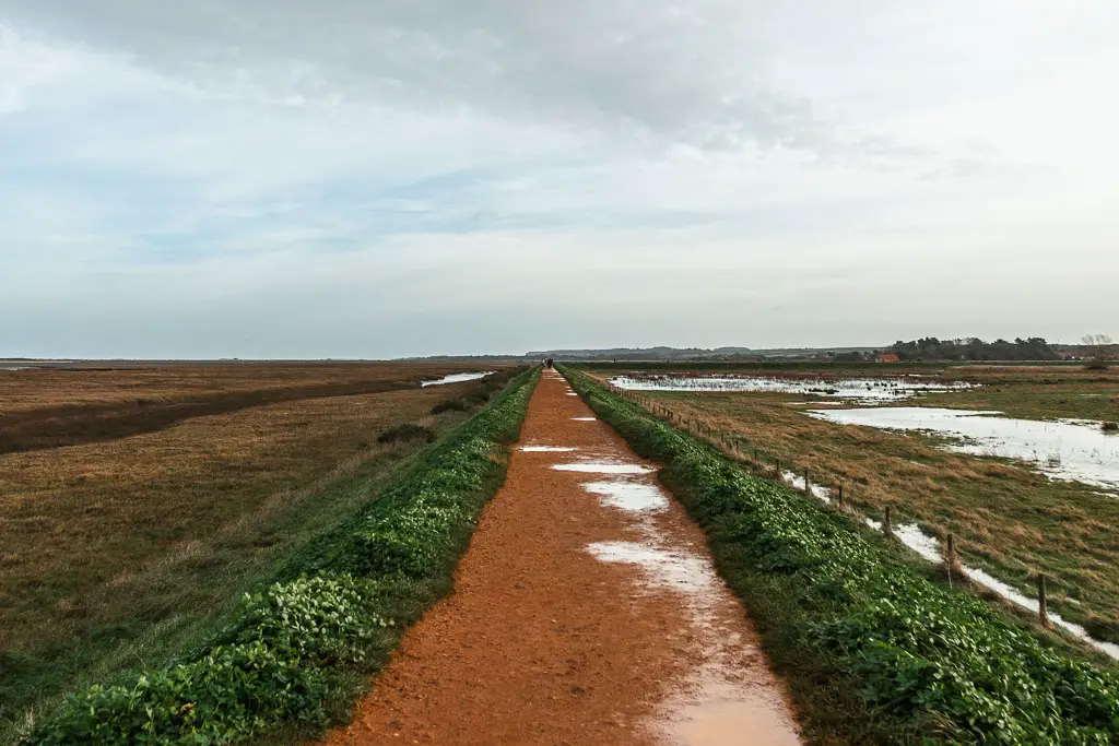
You will be lead onto a ridge type path, where you now begin a semicircle loop (the significance of this will come soon).
It’s a bit more exposed along here, which is noticeable if it’s windy. Which it was. I could see the houses of Brancaster Overy Staithe in the distance, which never seemed to be getting any closer.
Stay on the main path as it starts to curve.
As the path continues to curve, I found myself facing directly into the wind. It also started to rain. At this point I had been walking 15ish miles. I was tired. It was getting dark. Every step was a fight with the elements.
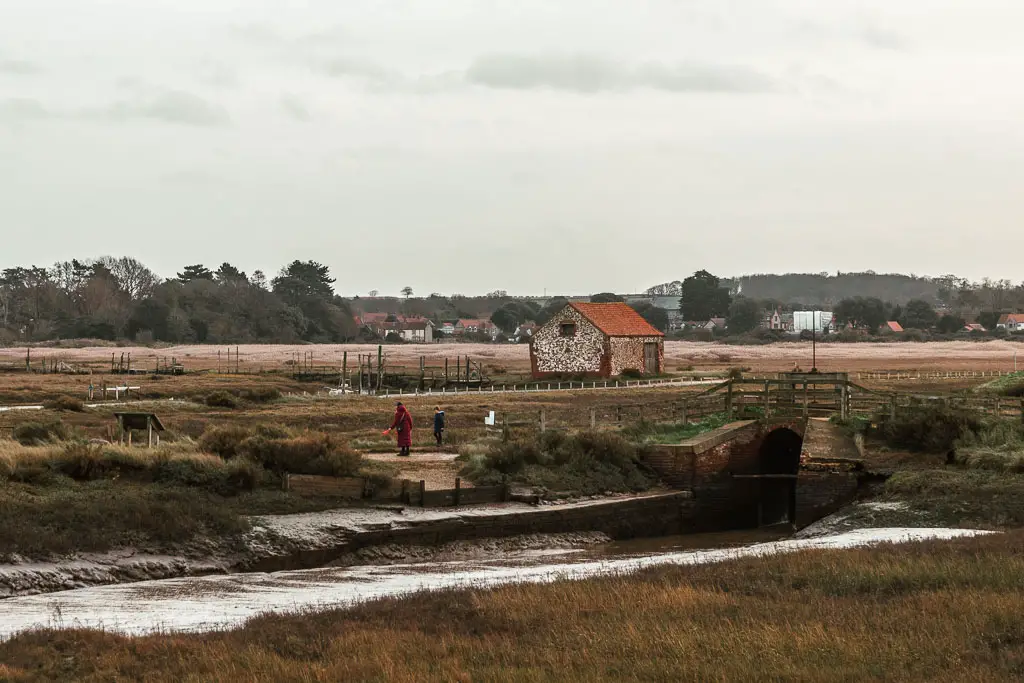
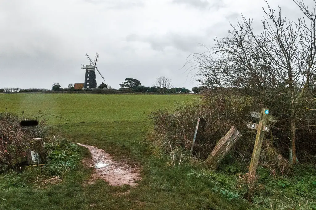
Follow the windmill to reach Burnham Overy Staithe
You should start to see a windmill over to your left. This is where you want to head towards. So when you reach the junction (where the coast path sign is missing), turn left towards the windmill.

The path will then lead you parallel to the road for a bit, then when you get onto the road, turn left. I have no more photos as it was now dark.
A short way along this road, you will pass a coast path sign on the left. However, to end the walk here, keep going to reach the pub.
The bus stop is in front of it. It’s a bench, with no bus stop sign. The markings on the ground should give it away though.
Read next: Day 2 Burnham to Blakeney