I both loved and hated this walk to Cauldron Snout. Let me explain…
What I loved
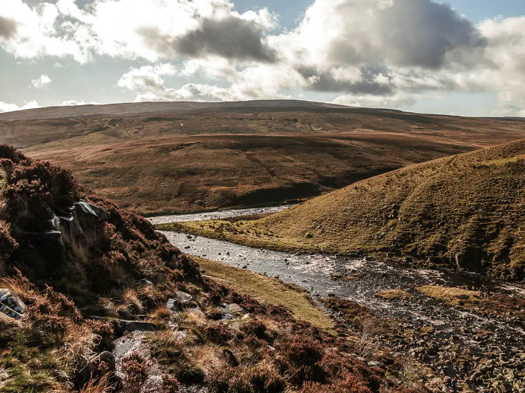
I loved the approach to Cauldron Snout. The way the mist rose up ahead of us, letting us know something big was coming. I loved the walk and scramble down the rocks, with Cauldron Snout slowly showing itself. Then getting to sit in front of it, on a rock, feeling the powerful force of the water crashing down.
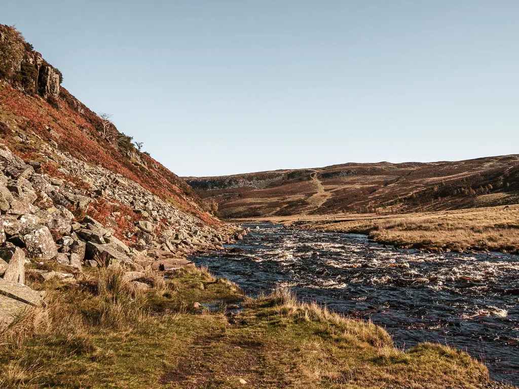
I loved the walk away from Cauldron Snout, below the cliffs, with the trail going from grass, to rocky, to plank walkways, and repeating itself a few times.
What I hated
I hated the long road. You see, to make the Cauldron Snout walk into a circular, you need to walk a couple of miles on the road. The road itself is somewhat scenic. A long winding immaculate tarmac road, cutting through the bleak desolate landscape. However, we did the Cauldron Snout walk anti-clockwise, which meant the road walk was all uphill, and we were met with the lord of headwind. Sometimes so strong that it was a real struggle to put one foot in front of the other.
What is Cauldron Snout?
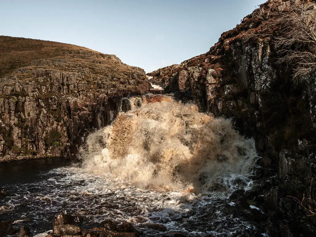
It’s a waterfall along the River Tees, just downstream of the Cow Green Reservoir. Apparently, it’s the longest waterfall in England. After seeing High Force Waterfall the day before, I was equally impressed with this one. Both were nice and robust.
Tips and other things to know about the Cauldron Snout walk
- There is a rocky and potentially very wet hill to walk down past Cauldron Snout. Doing the route anticlockwise meant scrambling down the rocks. I didn’t find it too bad, but if you would prefer to scramble up, do this walk clockwise.
- Due to the scrambling involved on the Cauldron Snout walk, I would highly recommend hiking boots/shoes. Cauldron Snout isn’t the only rocky sections, there are many more. That’s the only one on a steep hill though.
- A large section of the walk can be a bit boggy, and if it has rained recently, bits of the path will be underwater. You can walk to the side of it, but will still get a little wet due to the bogginess. For this reason I would also suggest making those walking boots waterproof.
- If you would prefer to walk downhill on the long road, then also walk clockwise. However, this would also mean walking the road first, which might be a bit boring. Unless you started the walk from Langdon Beck instead.
- If you want to avoid the road altogether, you could just do a there and back. The quickest way to walk to Cauldron Snout is from the Cow Green Reservoir car park. However, you would also miss out on the rest of the walk through the valley, which was a great part of this walk. In order to include this section, doing a there and back walk, I would start from Langdon Beck.
- A vote for doing the walk anti-clockwise (like us), you see all the misty goodness before actually seeing Cauldron Snout. I found this rather exciting. Knowing something big was coming.
- If you park at the Cow Green Reservoir car park (where we started), the way payment works is a bit strange. It says payment is voluntary, but then presents a list of how much to pay per hour/per day. To pay this, it’s pay by phone app. The thing is, there is no phone signal there. Between Ollie and I, we have 3 different sim network providers and couldn’t even get E.
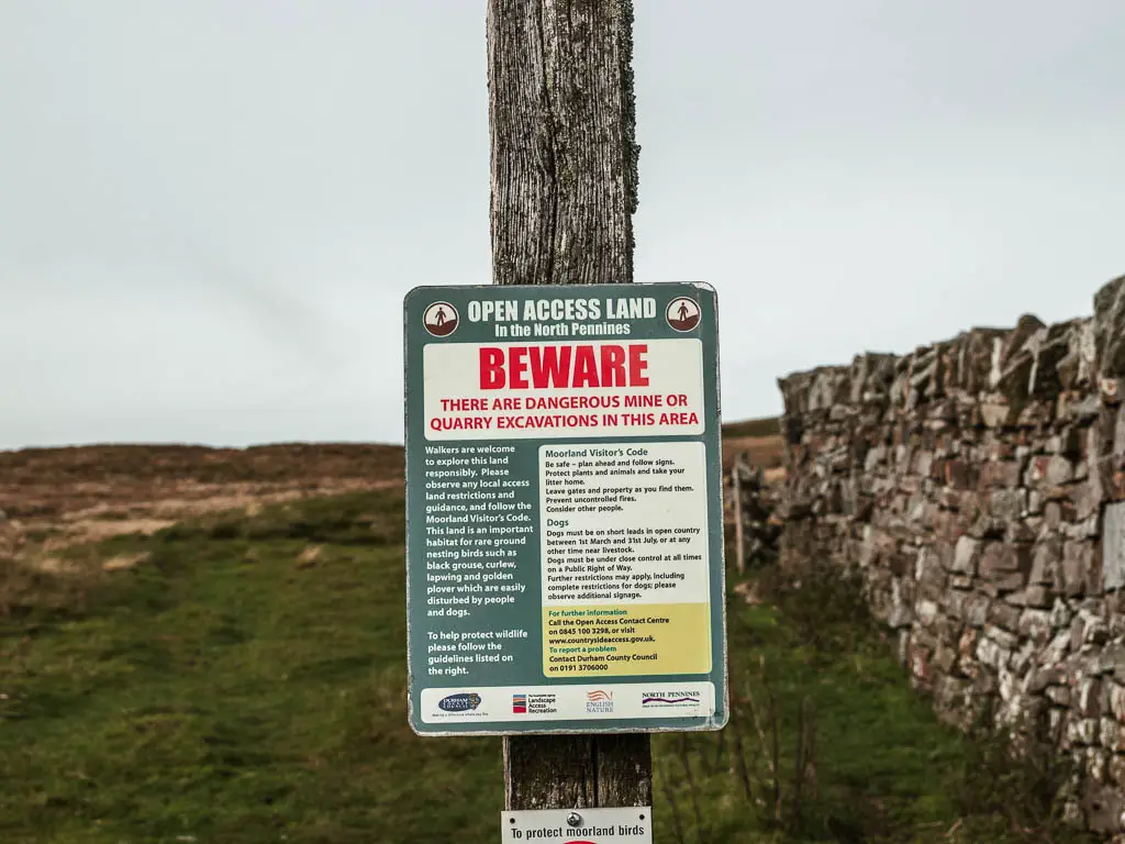
- You are walking in Open Access Land, and a lot of it is a restricted wildlife area. This means you must keep to the Public Rights of Way. There are lots of signs about to guide you.
Logistics for the Cauldron Snout circular walk
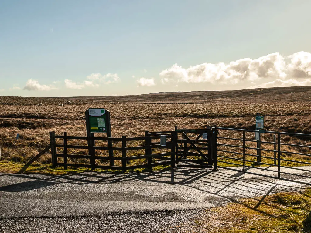
- Start/Finish: For this route – Cow Green Reservoir car park, south west in the North Pennies
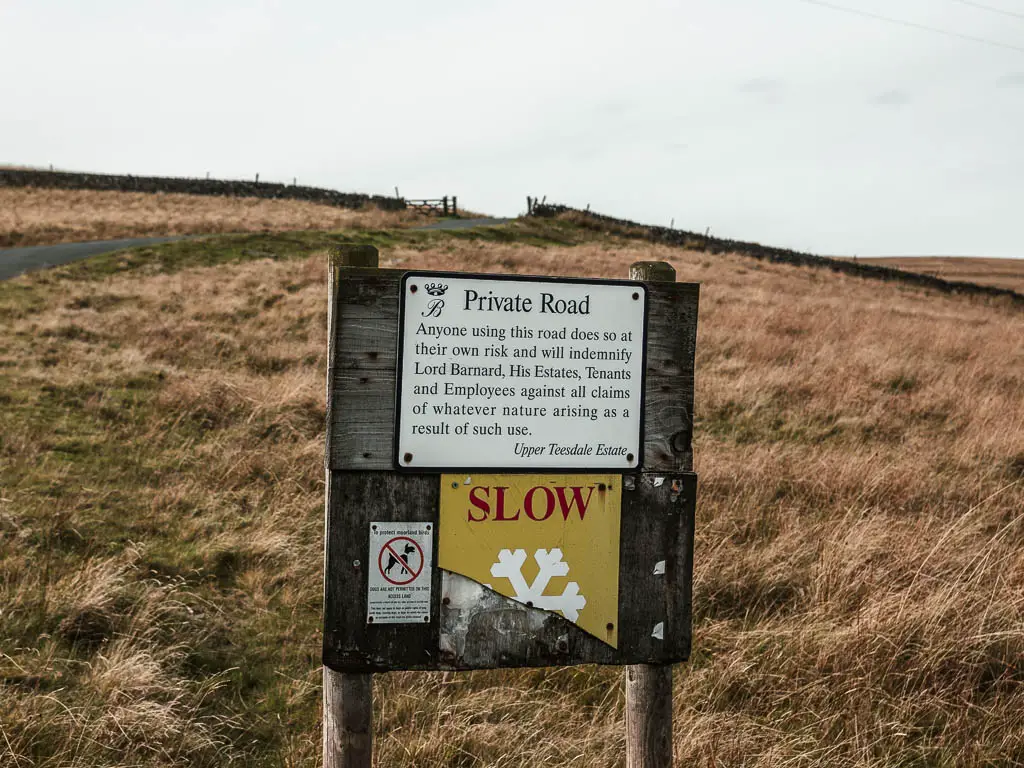
- How to get there: From Langdon Beck, take the side road at the curve in the main road. It’s next to Langdon Beck Hotel. Further along this road, you will reach a fork in the road. Take the left fork which leads you onto the private road of Lord Barnet. Don’t worry, you are allowed to go on this road. Read the sign when you get there. It amused Ollie and I….actually, here is a photo of it:
- Alternate start: Langdon Beck. If you start here, I would do the walk in a clockwise direction. Also, my directions in the guide below are anticlockwise, so they won’t help you so much, but rather show you what to expect along the Cauldron Snout circular walk route.
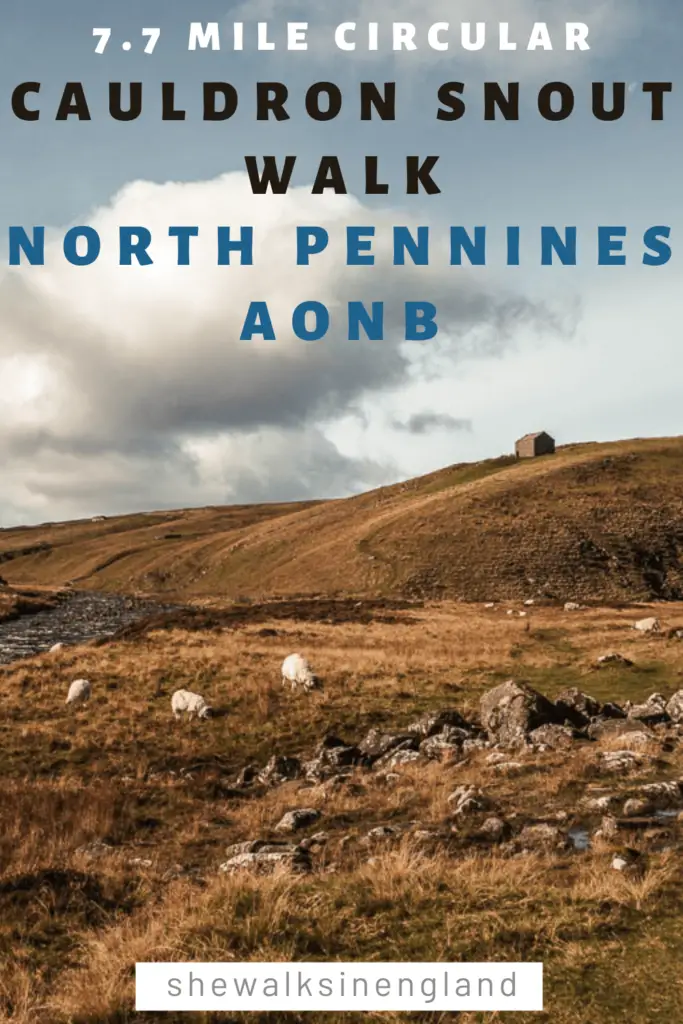
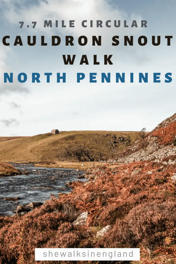
- Distance: 7.7 miles circular
- Time: 3h
- Difficulty: For this route – Easy start, moderate middle section with a technical aspect, the last section was only challenging due to the headwind. Without that, it would have probably been easy.
- Time of year: We did this in autumn
- Amenities: Nothing other than the car park
- Dog Friendly: Lots of livestock. No stiles. Dogs must be kept on a short lead between 1st March and 31st July, and under close control on Public Rights of Way
Map for the circular Cauldron Snout circular walk
You can find my more detailed route map on AllTrails.
More walking ideas in the local area will be at the end
A Guide To the Circular Cauldron Snout Walk
From the Cow Green Reservoir car park, follow the road back out. On the way, there is a small area with information boards telling you about the landscape you can see.
One thing that sticks out is a radar station way in the distance on a hill. This radar is an important part of Britains air traffic control system. The hill it’s on, is Great Dunn Fell. At 848m tall, it is the second highest hill in the Pennines.
Fun Fact: In the 1930’s, a renowned climatologist named Gordon Manley, discovered that the average temperature up on Great Dunn Fell in May, is the same as London in January.
You will find more interesting bits of information like this on the boards.
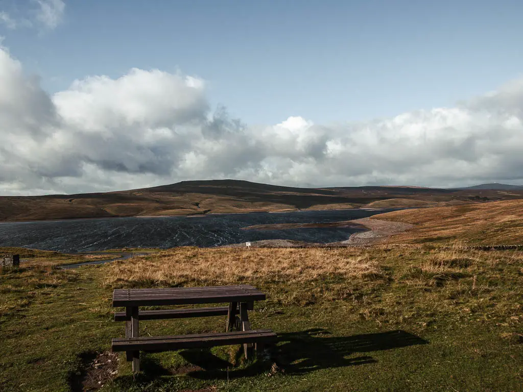
Walk alongside the Cow Green Reservoir
Walking along the road, you will pass a grass trail to your right, ignore this one, but take the next one a little further along. You will be on a gravelly type trail, with the Cow Green Reservoir to your right.
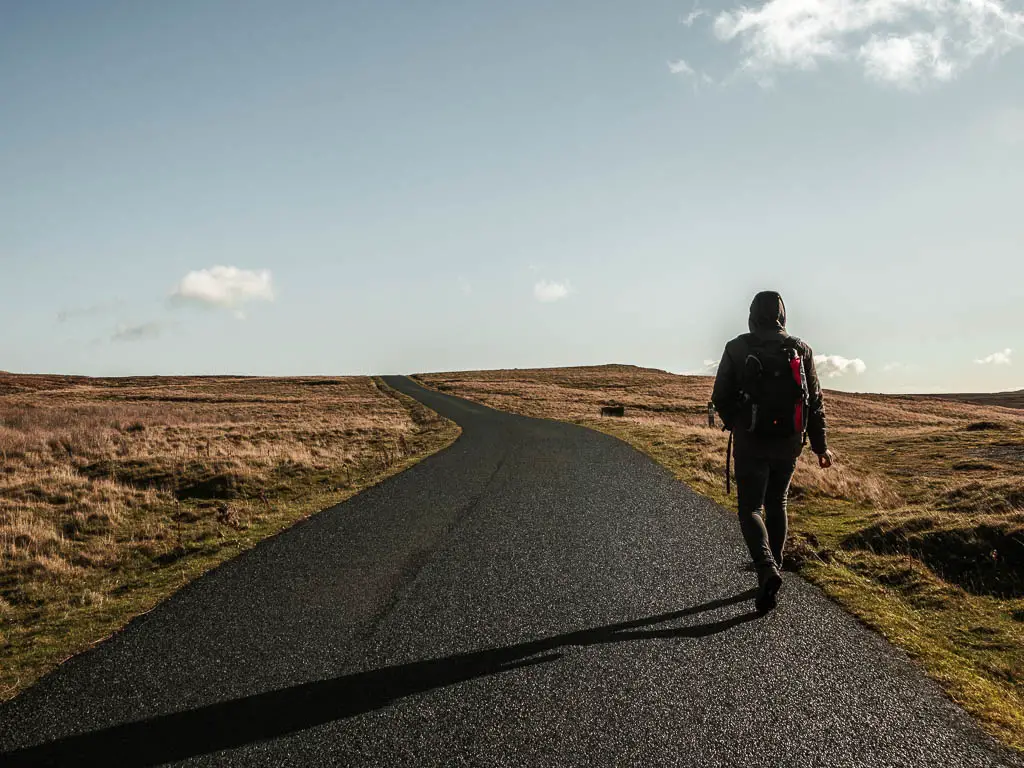
When you reach the junction, turn left, then when you reach the gate, go through it. You will now be walking along a long black tarmac road.
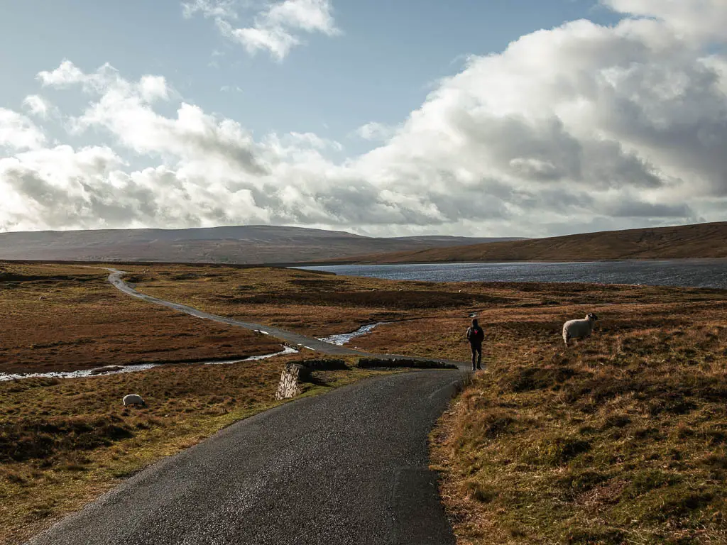
I didn’t know what the Cauldron Snout walk would be like before doing it. I definitely wasn’t expecting this, and wondered if the whole route would be this way. In that case it wouldn’t be as exciting as I had hoped. Don’t get me wrong, there is something special about this bit of the walk. A long black road, across the moors, with no end in site. Like you are really in the middle of know where.
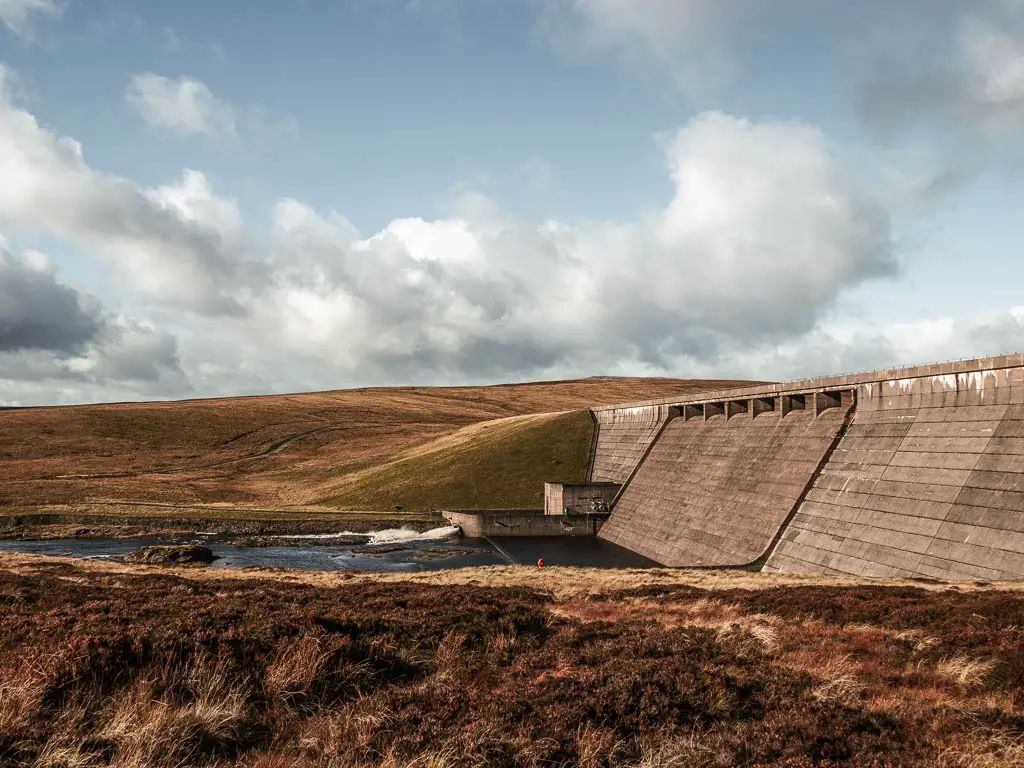
Walk to Cauldron Snout and the damn
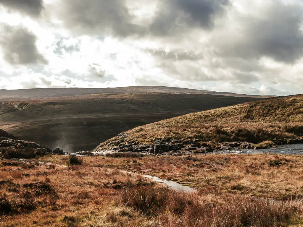
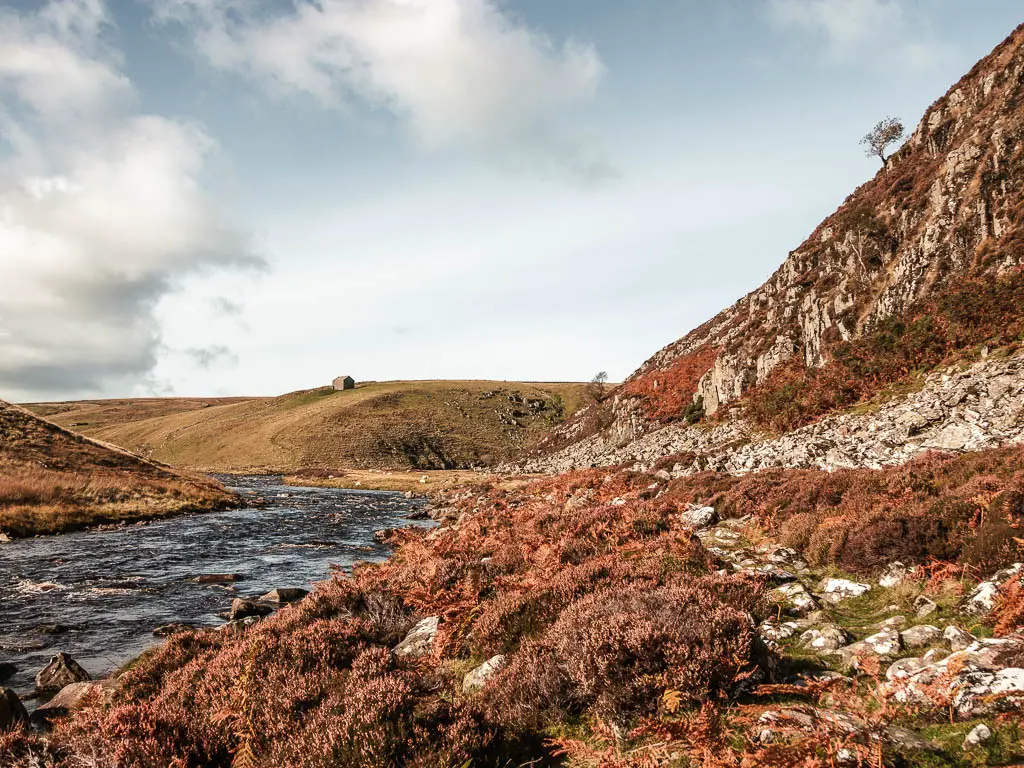
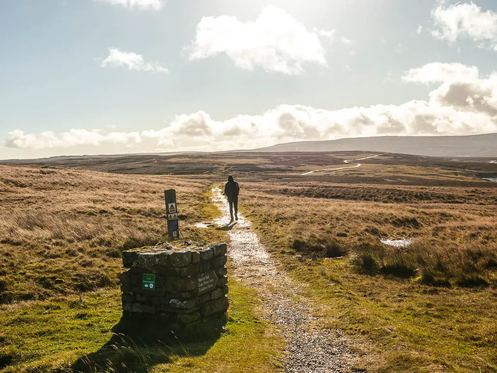
You will start to get a view to a damn on the end of the Cow Green Reservoir, then a short way past this, the mist rising from the depth ahead. This is where the rocky scrambling begins.
You are guided onto the rocky path by the Pennines Way signpost.
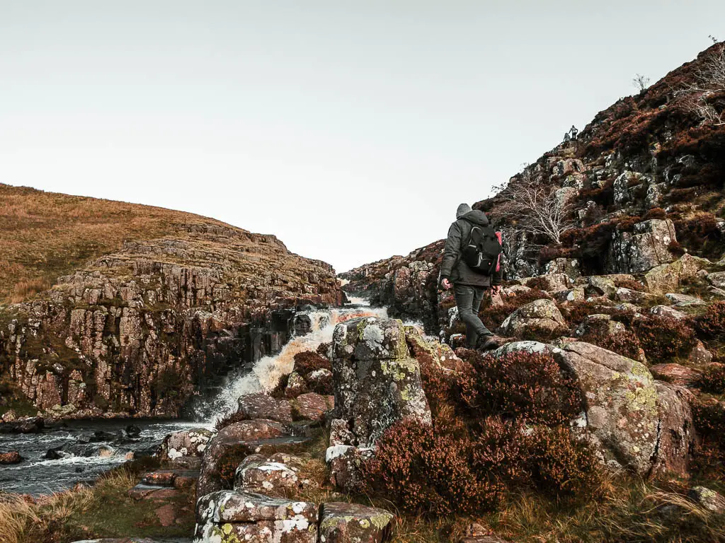
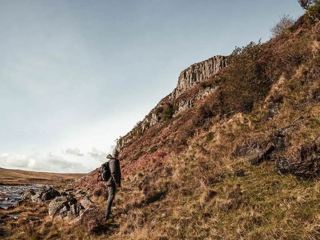
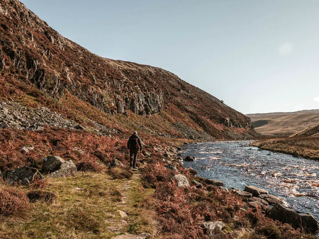
Walk down the rocks alongside Cauldron Snout
As you walk across the path and rocks, there will be a sudden drop, to take you down, with Cauldron Snout appearing to your right. It had been raining a lot before we did this walk, so it was all a bit muddy and wet, however, I didn’t find it too challenging scrambling down.
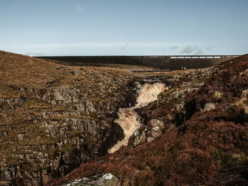
When you reach the bottom, if you walk up some rocks to your right, you will be able to get really close to Cauldron Snout, and there are some nice rocks, perfectly situated for sitting on to admire the beauty.
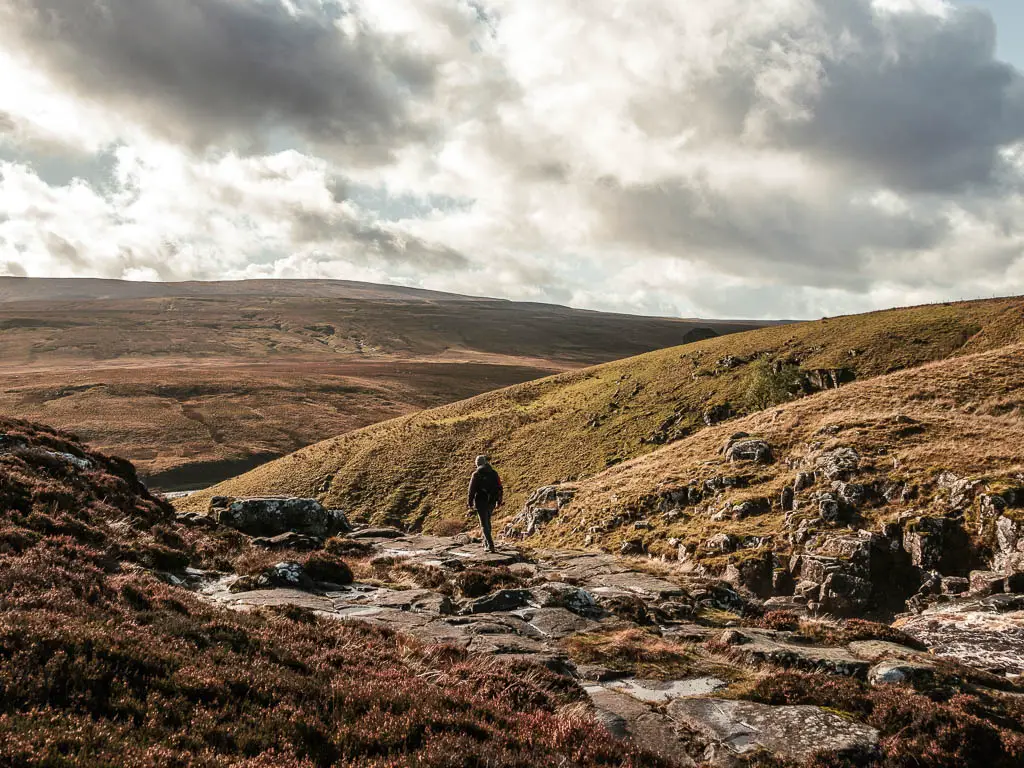
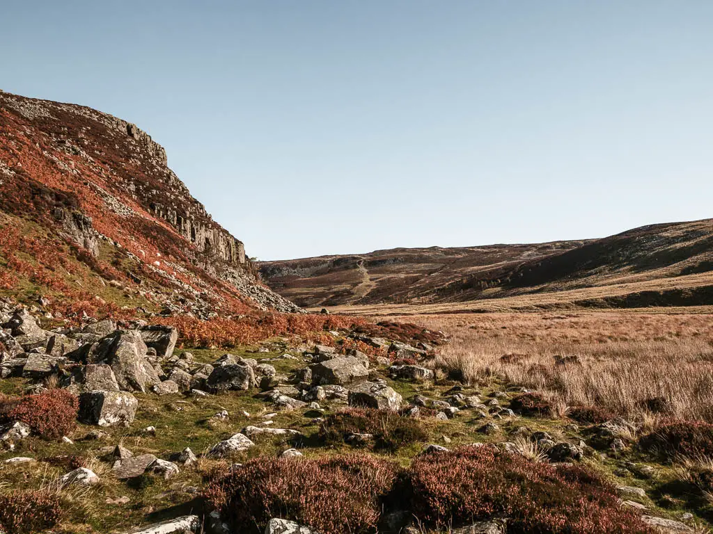
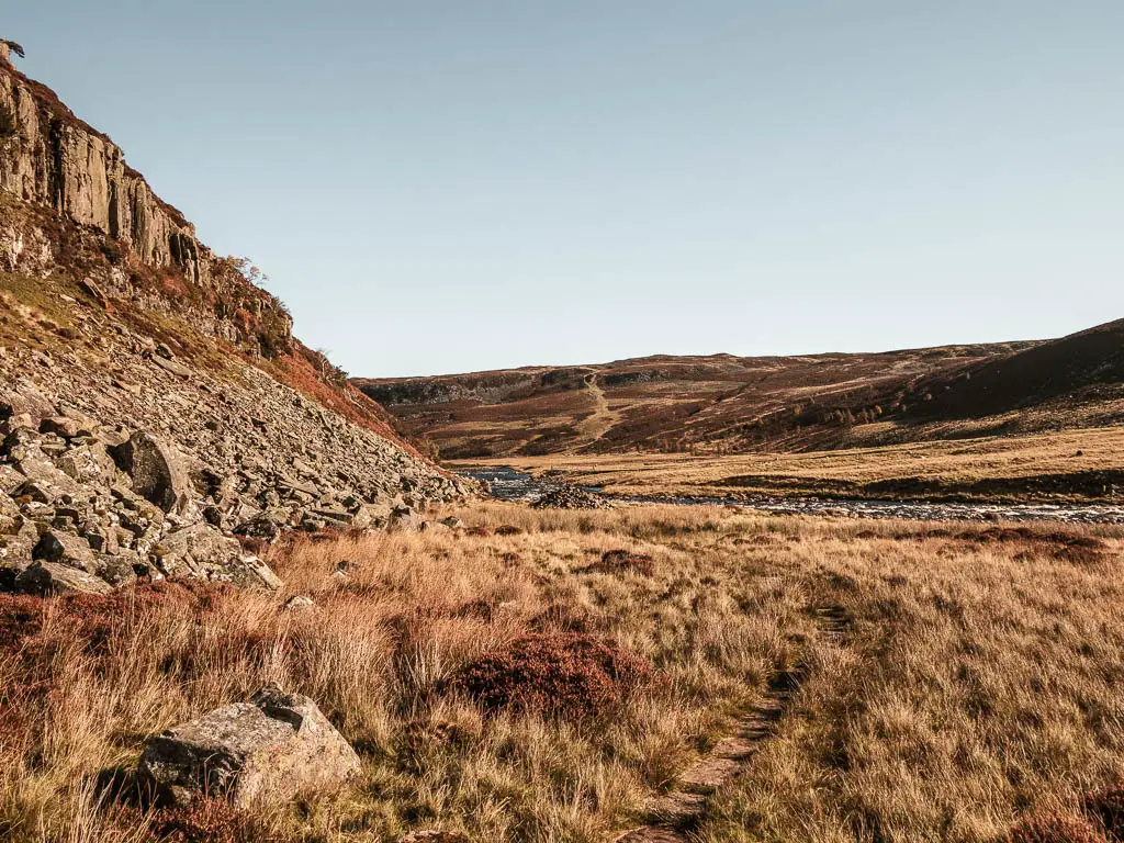
Leave Cauldron Snout for the next stage of the walk
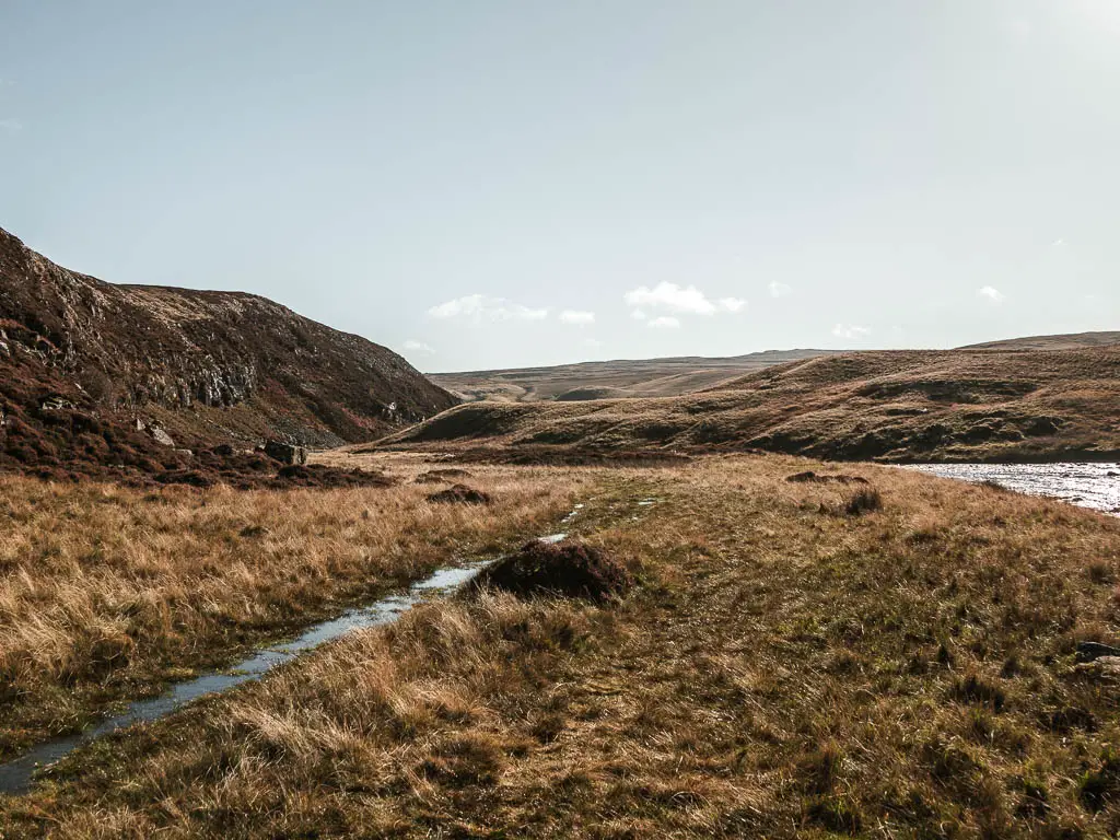
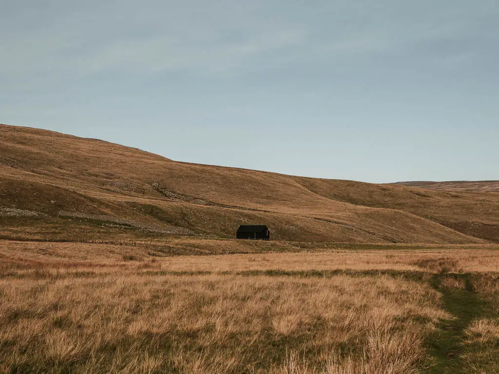
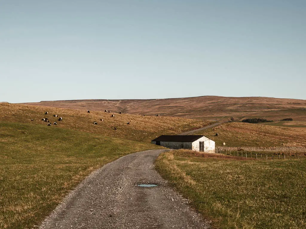
You should be able to see a grassy trail leading away from Cauldron Snout, for us it was all waterlogged, so we walked along the marshy bit instead. The lesser of two evils. As you walk along here, make sure to look back to get a view to the shed on the hill.
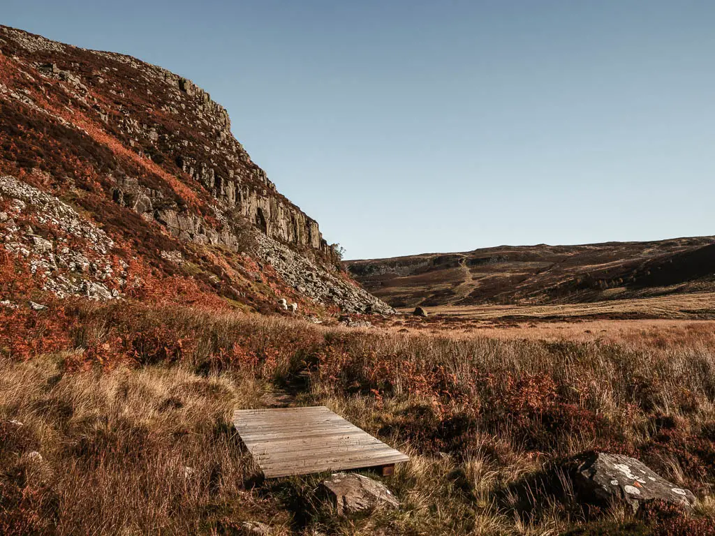
The rocks
The path will lead you to lots of rocks. This is a taste of what’s to come later. Hint: It gets a lot worse…or better, depending on how you take it.
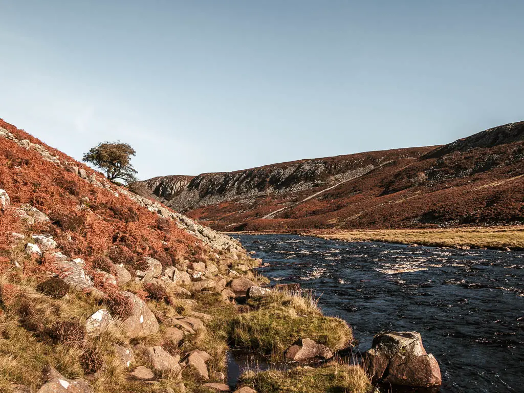
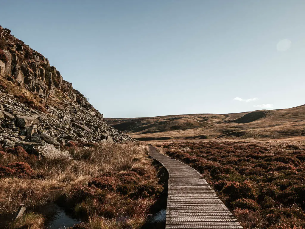
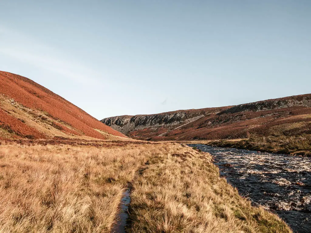
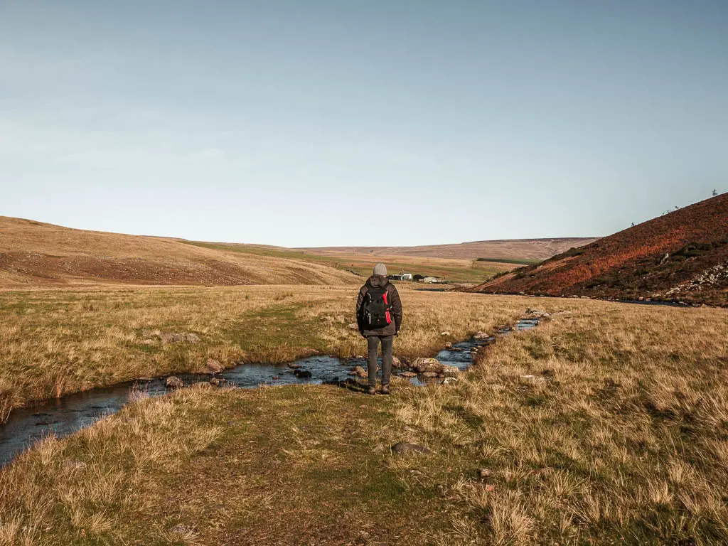
Walk through the valley
The trail is pretty easy to follow, in that there is know where else to go. It will mix up between grass, marsh, plank walkways, dirt, patches of rocks, and scrambling rocks. It will take you through this sequence a number of times. At times, you may feel you have gone the wrong way, as the trail disappears. Don’t worry though, as long as the river is on your right, you are correct.
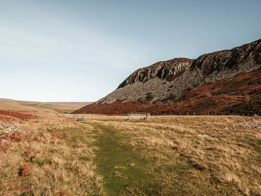
Walk through the fields
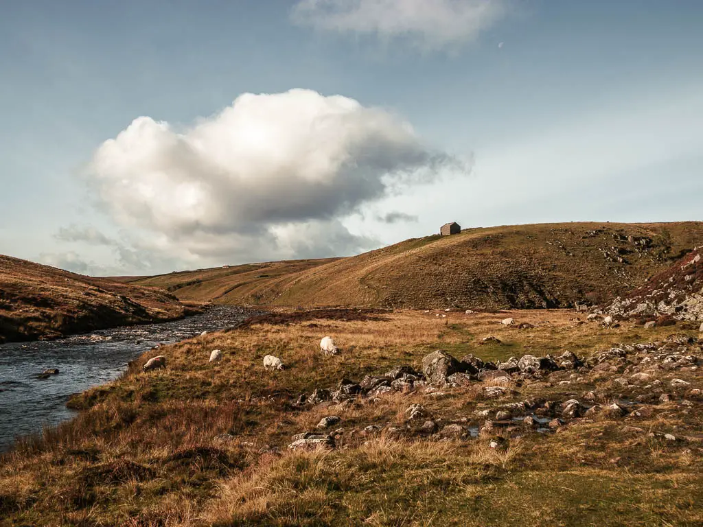
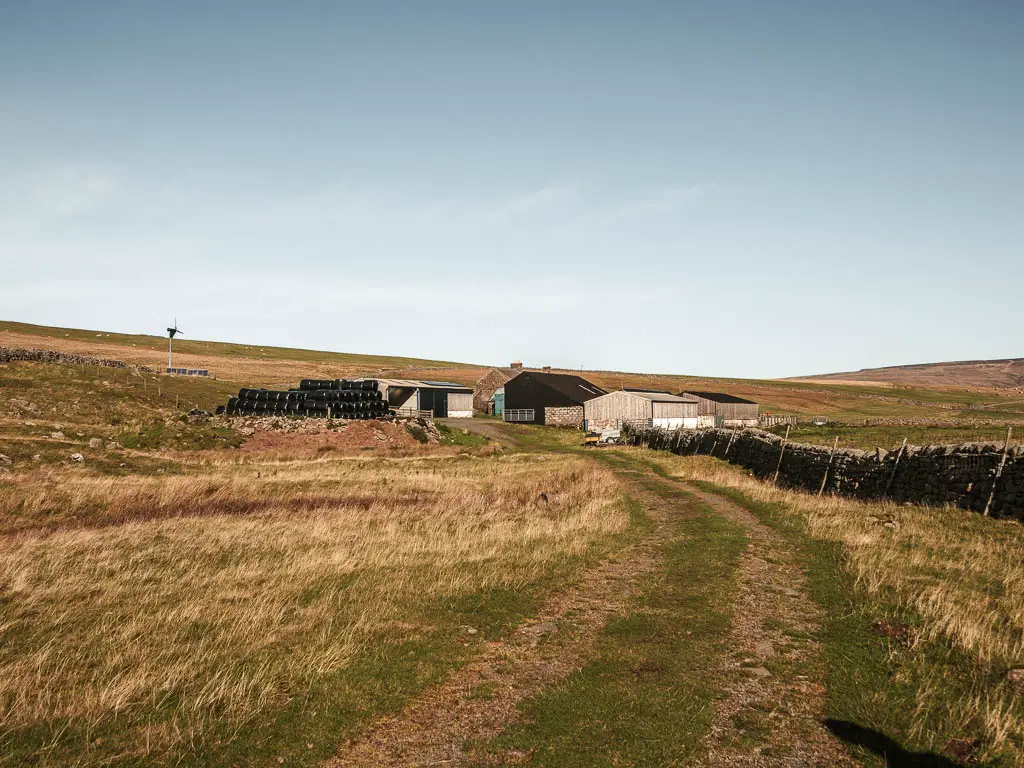
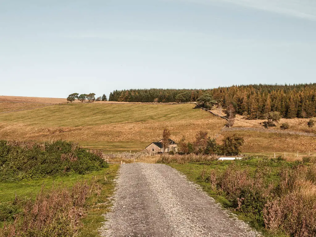
You will know you have reached the end of the ruggedness, when a big field opens up in front of you, with a wide grass trail. Now you follow this for a bit. It will lead you over a stream and past a seemingly abandoned shed to reach the farm.
Walk through the farm to the road
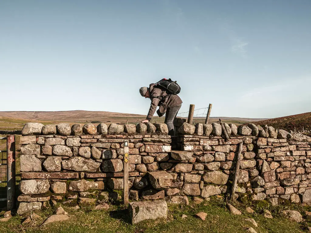
At the farm, there is a big metal gate, it’s a tough one. I tried, then Ollie tried. Then as we were about to climb over it instead, noticed the stone steps over the wall on the right.
From here, you have two options. There is a gate to the right, which takes you on a trail to Langdon Beck. If you started the Cauldron Snout walk from there, you can take this route. We were glad we hadn’t, as there was a ‘bull in field’ sign. We peered over to see if we could see it, but couldn’t. I figured it must be hiding.
You can still walk back to Langdon Beck following our route for a little longer though…
Following our walk, stay on the main path, through the farm, and onto the road on the other side. This will lead you to a white shed building.
The cows
We thought we had escaped the cows. Turns out we hadn’t. This is where they were all hanging out. As we got closer, we realised this wasn’t just cows. This was calfs and bulls. All the worst ones.
These cows did look different to the ones from down south though. They had a teddy bear cuddly quality to them. One was scratching himself on the metal gate. I have never seen cows this colour scheme either. With that white stripe down the middle of them.
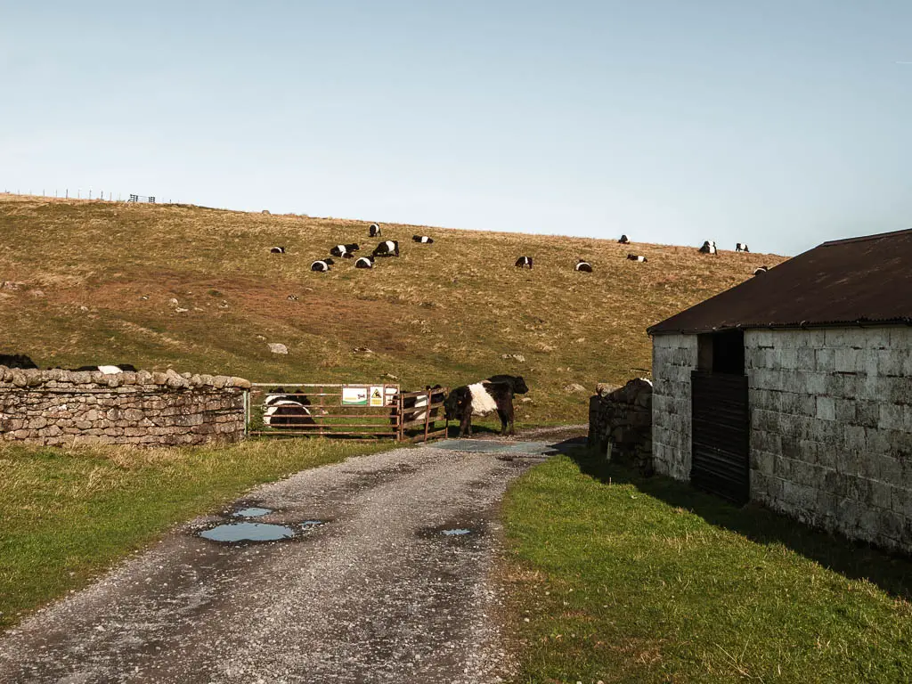
Despite this, I still let Ollie go first. Once he was safely past, I rushed through, keeping my head down, trying not to look any in the eye.
Walk to the main road for the final stretch of the Cauldron Snout walk
This gravelly road will lead you to some gates and onto the main road. Turning right will get you back to Langdon Beck. Left will take you back to the Cow Green Reservoir.
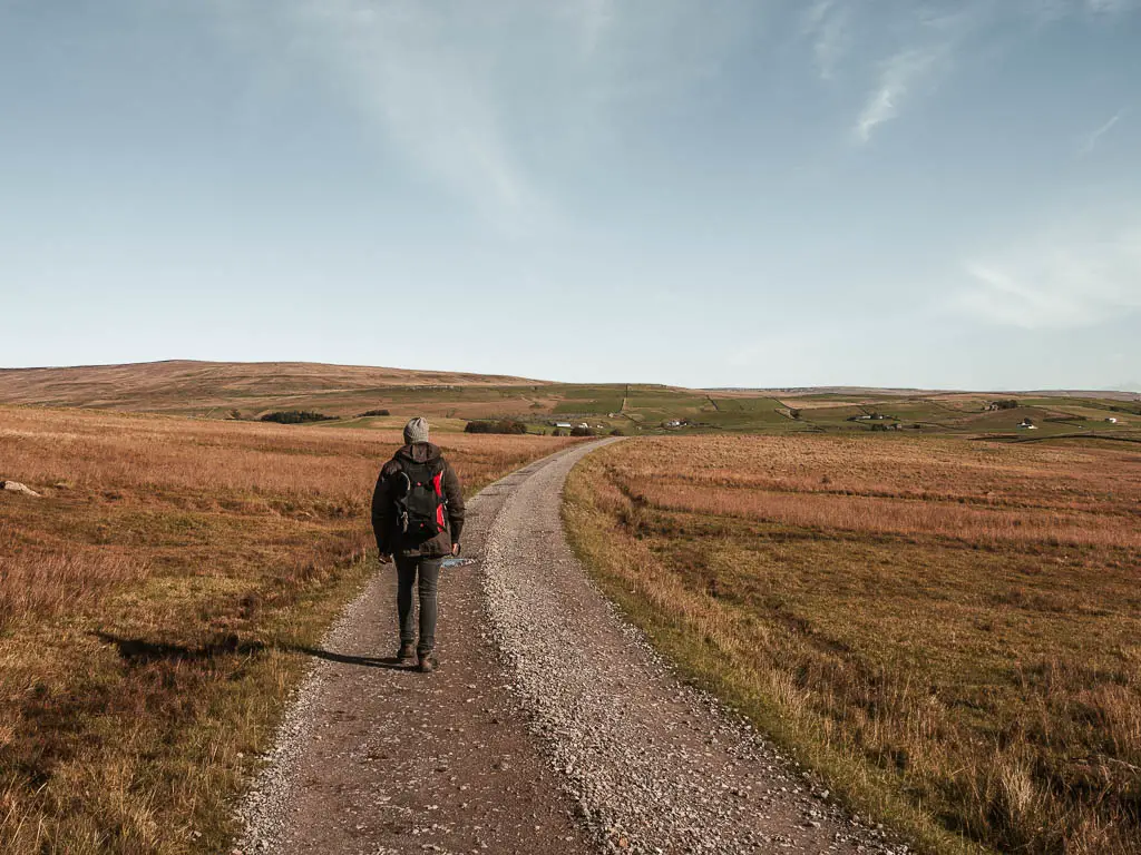
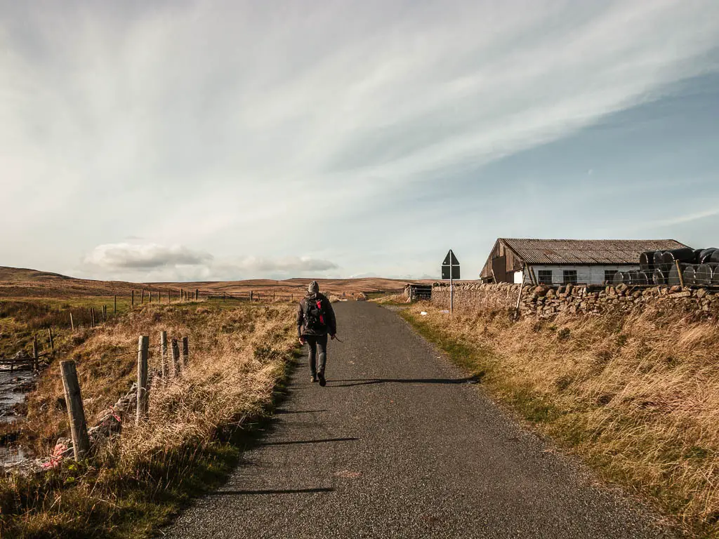
From here it’s a couple of miles of road walking. Surrounded by the moors. It’s also uphill.
At this point, the wind was present but not too bad, then once we reached Lord Barnet’s road, it all changed. The wind picked up and became so strong, I struggled to put one foot in front of the other. Whilst walking uphill. I wondered if Lord Barnet was punishing me for something.
Reaching Cow Green Reservoir
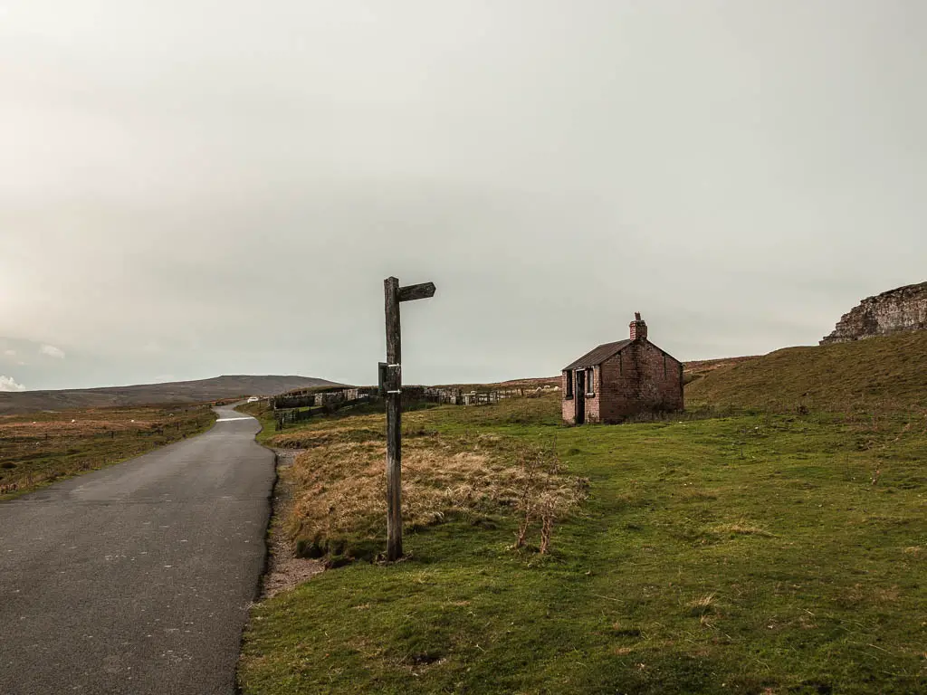
You will know you are nearly back at the reservoir when you walk past an abandoned shelter. I wonder if this was a bus stop at some point. There are a few little trails around here, however, I decided to stick it out on the road. What with signs warning of dangerous stuff about.
It was like a dream when the Cow Green Reservoir appeared over the hill. A reward waiting there to greet me, after that punishing walk up.
More walking ideas in the North Pennines
If you like waterfalls, then you should try the High Force Waterfall walk. This one actually features two waterfalls, both of which are quite impressive. This walk is much easier than the Cauldron Snout one.
I didn’t know at the time, but this would be my last walk in the North Pennines…for now. The weather turned, so we left for the Lake District. I will be back though. When the weather is a bit more friendly.
For more info about things to do in the area, you can check out the North Pennines website.
Pin it for later: A guide to the Cauldron Snout circular walk