
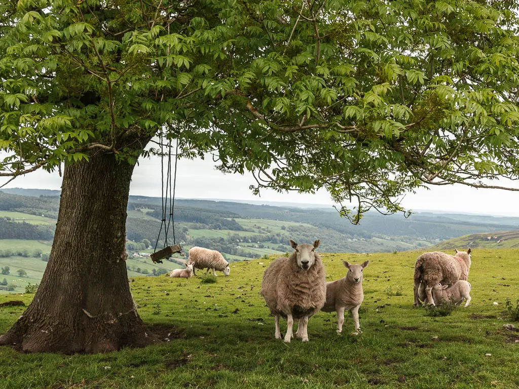
The North York Moors National Park, located in the North East of England, has some very unique things about it, and there are so many walks for all abilities. Firstly, it has the largest expanse of heather moorlands in the United Kingdom, which you can see in all its pink and purple glory during late summer/autumn. It also forms part of the North Sea Coast, with miles of coastline with rugged sheer cliffs, sandy beaches, and seal colonies.
This post uses affiliate links. You can read the privacy policy or disclaimer for more info.
What else to expect when walking in the North York Moors
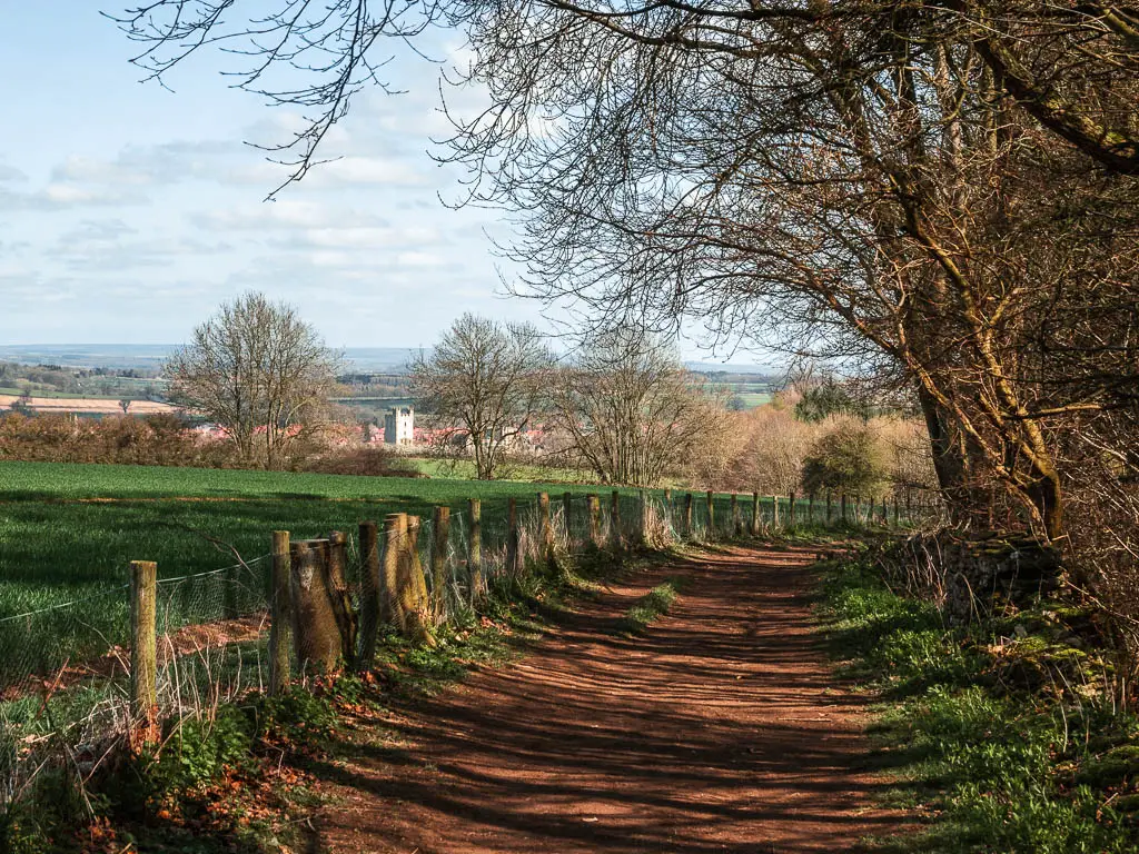
The North York Moors has so much to offer for walkers, from old railway trackbeds, to a lake from the ice age, an impressive natural hole, ancient stones, a hidden waterfall, steam trains, the Cleveland Way National Trail, woodland, and the most unusual peak I have seen in the United Kingdom.
Some of the best hikes in Yorkshire, can be found in the North York Moors. Everywhere you go, has fantastic views.
To explore other areas of Yorkshire, check out my guide on Yorkshire Dales walks here, or Nidderdale AONB here.
There are walks to good pubs, tucked away villages, a train station featured in Harry Potter, and a town which helped inspire Bram Stokers Dracula. Also, remember Heartbeat? That was filmed right here, in the heart of the moors.
There is a lot of history in the North York Moors, with remnants of the industrial passed dotted across the landscape, which you will also see on some of these walks.
Planning your walk in the North York Moors
Everyone of these walks in the North York Moors National Park, I have done. I have written a comprehensive guide for each one, which includes a detailed route descriptions, map, full logistics, tips, and lots of photos. That way you can easily follow along. All these walks are circular, with a couple of them having a linear walk option.
I have divided the walks into the following sections:
- The best coastal walks in the North York Moors
- Hayburn Wyke – 3.5 miles
- Robin Hood’s Bay and Ravenscar circular walk – 7 miles
- Whitby and Robin Hood’s Bay circular walk – 14.5 miles
- Walks with the best views in the North York Moors
- The Wainstones walk – 8.3 miles
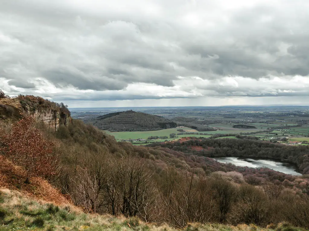
- Sutton Bank circular via Gormire Lake – 8.5 miles
- Roseberry Topping via Captain Cook’s Monument – 5 miles
- Hole of Horcum circular walk – 7 miles
- Osmotherley circular walk – 7 miles
- Rosedale Abbey and Railway circular walk – 10.4 miles
- Easy walks in the North York Moors
- Helmsley to Rievaulx Abbey and back – 6 miles
- Kilburn White Horse – 1.6 miles
- Goathland to Grosmont along the Rail Trail and back- 8 miles
Getting around the North York Moors
The nearest main towns to the North York Moors are Middlesborough, Scarborough, and York. From Middlesborough, you can get a train to Whitby which is the main town within the North York Moors. From there, you can start a couple of these walks, alternatively, there is another train line to get you further in.
If you are in York, you can get a train to Scarborough, which sits just on the edge of the National Park, or you can get a bus to Whitby.
These are the best places to get to, if you don’t have car.
In general though, within the National Park, it’s a little trickier using public transport. With long and infrequent bus journeys. Therefore, for most flexibility, my recommendation is to get around the North York Moors for all these walks, with a car.
If you would like to rent a car, then Discover Cars, are quite reasonably priced.
Best North York Moors Coastal walks
These walks all take you along the coastline of the North York Moors National Park, following part of the Cleveland Way. With impressive, rugged cliffs, waterfalls, and sandy beaches. The starting point for these walks, are also the easiest to get to via public transport.
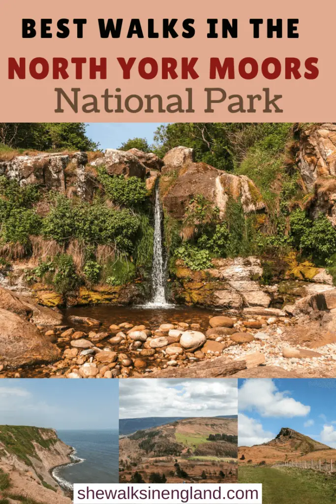
1) Hayburn Wyke circular route
Start/Finish: Hood lane Distance: 3.5 miles Time: 1h 30min Difficulty: Easy
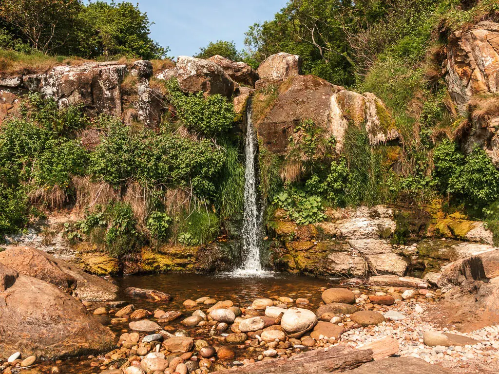
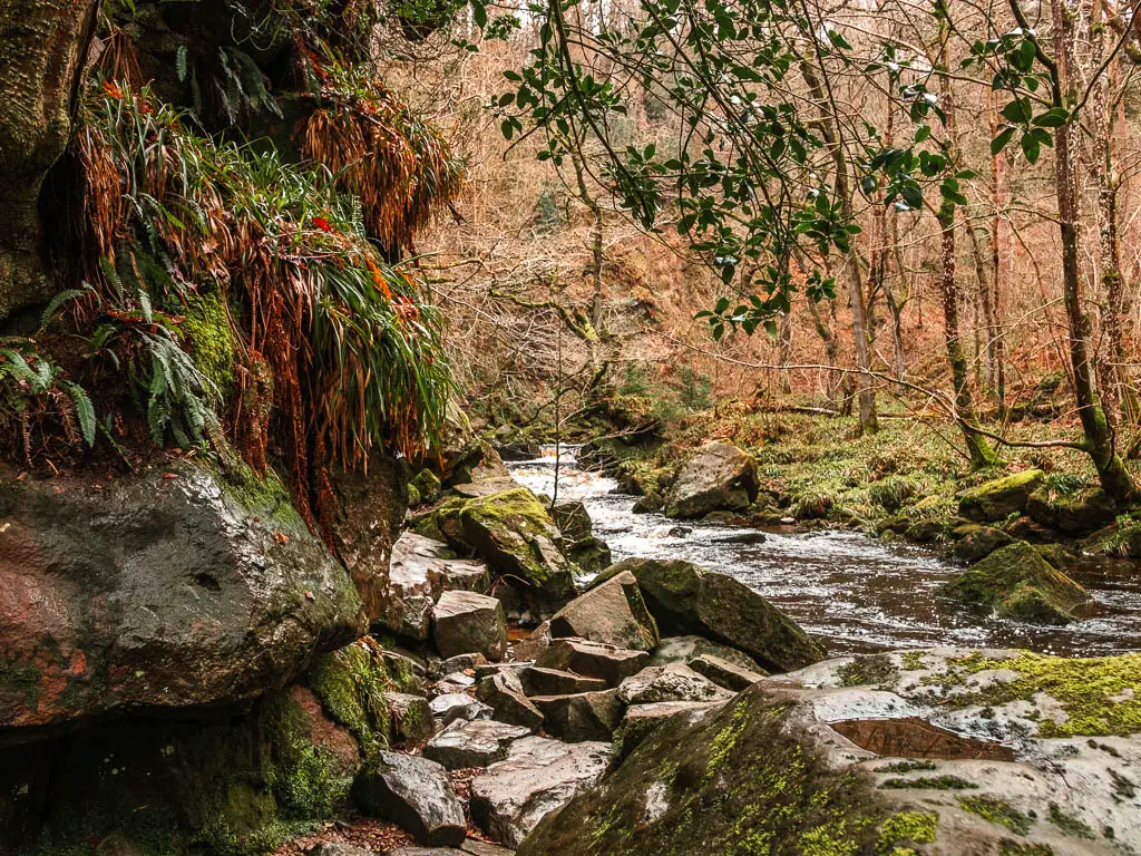
Located just north of Scarborough, this is my favourite of the North York Moors coastal walks. It first takes you along the clifftop, and then down to a secluded rocky beach with a gorgeous waterfall. It’s not the biggest waterfall, but it’s incredibly picturesque. The way it drops down the cliffside, with tufts of greenery in the crevices, is simply gorgeous. This is definitely one of my favourite waterfalls I have walked to out here in North Yorkshire.
Then you will walk back up along the woodland paths, where I was lucky enough to see Bambi. Before finishing with an optional pub stop near the end.
This is a proper hidden gem, as despite doing this walk on a very sunny weekend, I only passed two other people.
Read more: Hayburn Wyke walking guide with map.
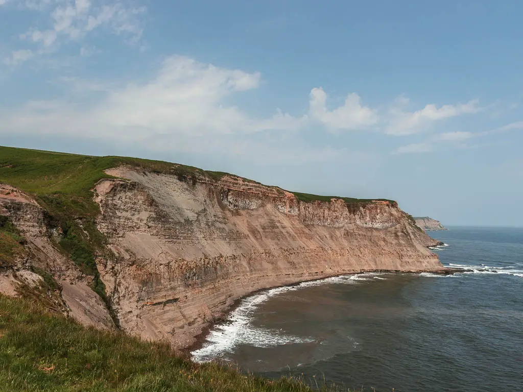
2) Robin Hood’s Bay and Ravenscar circular
Start/Finish: Boggle Hole car park Distance: 7 miles Time: 2h 40min Difficulty: Moderate
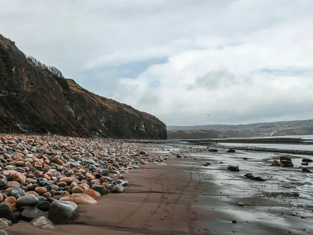
This walk, on the edge of the North York Moors, has something the other walks on the list doesn’t have…the seals. That’s right.
After walking along the clifftop, you will descend down onto the north sea coast. This is where you might find yourself amongst a seal colony. You have to be careful not to disturb them though. There are signs about telling you the do’s and don’ts. As well as a seal watch person, who will give you tips on how to navigate through them safely.
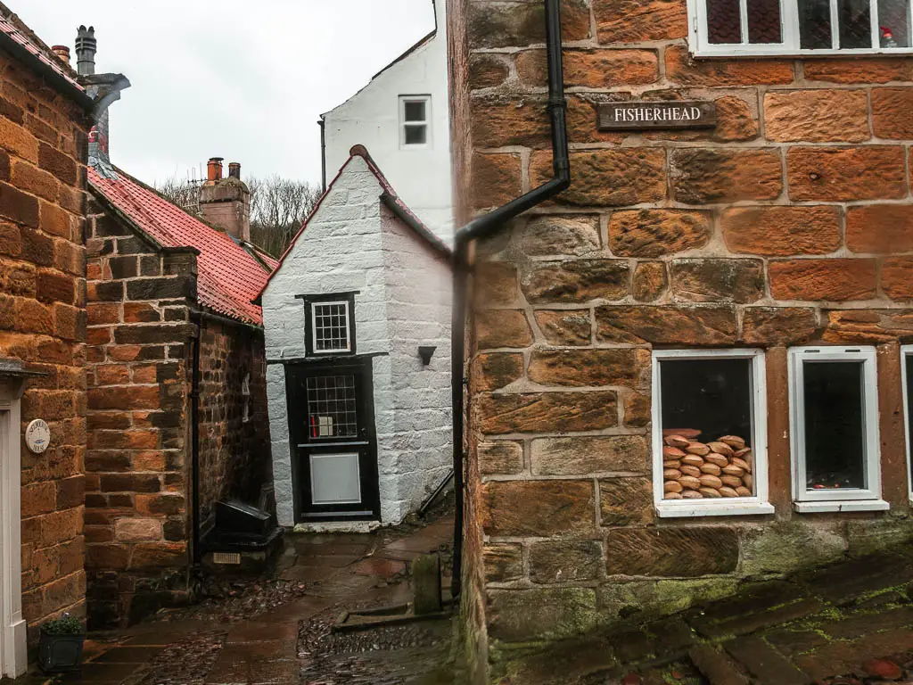
After that, you will finish the walk along a sandy beach. Passing by a waterfall or two. To reach the cute little fishing village of Robin Hood’s Bay.
Read more: Robin Hood’s Bay and Ravenscar walk guide with map.
3) Whitby and Robin Hood’s Bay circular or linear walk
Start/Finish: Robin Hoods Bay Distance: 14.5 miles Time: 4h 30min Difficulty: Moderate
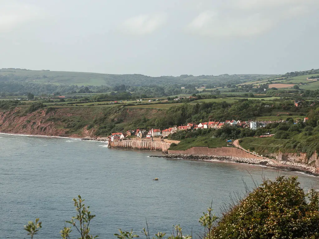
This is the longest of all these walks on the list. Taking you between a cute, tucked away fishing village, and a quirky, gothic, bustling harbour town.
The walking route first takes you along the North York Moors coastal path, following the Cleveland Way National Trail, with dramatic coastline views ahead. It then brings you back along the Cinder Track, which is the old railway line. Both trails are very different. The coast path gives you the grand cliff views, along an undulating trail. Whilst the Cinder Track is on a level maintained path, with trees and field views.
The beauty of this walk, is you don’t have to do the full circular route. You can make it a linear walk, and pick the trail that suits you the best. Then catch the bus back, with a journey time of just 15min.
This is a classic walk in the North York Moors. That, combined with being next to Whitby, means it can be a little busier than some of the other walking routes in the list.
Read more: Whitby and Robin Hoods Bay circular route guide with map.
Walks in the North York Moors with the best views
These walks all take you high up in the hills, with some of the best views across the North York Moors National Park. Some of the most impressive and grand landscape can be found on these walks. From deep valleys, to a peak that gave me goosebumps every time I saw it. Ridges, an ice age lake, a massive hole in the ground, and open moorland as far as the eye can see.
These are also the most challenging walks on this list.
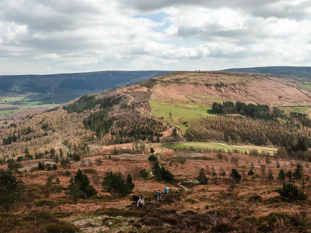
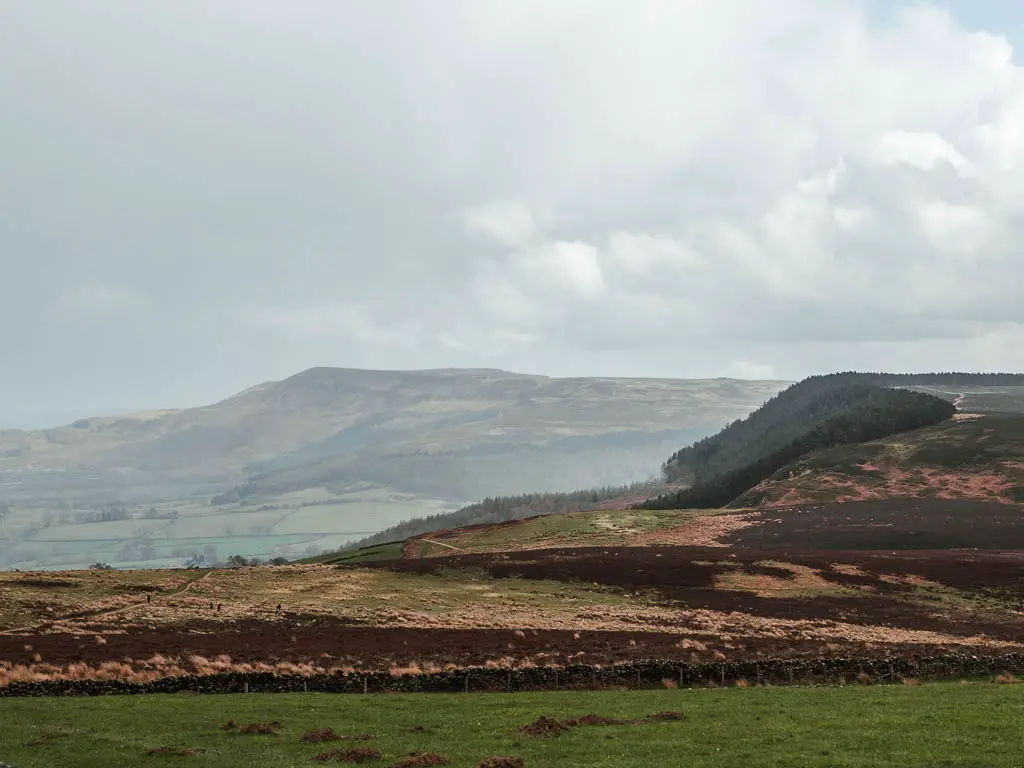
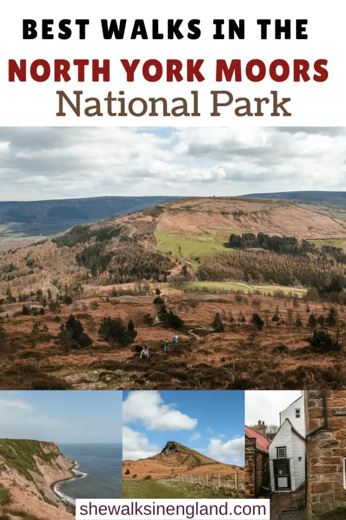
4) The Wainstones walk
Start/finish: Chop Gate Distance: 8.3miles Time: 3h+ Difficulty: Moderate/challenging
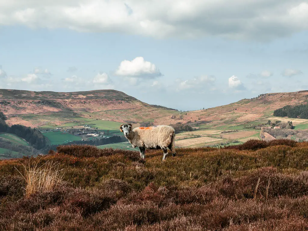
If you want a good old stomp across the moors in North Yorkshire, with breathtaking views, then this walk is the one.
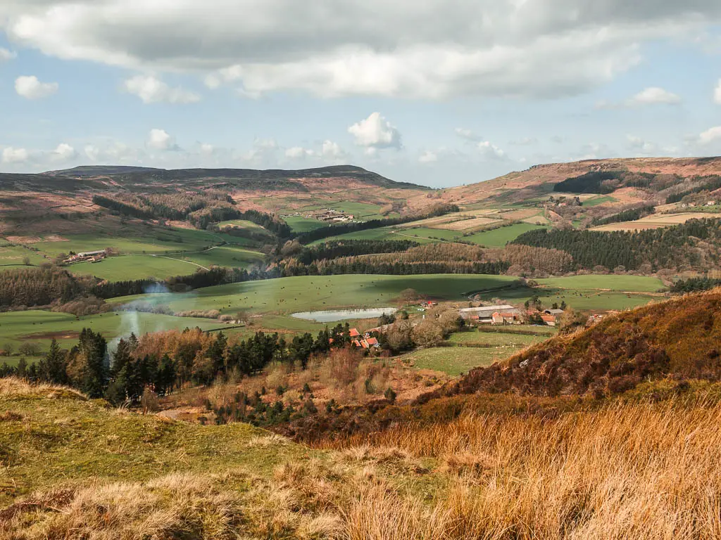
The route first takes you through Cold Moor, to reach the Wainstones. The Wainstones are the largest group of sandstone rocks up here, and you will need to scramble up them to get to the top. You will then skirt along the edge of Urra Moor, which is the highest moor in the National Park. On this walk, you will be surrounded by more heather moorlands than you thought possible. You can even see Roseberry Topping way in the distance (more on that walk below).
It is my favourite walk in the North York Moors, and also follows part of the Cleveland Way. This route can get muddy, so best avoid it after wet weather.
Read more: Wainstones circular walking guide with map.
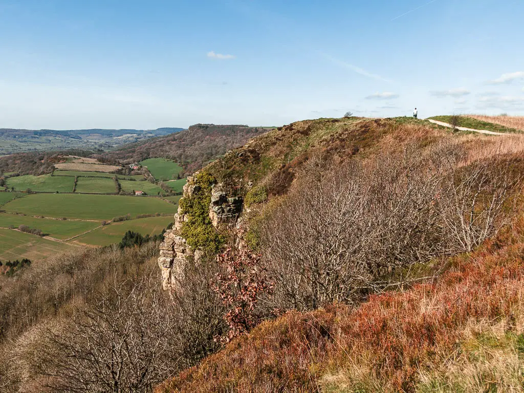
5) Sutton Bank circular via Gormire Lake
Start/Finish: Sneck Yate car park Distance: 8.5 miles Time: 2h 45min Difficulty: Moderate
This route has some of my favourite views of all the walks on the list.
Sutton Bank is the highest point, and the road leading up to it is so steep and winding, that caravans have been band from using it. It’s a National Trust area, however, you don’t need to pay to do the walk.
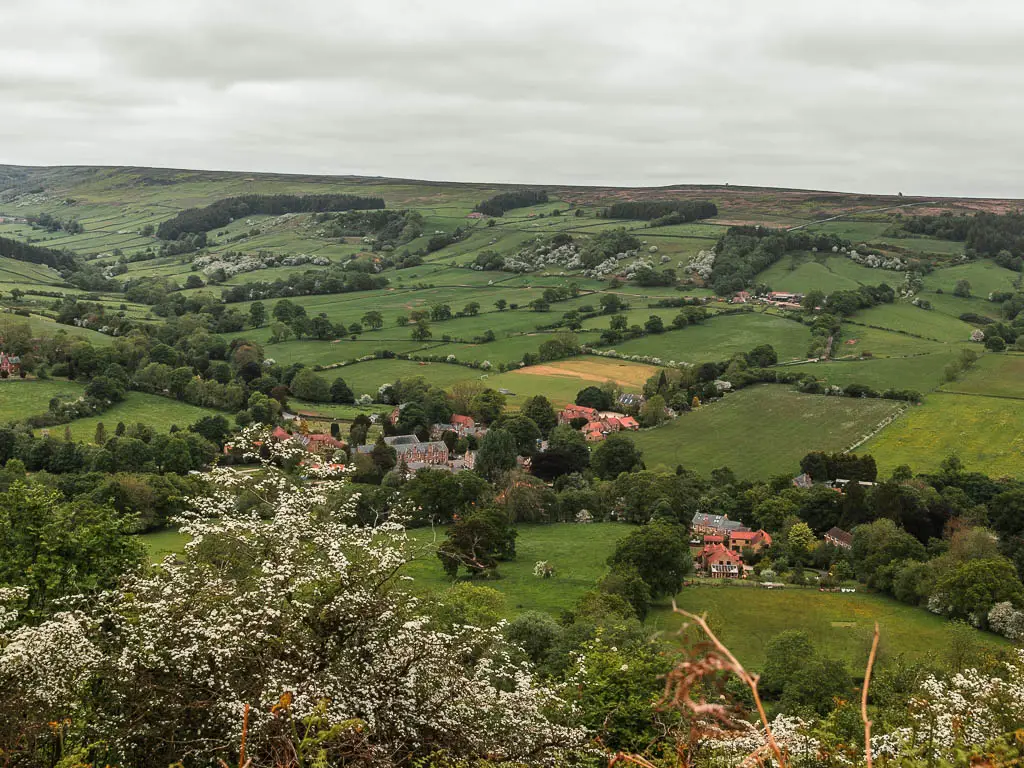
On this route, you will walk along the escarpment, which is part of the Cleveland Way, with incredible views down into the valley, across the North York Moors. You can even see as far away as the Yorkshire Dales. A real highlight is looking down over Gormire Lake, which was formed during the ice age.
You will then descend down into the valley and circle back through the fields. I did have some issues on my way back, which involved being chased by an angry farm dog, and nearly climbing up a tree to escape. In that guide, I have provided an alternate route to get back. To keep you far far away from that dog.
Read more: Sutton Bank walking route guide with map.
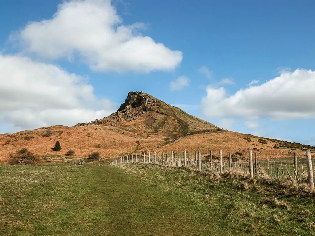
6) Roseberry Topping via Captain Cook’s Monument
Start/Finish: Gribdale Gate Capt Cook’s car park Distance: 5 miles Time: 2h Difficulty: Moderate
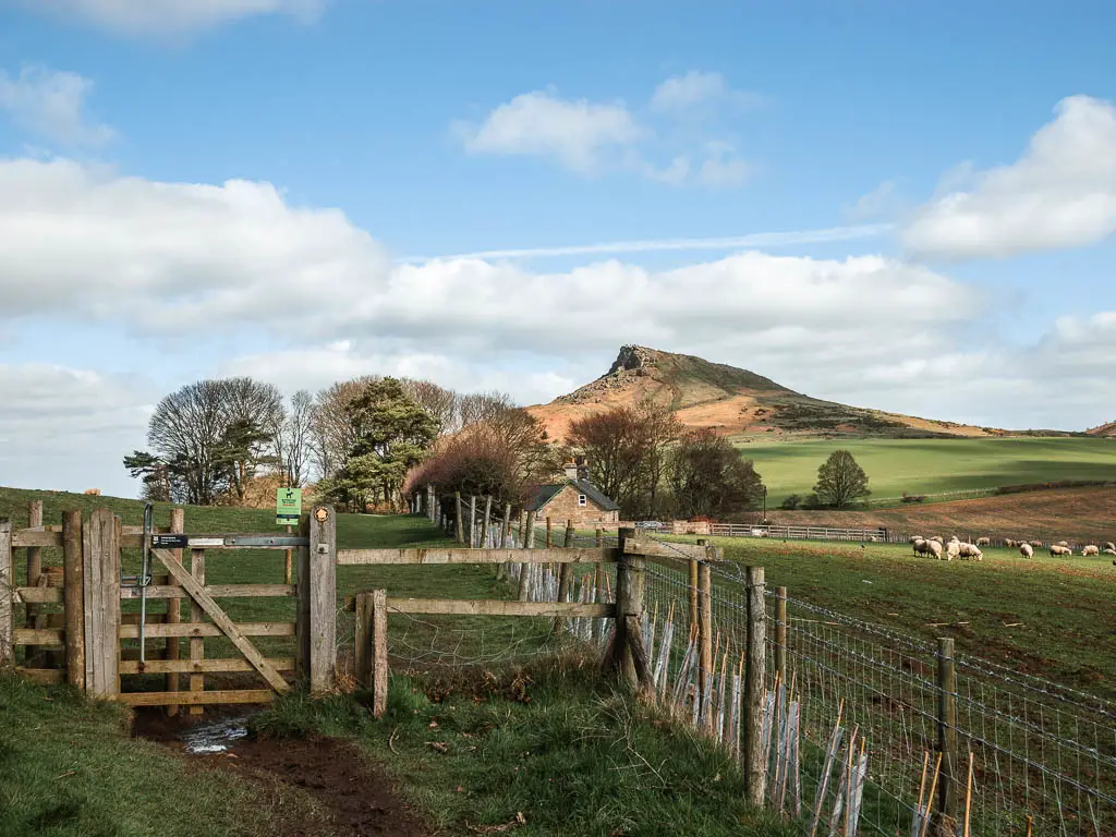
Located in the very north of the North York Moors National Park, Roseberry Topping is a uniquely shaped peak. Sort of pointing and drooping. When I first clocked eyes on it, I got goosebumps. It looks a little scary, and I wondered how I would walk up it, but it’s actually no where near as tough as it looks.
For this route, you will start off walking to the Captain Cook’s Monument, from which point you will have wonderful views across the North York Moors, and across to the pointy peak in the distance.
Fun Fact: Did you know that Captain Cook is from this area?
You will then walk down a fairly steep hill, and around through the fields, to then start the climb up Roseberry Topping.
As I said, the climb up isn’t as scary as it looks. It is only a little bit tough just before the summit, where you have a bunch of steps. Steps are always hard, where ever they are.
This is another walking route in the North York Moors National Park, which includes part of the Cleveland Way.
Read more: Roseberry Topping walk guide with map.
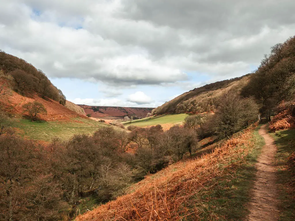
7) Hole of Horcum circular walk
Start/Finish: Saltergate car park Distance: 7 miles Time: 2h Difficulty: Moderate
The first time I saw the Hole of Horcum, was when I was driving to do a different walk. I was trying to look, but also trying to keep my eyes on the winding road I was on. I needed to know what I had just seen, and once I found out, I went right back the next day to walk it.
The Hole of Horcum is a very large natural ampitheatre. Basically a big crater type hole in the ground. For this route, you will walk down through it, and along the top of it.
Walking through the hole I found to be incredibly peaceful. A level of peace I wasn’t used to. This route is definitely a strong contender for being my favourite of these walks in the North York Moors.
There is the option to make this circular walk shorter, which I describe in the guide. However, if you follow the full route, you will have a good pub stop option at Levisham.
Read more: Hole of Horcum walking guide with map.
8) Osmotherley circular walk
Start/Finish: Osmotherley Distance: 7 miles Time: 2h 30min Difficulty: Moderate
I didn’t know what to expect on this walk. I literally decided on the day to head to the area to check it out. What I found was a fantastic route, across an impressive moor, with far reaching views across North Yorkshire. You can see as far away as Roseberry Topping. I was very very impressed….despite the rain. This route also includes part of the Cleveland Way National Trail.
There are a couple of hills on this one. One longer hill, and one short but very steep one. It’s a good old hike across the North York Moors, which finishes with some good pub options in Osmotherley.
Read more: Osmotherley walking guide and map.
9) Rosedale Abbey and Railway circular walk
Start/finish: Rosedale Abbey Distance: 10.4miles Time: 3h 30min Difficulty: Moderate
Don’t let the name fool you, there is no abbey on this walk. This is the name of the village. Now peaceful and pretty, it was once a dirty industrial hub, which you will get a glimpse into along this route.
This is a great walk if you want a solid leg stretch.
It first takes you through the bottom of the valley, with great views to some of the ruins of the industrial past up the hills. You will then walk up a big hill, to reach Blakey Ridge with views across the North Yorkshire Moorland, and a conveniently located pub. Next, you will walk back along the old railway trackbed. The trackbed is now a public footpath, although, it was once used to transport the iron or, from the mines and kilns.
Read more: Rosedale Abbey circular walk guide and map.
Short and easy walks in the North York Moors
These are the most easy and family friendly walks in the North York Moors. With Abbey ruins, the most northerly white horse figure in England, an old railway line, and a station from Harry Potter.
10) Helmsley to Rievaulx Abbey
Start/Finish: Helmsley Distance: 6 miles Time: 2h Difficulty: Easy
Ok, 6 miles doesn’t sound short, but if you break it down: 3 miles to get to Rievaulx Abbey, explore the Abbey, then 3 miles back.
This walk takes you along an easy trail, with a few hills, but nothing too crazy. You will have a lovely view looking down across the market town of Helmsley. You will walk through woodland, and along a peaceful road with nothing but the sound of the River Rye flowing next to you.
To go inside Rievaulx Abbey, you would have to pay. It’s English Heritage. However, you get a great view of it along the route, so can skip it if you prefer.
Apart from some sheep near the start, this is a dog friendly route. It would be a lovely walk for families as well. Everyone I passed either had a dog or young child.
It’s such an easy, gentle route, that it will leave you with all the energy to explore Helmsley when you get back.
Read more: Helmsley to Rievaulx Abbey trail guide with map.
11) Kilburn White Horse circular
Start/Finish: Kilburn Forest car park Distance: 1.6 miles Time: 30min Difficulty: Easy
The White Horse of Kilburn in the North York Moors, is the most northerly horse figure in England, and this walking route takes you along the top and under it.
It’s a short walk, and apart from one set of steps, it’s a very easy route. Part woodland walk, and part along a well maintained path along the escarpment.
When walking along the escarpment, you will have the most gorgeous views along the rocky cliffside and across the North Yorkshire Moors. This is probably the best part. Not the horse itself. You are so close to the horse, that it’s headless.
It’s actually right next to Sutton Bank, so you could connect it to the Sutton Bank circular I spoke about earlier. I chose not to, and I’m glad I didn’t. The White Horse is a bit more touristy. Although, I did it on a Monday, so it wasn’t so bad. Whereas, on the Sutton Bank circular which I did on a weekend, I had long stretches of just me.
This could be a very pram friendly walk, you would just have to start at a different location. That way, you miss out the steps and just walk along the escarpment, which I explain more in my guide.
Read more: Kilburn White Horse circular walk guide with map.
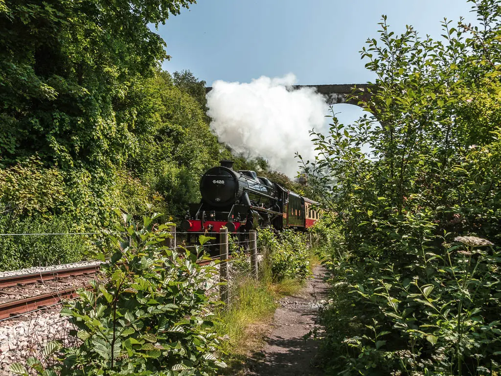
12) Goathland to Grosmont along the Rail Trail
Start/Finish: Goathland Distance: 8 miles Time: 3h Difficulty: Easy Public Transport: Yes
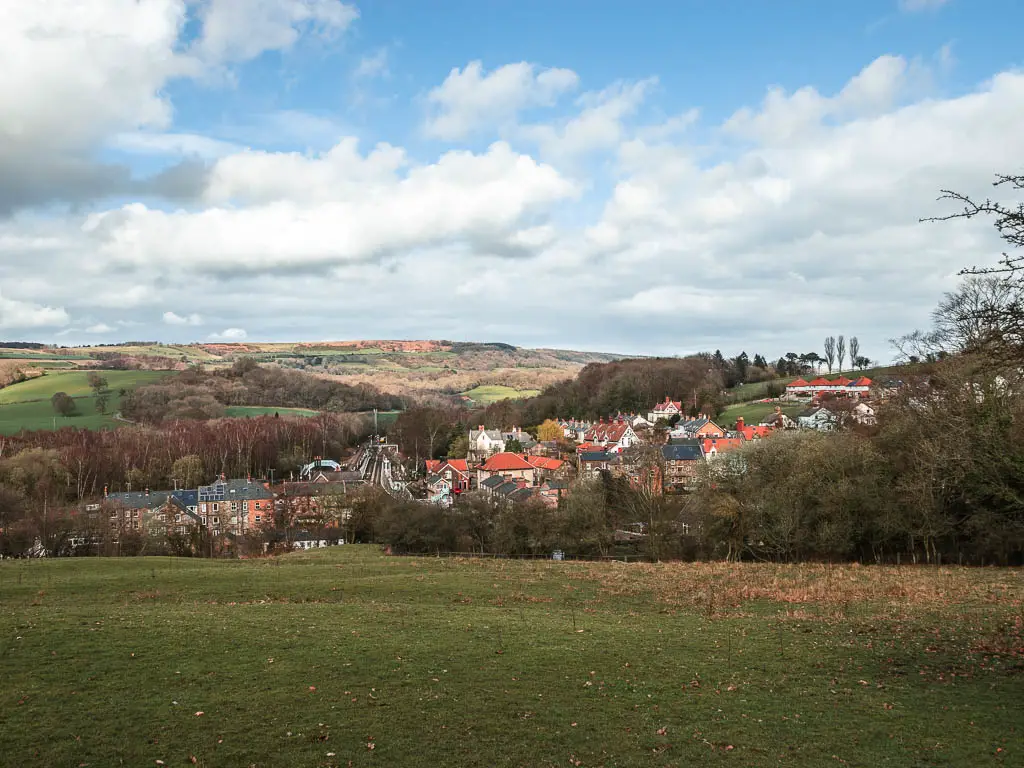
This is a wonderful walk, which follows the Rail Trail through the Esk Valley. Linking two very interesting villages in North Yorkshire. Goathland where Heartbeat was set, and Harry Potter was filmed, and Grosmont which has the cutest rail station, and is where ironstone was discovered.
Along the route, there are information boards telling you a bit about the history. They also give you little detour options to see something interesting.
At 8 miles, I know this isn’t technically a short route, but it’s very easy and can be broken up. It’s 4 miles to reach Grosmont, where you might want to hang about exploring and stopping off at the cafe. After which, you can head back either along the Rail Trail, or up across the hills.
You also have the option to make it a linear walk, and catch the train back. This train line runs to Whitby, so would make a wonderful day trip.
Read more: Goathland to Grosmont Rail Trail route guide with map.
Pin it for later: Best Walks in the North York Moors National Park
For more from the North York Moors, other than walks or hikes, you can check out the National Parks website.