The walk from Rye to Camber Sands makes for a lovely stroll as part of your visit to Rye. I say as part of your visit to Rye because (if you are coming from London; And we know I think the world revolves around London 😉 ) I wouldn’t come all the way here just for this walk. Tie it in with visiting Rye or a day at the beach.
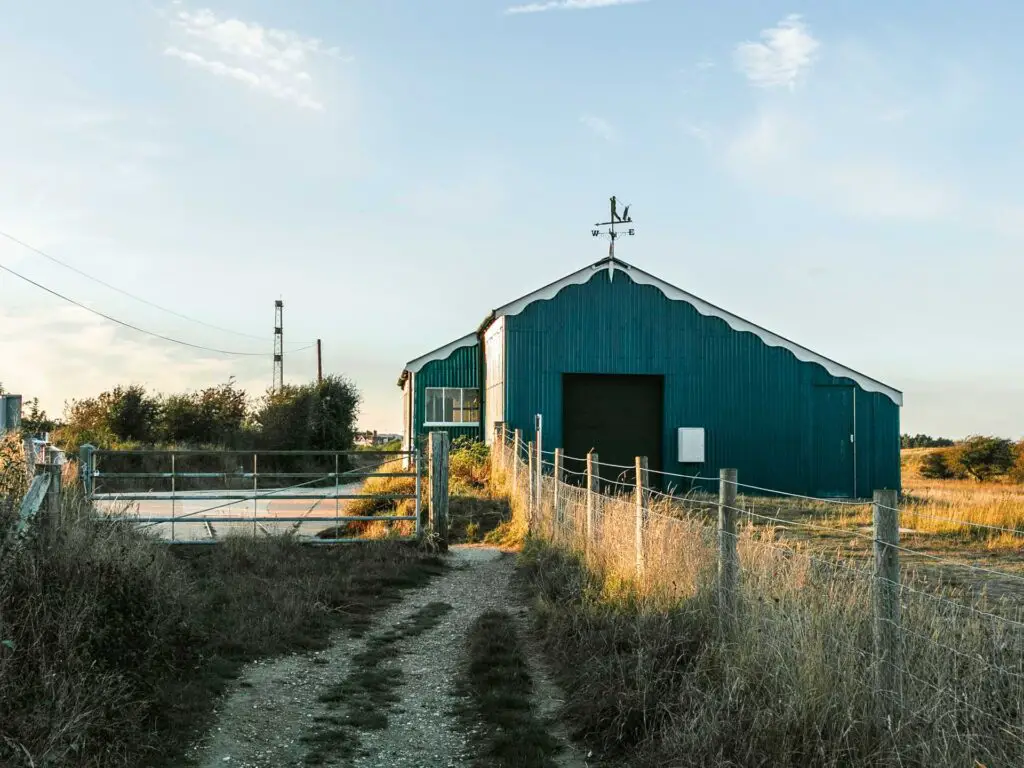
It’s not complex or challenging, but does feature some history with the old Rye and Camber Tramway line (I explain more below) and is even slightly arty with the red roofed shed.
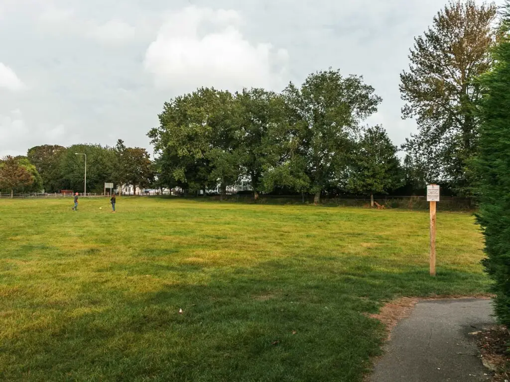
Update: This trail is closed, until October 2024 according to the sign, which means it will probably be 2026. Instead there is a cycle/bridle path to the left of there the ridge trail starts. Follow this and you will reach the beach. It’s about 3miles. To see the hut and tramway (which I discuss below), walk to the far right side of Camber Sands (right, when facing the sea). Then take the trail and you can see them.
Ollie wasn’t that crazy about this walk. He preferred the walk to Rye Harbour and Camber Castle. Don’t listen to him though.
I mean, the two walks are quite different so it depends what you are after. The Rye Harbour Camber Castle walk was hella longer, and yes, you do see more stuff. But this walk to Camber Sands would be better if you don’t want to be tired at the end of it, you are short on time, or if you just want to see a sandy beach.
Rye and Camber Tramway
On this walk, you will get to see remnants of the tramway track when you reach the golf course, as well as the old Station building (Golf Links).
It was in operation between 1895 and 1939, initially connecting Rye to the golf course. Basically, it took people to play golf. A bit later on, an extension was added to get people to the coast.
It actually stopped being used as a passenger service at the beginning of World War II, although the government still used it to transport stuff.
After the war, it was in such a bad state that it couldn’t be saved and was sold for scrap.
Logistics for the Rye to Camber Sands walk
- Start/Finish: Rye (East Sussex, on the edge of the High Weald)
- How to get there: From London there are no direct trains, but the switch is easy. Buy a return ticket from St Pancras to Rye. You will change at Ashford International. Journey time is 1h10min (give or take a few min).
- Distance: 6 miles circular (3miles one way)
- Time: 2(ish) hours
- Difficulty: Easy
- Amenities/Tips: Plenty to eat Rye. Here it is a bit posher than Camber Sands. No toilets for the rest of the walk from Rye to Camber Sands. You will arrive on the west end of the beach. This is the quieter section. If you want toilet/food you would have to walk along Camber Sands to the other end.
- Time of year: We did this in Summer
Read more: What to pack on a day hike
Map for the Rye to Camber Sands walk
Click on the top box to open in your Google Maps.
– More similar or local walking ideas will be at the end –
How to walk from Rye to Camber Sands
I’m going to describe this walk starting from Rye station (because that’s where we started). Out of the station, walk straight up the big main road. At the end, you have a couple of options. If you go left, keep going to where the road curves left. Here you go right, and up through the Landgate (the big arch thing).
We didn’t go this way. Rye is such a lovely little town, some of which you will experience by getting onto the high street, and walking past all the cafes and art shops. The reason I’m telling you about the first option is because Rye can get quite busy, particularly on a nice weather weekend. In that case you might want to avoid the high street. Or at least leave it to explore when you get back to Rye from Camber Sands.
Walk to Rye High Street
Anyway, following us, at the end of that first main road, go left, then take the first right along a side street going uphill (Market road). There is a lovely deli along here, if you fancy some snacks for the walk. Or maybe pick up something for a picnic once you reach Camber Sands.
At the top of Market road, turn left to walk along Rye High Street.
Top tip: Rye is famous for a little road called Mermaid Street. If you would like to take a look, instead of turning left on the high street, go right. Then take the first left along West Street. Mermaid Street will be the next road on the right.

Walk to the Landgate
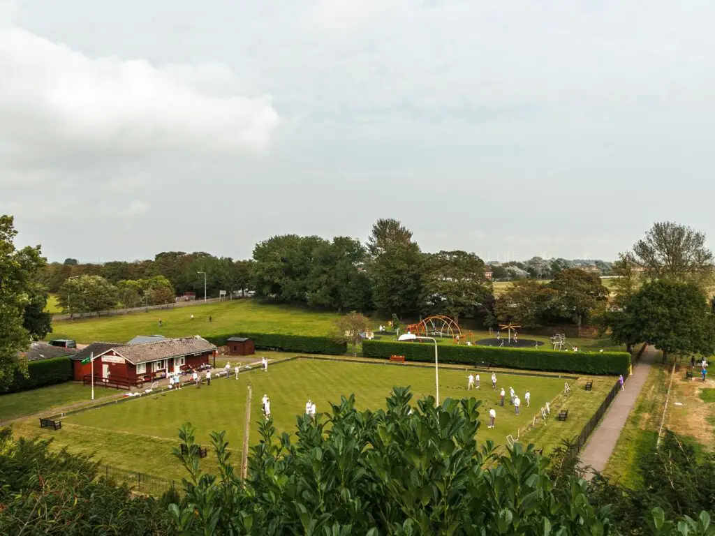
Keep walking along the highstreet. At the end it will curve left. Here, there is a nice sitting area where you get a lovely view down to the bowls green and beyond.
Keep following the road, and you will see The Landgate up ahead.
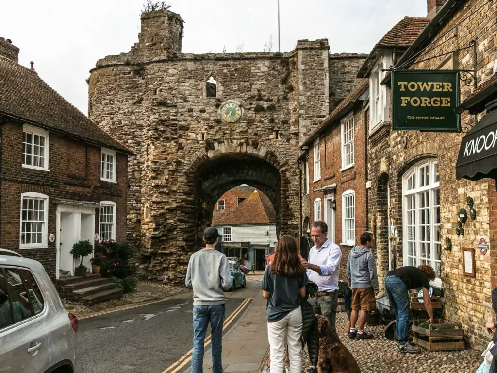
Top tip: Stop for a hot chocolate at Knoops (or chocolate milkshake in summer). They are famous for it.
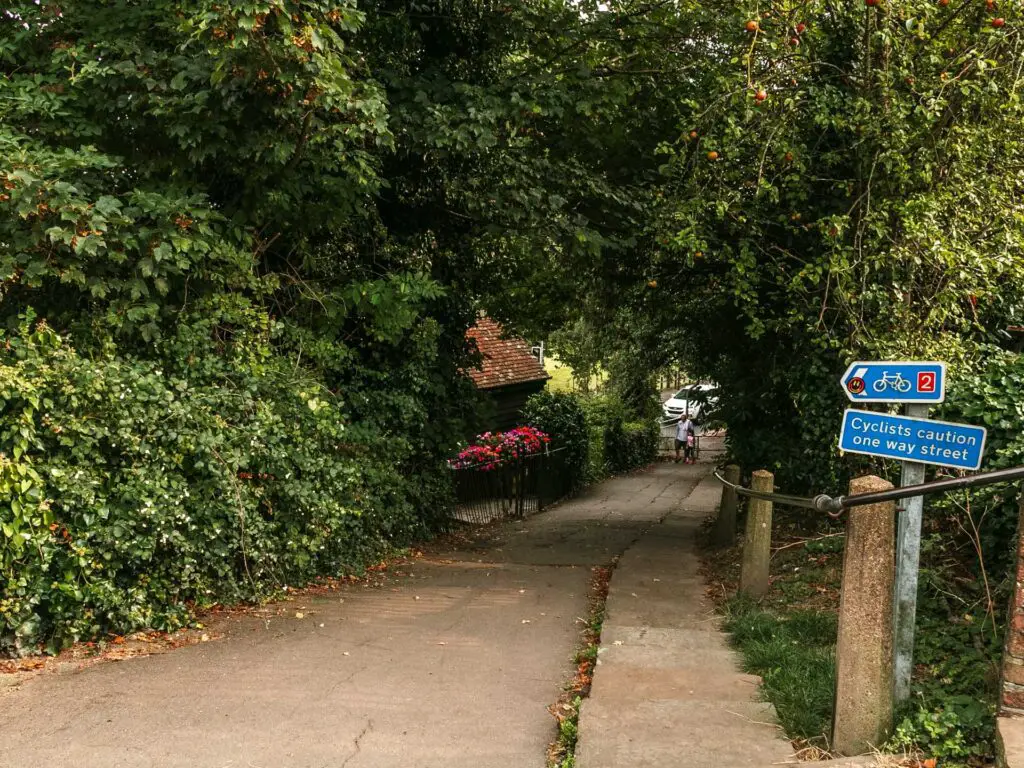
Just before the Landgate, next to Knoops, there is a path leading back on yourself, downhill.
Walk to the bridge and river
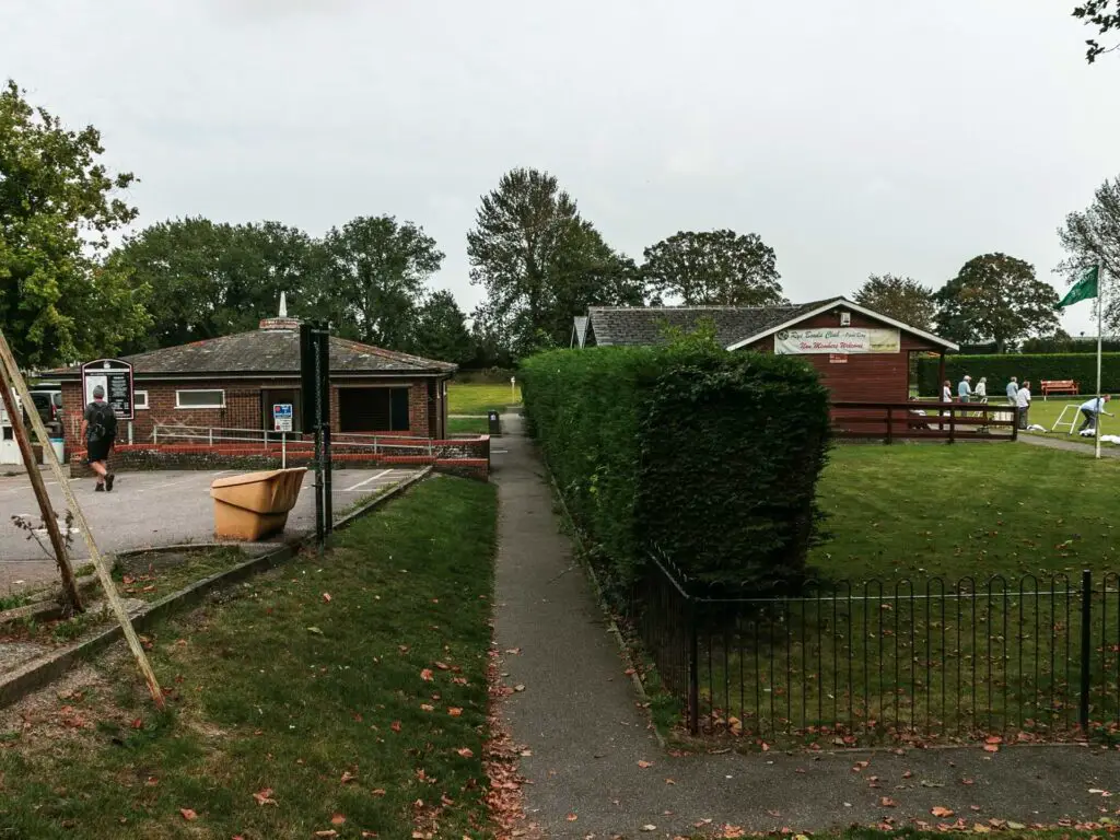
Walk down this path before Knoops, and across the road. That bowls green you saw from above will be here.
Take the path to the left of it (the green will be on your right, the car park on your left).
Follow the path to the end, and you then need to walk in a sort of left diagonal direction across the field.
For visualisation, it’s the direction of your 10 or 11 o’clock.
When you reach the road, keep following it to walk over the bridge.
Walk along the River Rother
Over the bridge, take a right and you will be met with two options for the rest of the walk to Camber Sands.
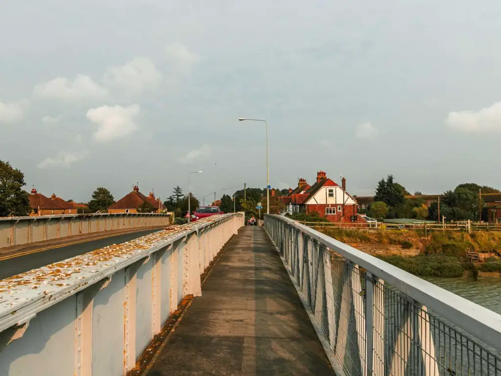
We initially took the left trail, but then changed our minds as the right trail looked like it would be more scenic.
The right trail runs along the River Rother. This is what I would recommend, taking the right trail along the river to walk to Camber Sands, then you can walk back on that other trail on your way back to Rye (I tell you more about that later).
Walk along the river to Camber Sands
For the rest of the walk from Rye to Camber Sands, you can simply just follow the river. There are a few times where the trail splits again, but for the most part, they lead the same way. To keep it simple, we always chose the right trail split.
So if in doubt, go right.
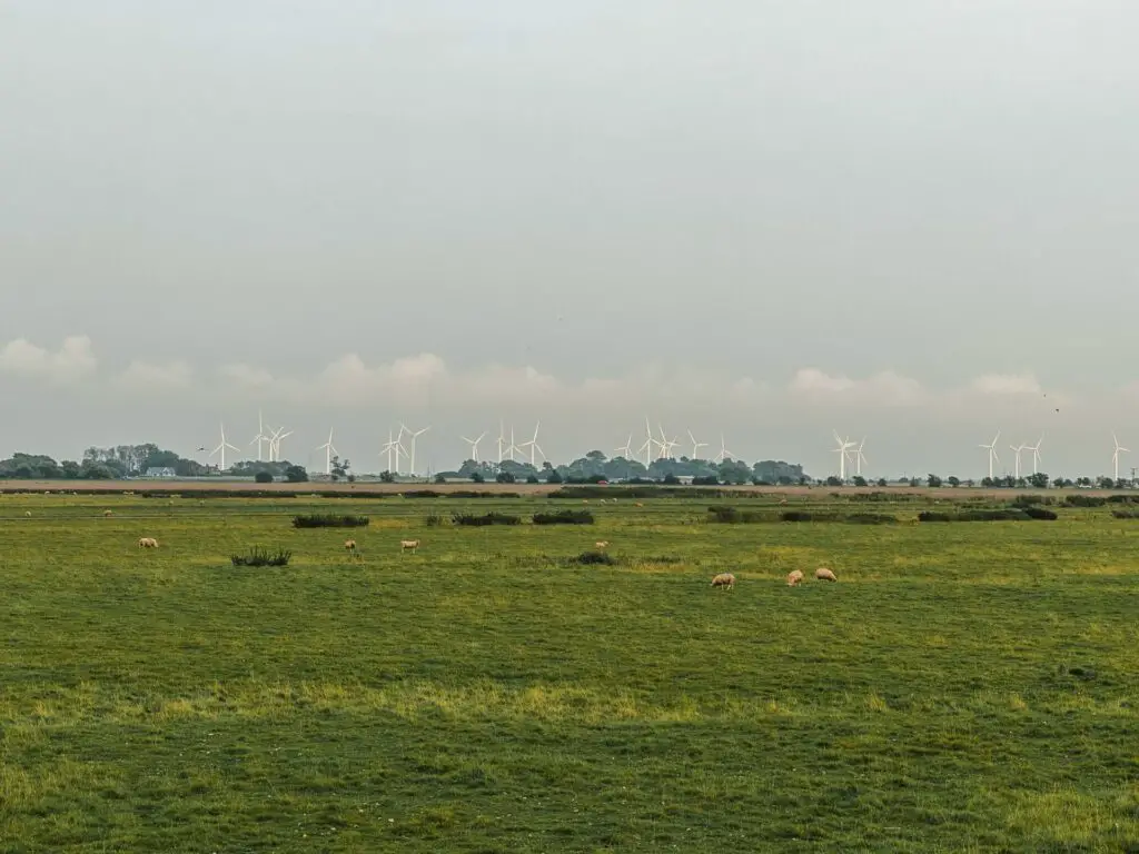
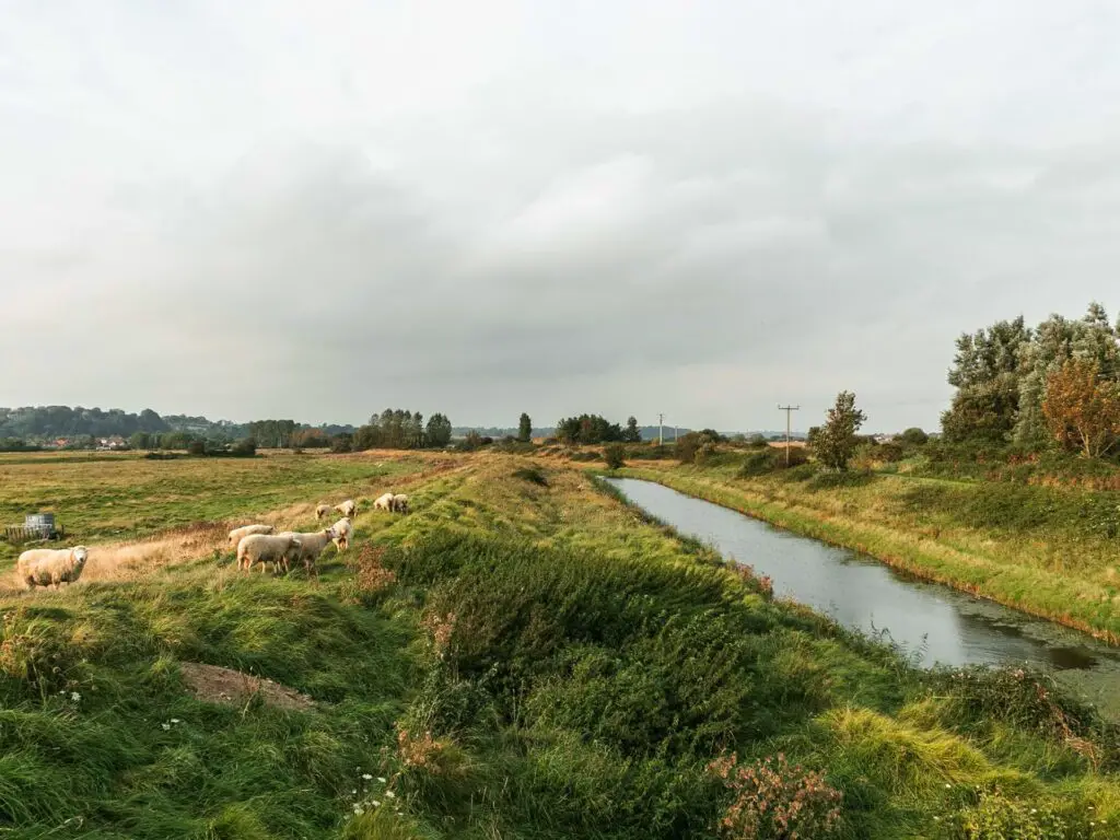
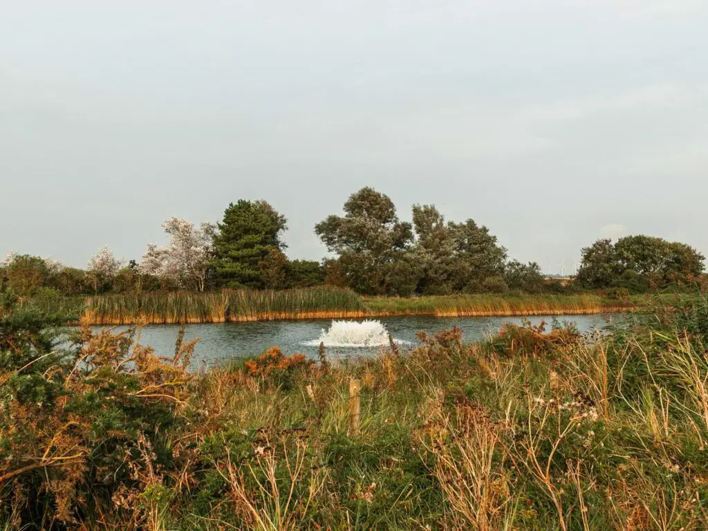
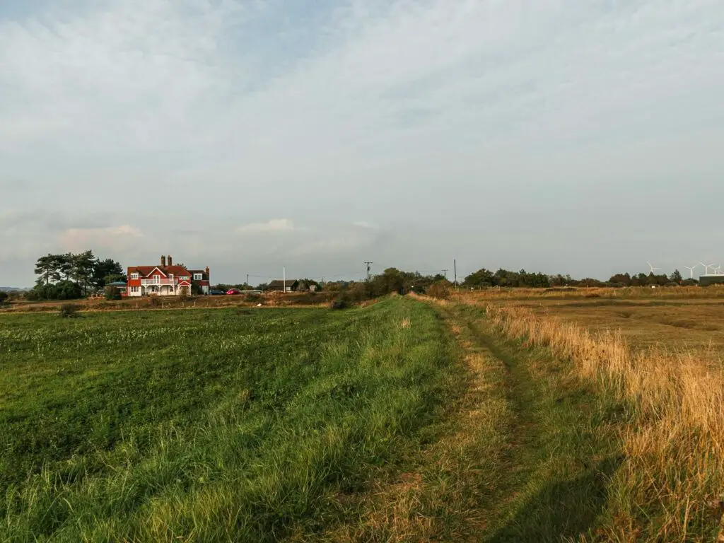
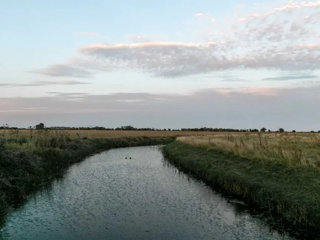
The first part of this riverside walk is on a sort of ridge. To your left will be fields, with wind turbines visible in the distance. To you right, the River Rother with boats, and then some marsh land.
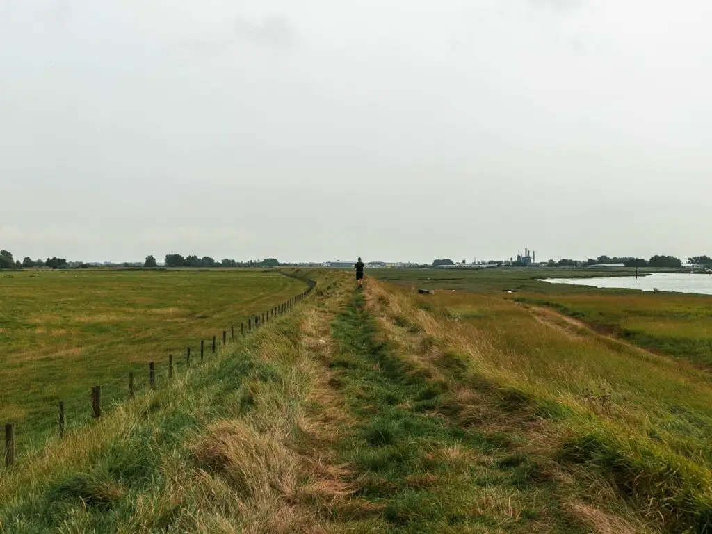
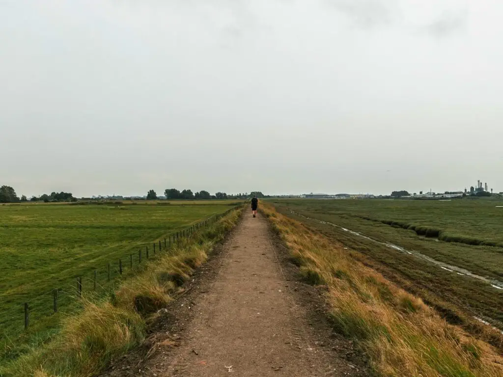
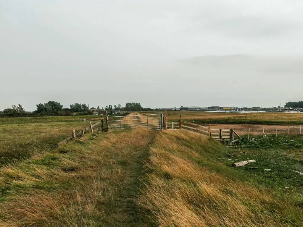
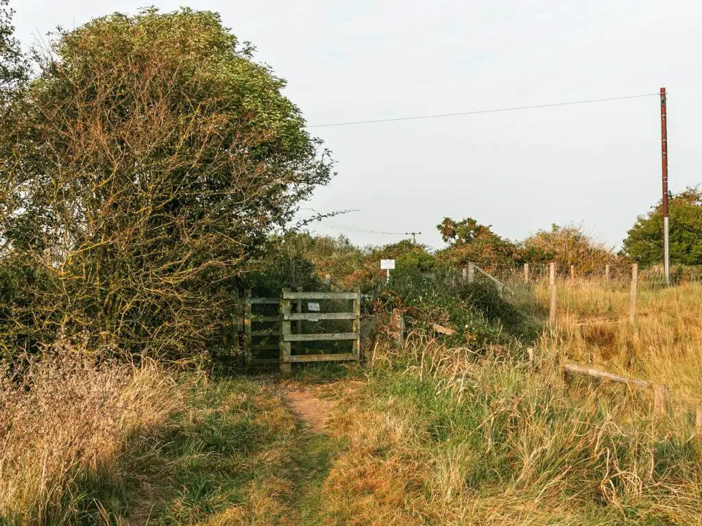
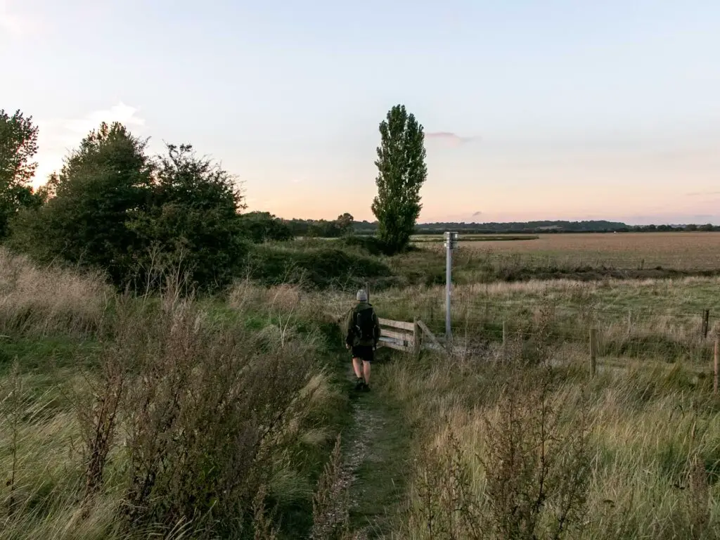
At the metal gate, go through it (or over it) and keep going along the ridge.
The next big junction
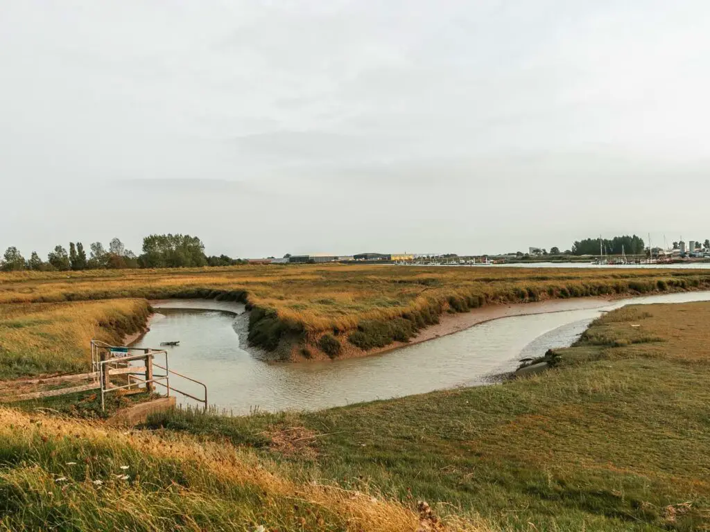
You will reach a junction where the trail continues straight, or left along the river offshoot. Remember this point. On your way back, take that left trail which will lead you back to Rye (along that path we almost took earlier on).
For now, keep going straight.
Walk towards Rye Harbour and the golf course
After this junction, continue along the grassy trail, past the ‘water feature’ on the left. There will be a trail split along here. As I said, keep to the right trail….or don’t, whatever floats you boat.
If you went right, the trail will run right alongside the River Rother again.
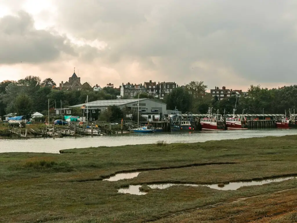
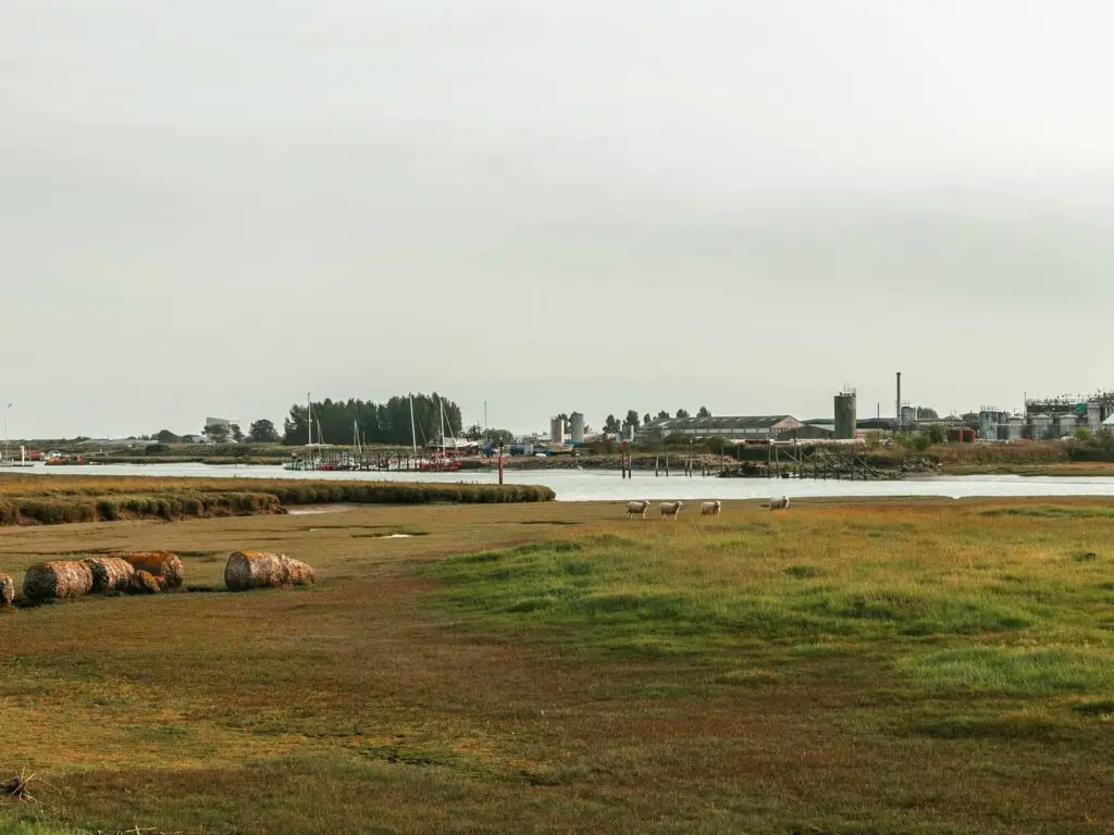
Along here you will start to get a view of Rye Harbour up ahead.
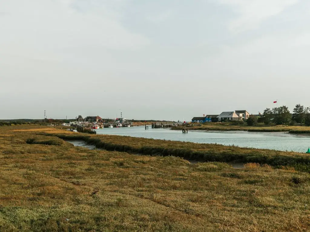
Following the trail, a bit further along, it will bend to the left and lead you to a gate. Through here, to the right, is the golf course.
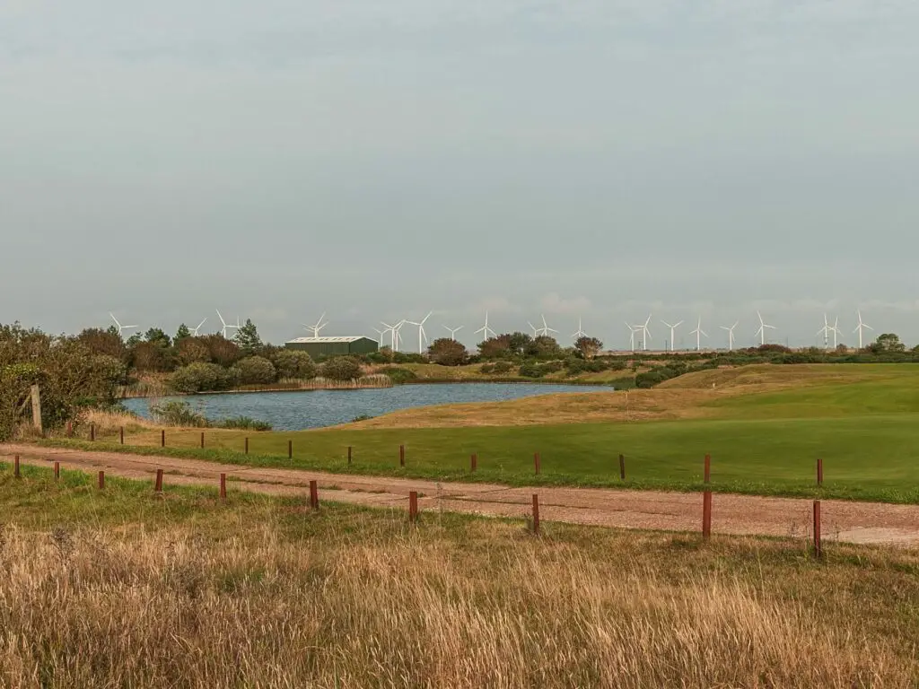
I always find golf courses interesting on these walks (by these walks, I mean most walks in the English countryside). One minute you are in rugged, overgrown territory, then suddenly you are surrounded by immaculate lawns.
I also always wonder if this will be the time. The time when a golf ball lands on me.
The Rye and Camber Tramway
At the golf course, you will pretty immediately see the old Rye and Camber tramway line on the ground.
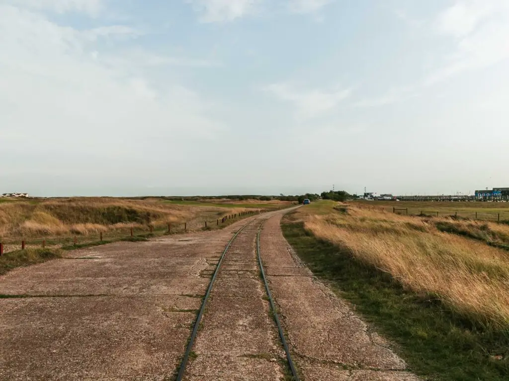
When I saw it, I squealed in delight. This stuff doesn’t excite Ollie, but that’s ok, I was excited for the both of us.
Anyway, follow it.
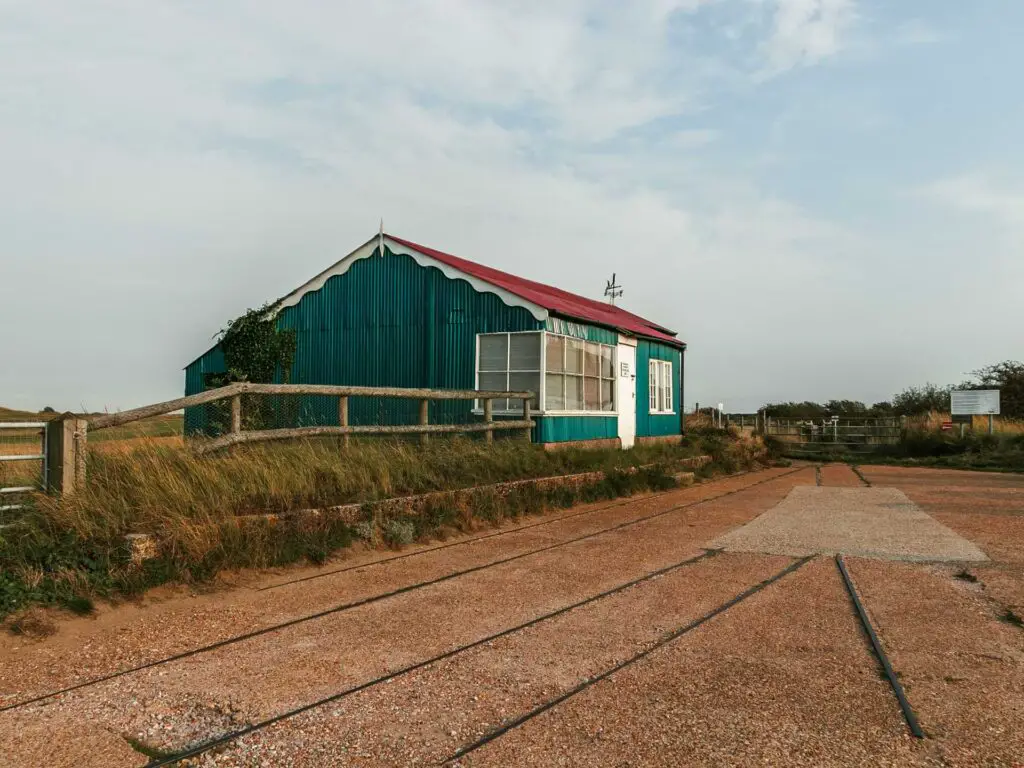
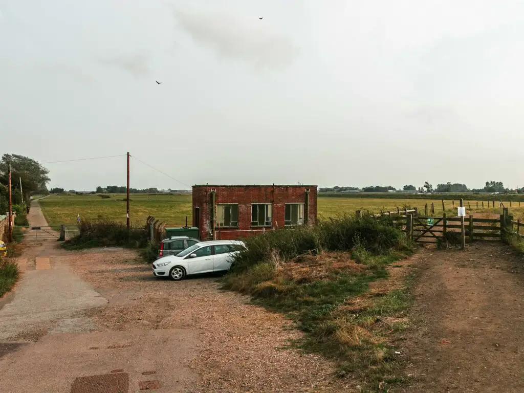
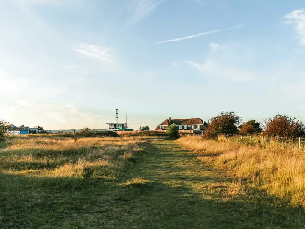
When the tramline disappears, keep following the road, and the tramline will appear again later on when you reach the old station building (Golf Links).
Walk next to Rye Harbour for the final stretch to Camber Sands
At the station building, you have a couple of options. Just past it on the left, there is a gate leading you onto the trail. We didn’t go this way. We instead walked to the right to Rye Harbour.
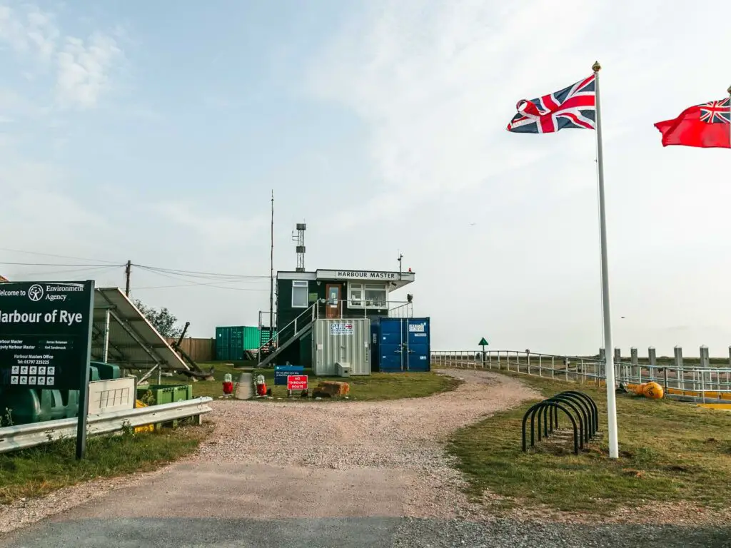
That left trail with the gate is probably the proper way. I mention this because the way we went, along the Harbour, the gate to the trail was locked.
So we climbed over it.
NB. Do this at your own risk. I will not be held responsible for injury or telling off.
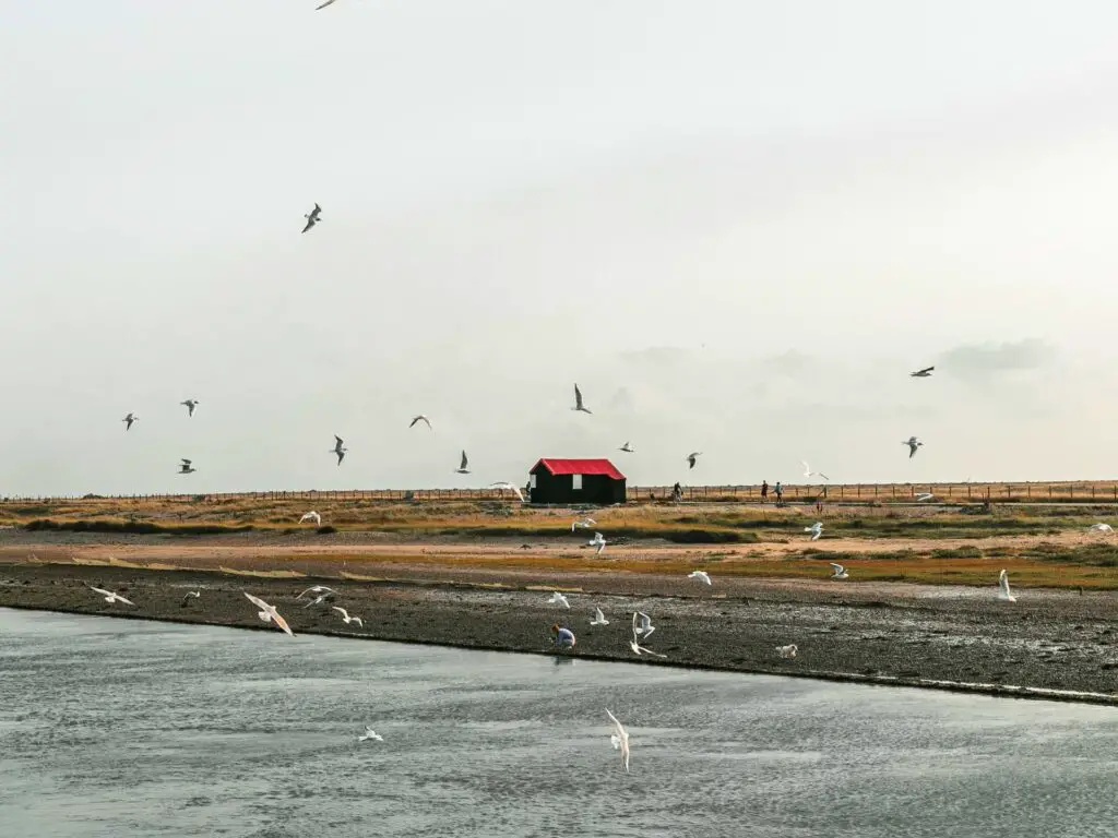
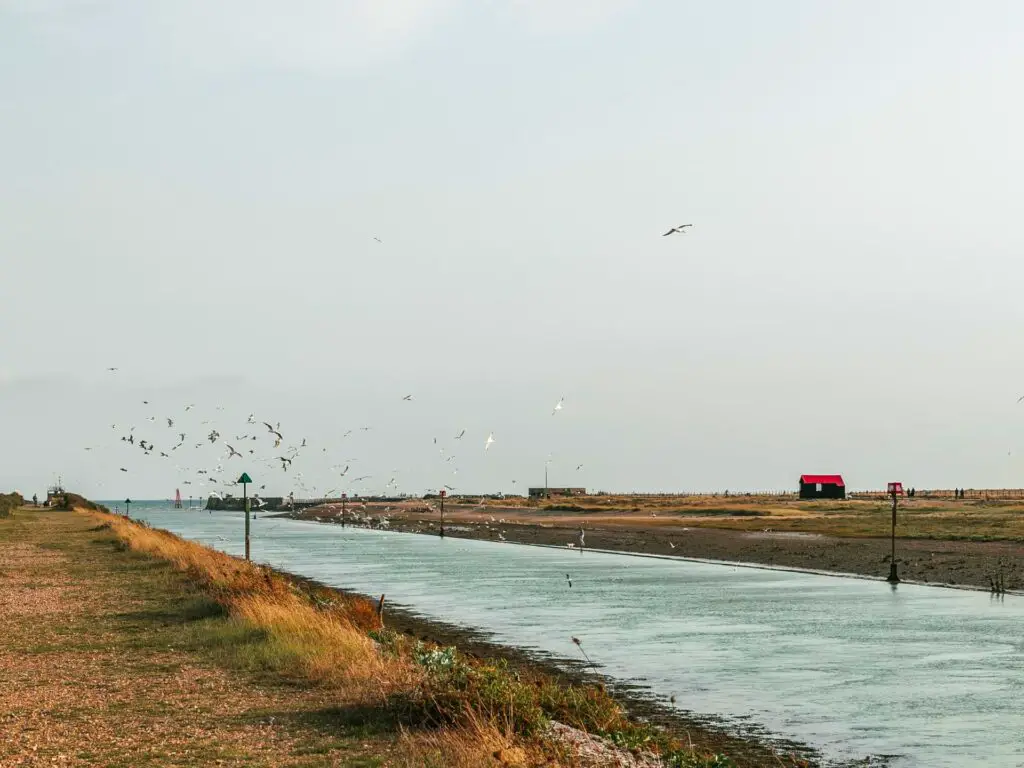
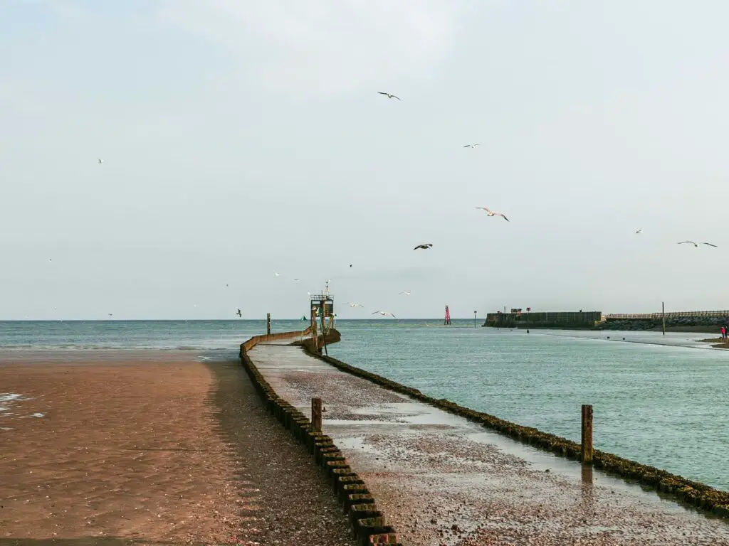
Following the river, you will get a cool view of the famous red roofed hut. Bonus if you get all the seagulls like we did. Even better if one poops on you. It’s lucky you know.
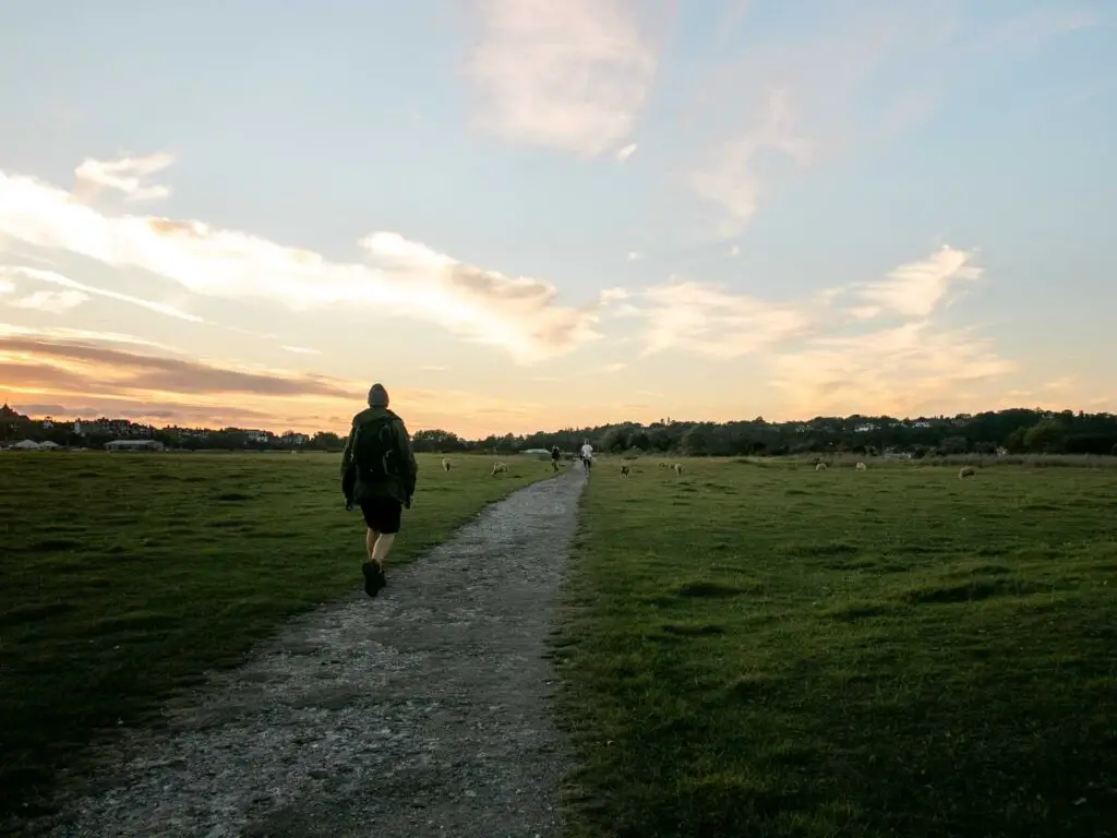
Walk to/along Camber Sands
At the end, you will reach your destination (or halfway point, whichever way you want to look at it).
Now run free….
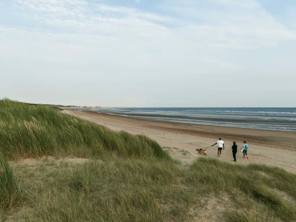
Despite being summer, it was very cold. We did not even consider getting in the water.
Instead we had a little wander along the sand dunes and found our spot to rest and recuperate (eat). This end is the quieter area of the beach. If you want amenities (food toilet etc), walk along to the other end.
Walk back to Rye from Camber Sands
To head back, start off by walking back the way you came. This time we made our way onto the grassy trail which led us to that gate next to the tramway station.
From here, it was through the golf course and along the old tracks…Basically just keep going back the way you came until you reach that junction I told you to remember earlier on.
One thing to note, for the walk back, we had planned to take the trails we didn’t walk on (you know how I told you to keep to the right trail whenever the trail split. Well, we were going to do this method for the walk back, to mix things up a little. However, upon trying this we discovered things were quite overgrown, so we abandoned that idea.
Back at the junction
Whichever way you choose to go, when you reach that junction (the one you mustn’t forget), follow the trail on the right, along the river offshoot.
It was getting dark by this point, and my photos didn’t turn out great, so you will have to imagine (I showed where the trail is when we walked past it earlier on, if you want to go back and see).
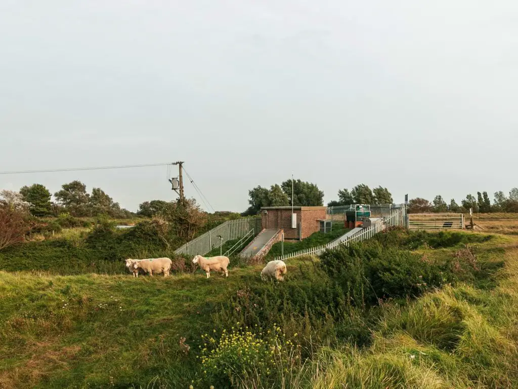
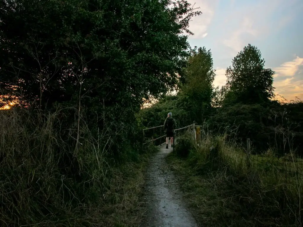
Anyway, follow this little river offshoot, and when you see the gate to the left, walk through it.
Through the gate, turn left along the path and over the bridge.
Keep following this path (I think there are some more gates if I remember correctly) and you will be led through a big field (maybe with some sheep).
Keeping on this path, at the end you will be back at that junction from the very beginning. Walk back over the main bridge and back into Rye.
More walks near Rye
Rye Harbour and Camber Castle circular walk – 10 miles. Pretty flat. Some cool sheds and a castle.
Hastings to Rye walk – 13miles. Hilly coastline walk. One of the walks I always recommend.
Rye to Dungeness – In the works
More walks similar to this one (Rye to Camber Sands)
Margate to Ramsgate – 8miles. An easy walk featuring sandy beach and medieval towns.
Ramsgate to Sandwich – 8miles. Also easy and also medieval.
Deal to Sandwich – 11 miles. Very Easy and very medieval. Very shingle.
Amberley to Arundel – 5.5 miles. An easy river side walk with a grand castle view.
Walks in High Weald
Ardingly Reservoir and Ouse Valley Viaduct walk – 8 miles. Not that near Rye. It’s located on the other side of the High Weald. The reservoir is pretty and the viaduct is very cool. If you are into your photos, then this is the one.
I have been planning out a bunch of walks in the Weald, some with Castles. I will be working on them over the next few months. For now, you can check out the High Weald website for more walking ideas.
Pin it for later: Walk from Rye to Camber Sands