Wow. What a walk. I was absolutely blown away by this walk from Gunnislake to the Devon Great Consuls. Beautiful river, lush green dense forest, disused mines and lovely views across the Tamar Valley.


Something else that makes this walk interesting, is that it is part Cornwall, part Devon. I didn’t learn this until the very end. North/East of the Tamar River is Devon and South/West of the river is Cornwall. I noticed when crossing over the bridge, a big Devon sign on the other side. I didn’t give it much though until the way back, when crossing back over the bridge and seeing a big Cornwall sign this time.

The Devon Great Consuls
It was a copper mine back in the 19th Century, and was considered the most productive copper mine in the world. When it started to become cheaper to import copper from abroad, it turned its hand to producing arsenic. It still wanted to be the best, and it was. It became the biggest producer of arsenic.

Obviously it doesn’t do that any more as arsenic is toxic, and it’s now a world heritage site, open to the public since 2006.
Logistics for the walk from Gunnislake to the Devon Great Consuls
- Start/Finish: Gunnislake Station
- How to get there: Gunnislake is on the Tamar Railway line, a branch of the Great Western Railway line. You can get here direct from Plymouth in 45min.
- Alternate start finish: There is a carpark for quicker access to the mine trails, in Gulworthy, by the Tamar Trails centre.
- Distance: 7.5 miles (but I didn’t walk back to the station, I stopped in Gunnislake village, so add a bit if you plan to walk back to the station).
- Time: 2h 30min (but allow more time – see tips)
- Terrain: Asphalt, dirt trail, mud, water, rocks.
- Type: Circular
- Difficulty: Easy
- Amenities: In Gunnislake there are a few pubs, a cafe, car park. Over by the car park near the Devon Great Consuls, there is a Tamar Trails Centre with a cafe.
- Dog Friendly: No stiles or loose livestock. However, I saw signs along the woodland trail about keeping dogs on lead due to nesting birds. Also, the Devon Great Consuls is a hazardous area so, dogs would need to be kept under close control.
- Time of year: Spring
Tips for the walk from Gunnislake to the Devon Great Consuls
- Trains back to Plymouth are every 2 hours. I sped through this walk, as I wanted to make that train. Trust me, you won’t make it, so don’t try. Get the next one which allows you 4 hours for the walk – see tip below.
- I wasn’t even close to making it back, and when I did get back to Gunnislake, I had another 1.5 hours wait for the next one. I could easily have killed another hour by taking my time, and reading the information boards to learn more of the history up at the Devon Great Consuls. There are also some lovely placed viewpoint benches up there.
- If it’s been raining it will be muddy and wet. Think about your footwear choice. I recommend waterproof hiking boots.
Map for for the walk from Gunnislake to the Devon Great Consuls
More walk ideas (with full links to guides) near Gunnislake and in the Tamar Valley will be at the end
A Guide To The Walk From Gunnislake To The Devon Great Consuls
My plan out of the station at Gunnislake was to walk along the main road to get to the river crossing. However, when I arrived and checked maps, I realised it’s a 20min walk….on a main road. I could see an alternate route to get to the river further down, and follow a trail along it, so decided to give that a go.
And I’m glad I did. Let me show you.
Walk to the Tamar River
To get to the river, turn right out of the station, then immediate right again so you are now on the other side of the station. Then take the first left.
You will now be on a country lane type road, lined with so much bush and green. I don’t know if it was because it had rained that morning, but everything felt so lush and fresh. As you get further along, you will get views ahead to all the woodland forest goodness ahead. The whole thing just felt so good for the soul.


Another thing to note about this section, is it’s a steep downhill, for a long time. I couldn’t help but think about how I would have to walk up this, on my way back to Gunnislake later.
At the bottom, when you reach the road, turn right. Then a short way further along, look out for the footpath sign on the slip road to the left.


I didn’t think things could get any lusher and greener, but they did. It was like a hollow was cut into the ground to make the road, and the banks were covered in moss, fern and general green stuff.

You will continue to walk downhill, past a house, and then you reach the river.
Walk along the River Tamar towards the bridge and the Devon Great Consuls
At the river, turn left and just keep going all the way until you reach the bridge. The trail starts off as the usual dirt trail, and lots of trees.
Then a bit further along, you will be out by some houses again. You need to keep an eye out for the trail, which is to the right of one of the houses. See last photo below:


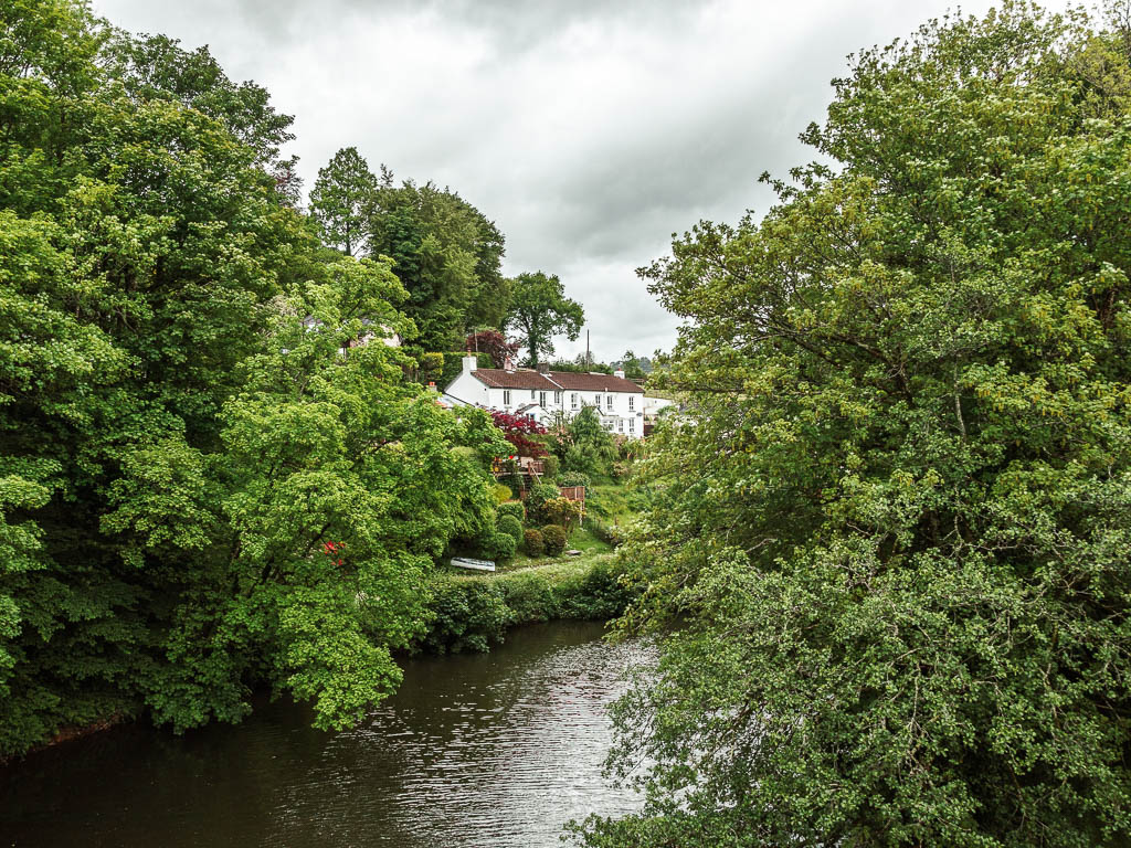
Along here, the trail becomes super overgrown with green stuff, and then you will get a bit of an open view to the river and mini waterfall, with a cliff behind it. It all feels so magical, like being deep in nature, when in fact you are basically still in the village.


The trail continues on, alongside the Tamar River, passing by a stone shed, still surrounded by green, passing by some more houses, until you reach the bridge.


Cross the bridge over to Devon
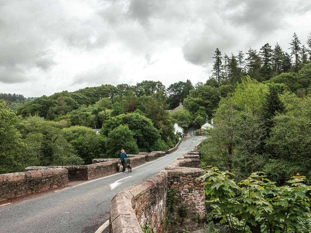
Remember, you are still in Cornwall at the moment. When you cross over that bridge, you will be in Devon. Maybe go stand in the middle for a moment, and you can be half in half out.
There are cars coming and going, and the bridge is narrow, however, there are little bridge cut outs you can stand in while they pass. It means you can also take photos without being in the traffic way.


Once over the bridge, don’t worry, you don’t have to take that massive uphill you will see ahead, but instead go left.
Walk to the woodland
You will be walking on the road for a bit, but it’s not very trafficked. Not a single car passed when I was there. You will walk past the water pumping station, and the road will change from asphalt or tarmac (one of them, I can’t remember which) to dirt, gravel and rocks.


There is a strange section coming up where the road floods. There was water coming down from the rocks, like a waterfall of sorts, and along the road and into the river. Forming a stream in the road. One of the reasons I suggest waterproof shoes.

You will also now have an open view of the river to the left, as the road curves with it ahead. Keep going and follow the path as it turns uphill alongside a big field, as it takes you into the woods.


How magical does this field look. Such a luminous green, and those little tufts.
Walk through the woods towards the Devon Great Consuls
The majority of the rest of the walk is now woodland, only really opening up around the Devon Great Consuls. It’s a really easy route to follow. Just keep on this big main path.
The route is along a dirt path with some muddy bits, through really lovely woodland. It’s varying woodland to keep things interesting.


Someway further along, there will be an uphill where you will then reach a bigger junction. You need to do a hairpin bend to the right.

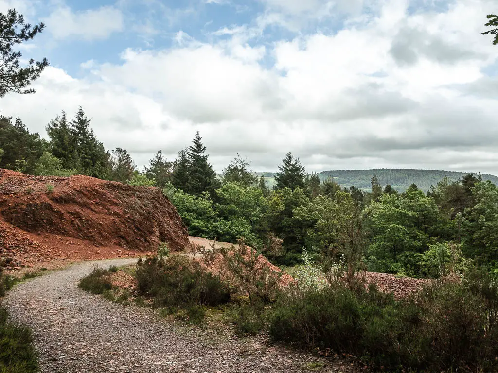
You will now be quite high up, and get the occasional peek through the trees to the views. The views though, are about to get so much better. Keep going on this big main path, which is now relatively level, and you will reach a big open area with the main structures for the Devon Great Consuls.
It was also along here that I saw the one and only other person on this walk. A runner.


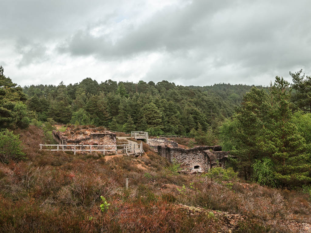
The view from here is fantastic, across the tree tops of the Tamer Valley (and some signs warning of hazardous materials). The big ruins area you can see, is Wheal Anna Marie.

As you make your way around the corner to the right, you will see a stone ruins on the left. You can go in there, where there is tonnes of information about the area.


Walk along the Mineral Railway Trail
Just past the information ruins, is a junction. Take the left one to walk along the Mineral Railway Trail. This is where there used to be a track to transport all the goods.


It’s now a bit more woodland walking on a dirt trail, to reach another open area with more ruins, before going back into the woods.

Just like earlier, the route is super easy to follow. Just keep to this main trail, as you work your way through the woods.
It was somewhere along here, I started to hear the cows. Really aggressive sounding cows. The noise was coming from somewhere in the distance to the right. I looked right at the steep drop with dense woodland. It all made me feel a little uneasy. I kept telling myself, I’m safe. The cows can’t get me from up here. It just made me a little nervous though, that I didn’t know where they were.


Anyway, keep following the trail, and you will pass by a sign for Wheal Emma. I couldn’t see Wheal Emma, but the sign says she is there. Then the trail will lead you to a junction with a signpost.


Leave the Mineral Railway Trail to walk back to Gunnislake
At this junction, you can go either way. The left one should lead you back to the car park if that’s where you came from. I decided to go right, as it would take me back to the luminous green field with tufts from earlier. I liked that field and wanted to see it again. Also, there was a sign here warning of a very steep decent, which sounded fun.
So, I can report, the steep part is just the first bit, and it’s very short. It is very steep though, and potentially slippy, with a drop ahead. But once past there, you are safe.


As I continued to make my way down, I realised I was now walking right alongside the cow field with the aggressive cows. The way they were mooing, and how it echoed through the woods, was quite unnerving.
A short way along I saw something in the woods which stopped me dead in my tracks, and I felt an instant sense of deep fear. The kind of fear like I was about to have to run for my life.
It was a tree stump.
Getting out of the woods
Now, so far I had been really loving this walk, but I wasn’t anymore. I felt a bit sick. I wanted to get out of these woods. I had this feeling of impending doom, so I really started to rush. It was something about the fact that I had been deep in woodland for so long, on my own, with the echoing aggressive cow noises, and that rush of adrenaline fear from a moment ago.
At the end of this path, at the junction. You can go straight ahead and down, but that’s a very steep path. Alternatively, turn right and follow it as it curves you down in a more gentle manor, to reach the bigger trail at the bottom. This is the trail you would have been on earlier. At this point, turn left, and you are essentially now walking back towards Gunnislake the way you came.
I started to feel a bit calmer when I reached the luminous green tufts field. It was even more luminous now. It had been raining when I was walking in the woods (an advantage of woodland walking), and now the sky was half grey, half bright sun.

At this point, I realised I had missed the train back to Plymouth from Gunnislake. I could slow down. Because I had been on a time limit, I hadn’t stopped to eat…probably another reason I hadn’t been feeling great. I now realised how hungry I was, so I perched myself on a rock next to the luminous field, looking across the river, and tucked in.

The end of the Gunnislake to the Devon Great Consuls walk
As I made my way back, I noted that the road stream was now bigger. The rain had done its thing.
And then as I crossed back over the bridge, and saw the Cornwall sign on the other side, the whole Devon Cornwall border thing clicked.

From this point, you have two options. Walk back the way you came to get back to Gunnislake Station. Or walk to Gunnislake Village. I now had nearly two hours to wait until the next train, so there was no point going back to the station yet. I was also secretly happy I didn’t have to walk up that big hill near the station.
If you want to get to the village, you start off walking back on the riverside trail like earlier. Then when you start passing by some houses, look out for a path on the right, leading to some steps. Go up them and then continue up the residential street. This is uphill. I had to laugh at the fact that I swapped one hill for another.


At the top, you do a sort of switcheroo. Go left, then immediate right, and this will lead you to the main road.
What next?
Well, I wasn’t really in the mood for hanging around the village. I had a look online, and realised there was a bus coming soon heading for Calstock, where I could also get the train from (the same train mind you, so I would still have a long wait). I decided to do that, and wait out my time by the river, looking up at the Calstock Viaduct.
When I got to Calstock, I did just that, only for a moment though. After working my way through another snack, and realising I still had a long wait, I went off on another walk….
More walk ideas near Gunnislake and in the Tamar Valley
Calstock riverside walk – This is that next walk I did. It was brilliant. You see more old mines, and walk along a really lovely section of the River Tamar with a view to the Viaduct. It’s much shorter, so easier to fit in, and a great way to see some mines, if you aren’t into the bigger walks.
Bere Alston circular walk – This is the first walk I did in the Tamar Valley. It features lots of wild garlic, the Calstock Viaduct, lots of woodland and more Tamar Valley views.
Drakes Trail – This one is just outside of the Tamar Valley, but super close to Gunnislake. You can get between the two on the number 79 bus. It’s an easygoing walk, along a bike trail. There are two things that make this walk stand out. A really cool tree top bridge, and a seriously creepy tunnel.
You can can about walks you must try in the Tamar Valley, which is a more detailed side by side guide. If you would like to see more of Dartmoor, then check out the best walks in Dartmoor National Park.
You can read more about activities to do in the area, and its history on the Tamar Trails website.
Pin it for later: Walk from Gunnislake to the Devon Great Consuls


