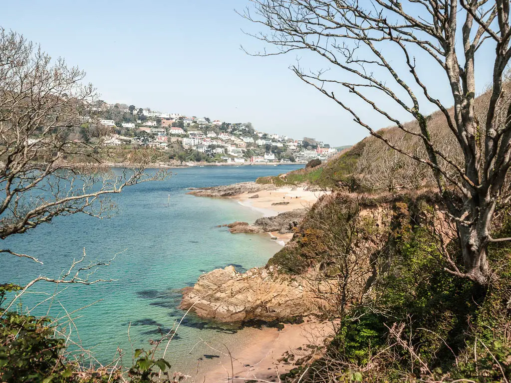
Holy mother of God. This was my first time in Salcombe. I have seen a lot of Cornwall and Devon but nothing quite like this. Crystal clear water and turquoise water, pale sand. It was like stepping into the Mediterranean. I told Ollie afterwards, ‘we don’t need to go back to Greece, we can just come here’. I had a few walks planned to do in Salcombe, and the coastal walk to Prawle Point would be my first one.

What to expect on the coastal walk from Salcombe to Prawle Point
You start off by crossing the water over the East Portsmouth on a little boat.

You then walk past some lovely stretches of sand, through some woods, with a view to Salcombe across the water. When you turn the corner, that’s when the fun begins. Narrow dirt trails along the edge. Some very rocky bits of trail that involve a bit of scrambling. Hidden secluded beach coves surrounded by rugged cliffs.


The distance between Salcombe and Prawle Point isn’t that far, but it took me a lot longer to walk it than I excepted. Probably due to a combination of the scrambling and stopping a lot to admire the views.


Fun Fact: Prawle Point is the most southernly tip of Devon.
Should you walk from Salcombe to Prawle Point there and back or circular?
I had a good think about this before heading out. There and back would keep me by the coastline. There are some slightly higher up trails so I could vary it a little, but most of it would be on the same trail. Circular would take me around East Prawle and along roads.
I didn’t make my final decision until I was actually there. Once I reached Prawle Point, I just kept going. Then once I reached East Prawle, I was curious what the views would be like if I stayed up here (it’s way way uphill from the coast path).
I figured I should check it out, then I could let you know….
My advise is to stick to the coast path. Kind of.
You should definitely walk up to East Prawle. It’s very pretty, and there is a cafe and pub to enjoy. Then you can do a loop to take you back to the coast path to walk back to Salcombe.
The way I went is pretty much all road and not very interesting. Quite tedious actually. I would only suggest doing it this way if:
- Your knees are hurting, and you need something less hilly.
- You are on a time limit to get back to Salcombe (ie. You are at risk of missing the last boat back – more on that in tips)
Anyway, I will show you what it was like, so you can decide for yourself. I will also show you where I would suggest instead.
Logistics for the walk from Salcombe to Prawle Point
- Start/Finish: Salcombe/East Portlemouth
- How to get there: Salcombe is located in South Devon. You either drive, or get the bus. Bus number 164 will get you there from Totnes which does have a train station.
- Distance: To walk from Salcombe/East Portlemouth to Prawle Point, it’s just under 5 miles. The full there and back is about 10 miles.
- Time: 4h. I was surprised it took me this long.
- Elevation: Highest point is 150m. With the ups and downs, elevation gain is about 500m.
- Terrain: Dirt trail, grass, road, possibly sand.
- Difficulty: Medium
- Amenities: Everything in Salcombe. A cafe and pub at East Prawle. Some viewpoint benches along the way.
- Time of year: Spring
Tips for the walk from Salcombe to Prawle Point
- There is a regular ferry boat running from Salcombe (next to the Ferry Inn) to East Portlemouth. At the time of writing costs about £2 for adults one way. Journey time is maybe 1 minute. The website says it stops running at 5pm, however, when I was there they said 6pm. Check when you are there though! If you miss the last boat back, then you are stuck. The only option is to swim across….or call someone to drive around to pick you up. It’s about 14 miles for them to come and get you.
- Hiking boots for sure. Parts of it are very rocky and you will be scrambling a little. Other parts are very narrow bits of trail near the edge, so you really want something with good grip.
- If it’s warm enough (or not, depends on if you are wuss like me) take swimwear. There are so many little beach coves where you could go for a swim.
- I already mentioned above, once you reach Prawle Point, walk up to East Prawle, then come back to the coast path to walk back to Salcombe. There will be a few times you can take a slightly different trail along the coast, but I will explain better below.
Map for the circular walk from Salcombe to Prawle Point and East Prawle
More local walking ideas will be at the end
A Guide To The Circular Walk From Salcombe To Prawle Point
Once you have got the little boat across the water from Salcombe to East Portlemouth, the walk to Prawle Point can begin.

Once off the boat and up the pier, go up the steps and turn right on the road. You will now be on road for a little while, but it’s a nice road. I don’t recall a car passing by at all. Along here, you get a view through a gap in the trees to a beautiful bit of beach called Small’s Cove. I have no idea how you get to that beach. Looking closely, I have a feeling it’s just boat access, but don’t worry, there are so many more beaches to come.

Some way further along the road, you will reach Mill Bay. This is a much bigger beach. It was a bit busier on this one, so I suggest to keep going. The good ones are coming…


Walk to Sunny Cove
Past Mill Bay, the trail will be slightly uphill to the right. You will now be under tree cover along dirt trail, with a few ups and downs, and views through the trees to the right of the gorgeous clear water and Salcombe on the other side. There are a couple of junctions, but just follow the signs for Sunny Cove.


Sunny Cove was beautiful, and much less crowded. But wait, the beaches get even better….
Walk out of the trees and into the open, with a view to Prawle Point
From Sunny Cove, go back to the trail and continue along it towards Gara Rock. You will continue to get gorgeous views back to the little coves through the gaps in the trees.


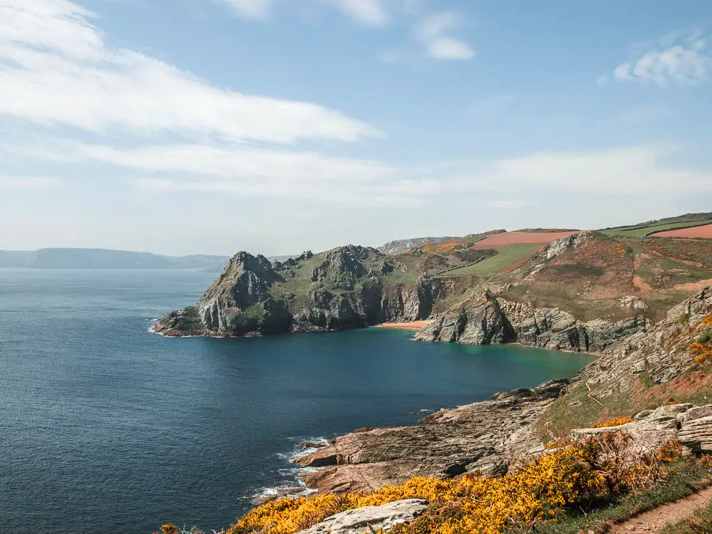
Then the trees gradually get less and less as you round the corner, and start to get a view all the way down the rugged coastline. The trail gets narrower, and the first rocky bit begins somewhere around here.


I could see waaaay in the distance a peninsular, actually, a few peninsula’s. The peninsular furthest away seemed like it must be the most southernly point. But it was just so far away. That couldn’t be Prawle Point could it? It should only be 5 miles away, and that looked like way more than 5 miles.
I decided that it wasn’t Prawle Point, the peninsular that I would walk to is a few in front of that one….
I can tell you now, that is indeed Prawle Point.
Walk past all the beach coves
For the next while, you will be walking on this narrow trail, with a few ups and downs and rocky bits.


You will round a corner and a little beach cove will come into view. That is Gara Rock beach. After going past it, and up another hill and around another corner, the next little beach will appear. They come one after the other. So you can really take your pick. Or try them all.


Along this section of the walk to Prawle Point, there is another trail a little higher on the hill, so it would be a good one to take when you walk back to Salcombe. To mix things up. I don’t think it continues past here though, so you will be walking back on part of the same trail you walked out on.
Walk to Gammon Head
I could see a peninsular ahead. An interesting bumpy looking one. I had it in my head that that was Prawle Point. As you get nearer to it, the trail runs up the hill, giving a sense that you are on the final approach.

Once I reached the tip, I had a nice sense of completion. I got my phone out to pause my tracker and take a snack break, when I noticed the distance was only reading 3.5 miles. Wait a minute….
I had a look over the other side, realising that this was not in fact Prawle Point, and I still had a bit of a walk to go.
My scene of distance has been way off today. I felt like I had walked much further. Maybe I was tired. This peninsular is actually Gammon Head. There is sign a bit further ahead saying so.
Walk to Prawle Point
Ok. Here we go again. This is now the official last stretch to reach Prawle Point, and some of the views to come, might actually be the best on the walk.
The trail now takes you around some of the most beautiful beach coves of the walk, and as you make your way around and up the hill, the views looking back are breathtaking.


There is a bit more rockiness around here as you continue to walk up, and you will then reach the gate entrance to Prawle Point, with the little watchtower visible ahead.


When you reach the very top, you will get a view along the vastly different coastline on the other side .

Walk from Prawle Point to East Prawle
Behind Prawle Point, you should see some houses, now go and walk towards them, and then downhill on the grassy trail.


There is a signpost coming up which points left to East Prawle. You now have two options. Take this left, or keep going straight. If you stick to the straight, when you reach a beach called Horsley Cove, you can go left to walk up to East Prawle. I tell you this, because this first left is road.
At first it’s a long uphill on an average little road, then at the end, you take a right turn onto the bigger road.


If you chose this way, you will now continue to walk on road for a while, but there is a nice view back to Prawle Point from up here, and way out into the sea. It also gets quite pretty further along. I actually rather liked it.


If you took the same road as me, then just before it takes you downhill, turn left onto the pretty trail leading to the houses.


When you reach the houses, follow the road up to walk into the centre of East Prawle


Head back to Salcombe along the coast path
Ok, so this is what I suggest you do, instead of what I did. Walk to the top of the square (where the cafe and pub are), and turn right. At the fork coming up, take the left. This road will lead you to a trail. I can see on my map, that the trail spilts in two. You will want to take the left one. This should lead you back down to the coast path, a bit further ahead of Prawle Point, where you can now walk back to Salcombe.
It won’t be until you reach the area of Gara Rock beach, that you can take the alternate higher up trail that I mentioned earlier.
Head back to Salcombe along the road
If for whatever reason you want to take the road, then I will give a quick rundown of what it was like.
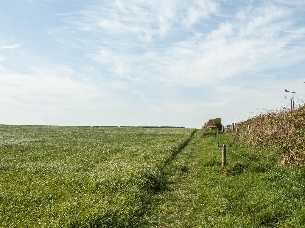
So, I walked past the Pigs Nose Inn (keeping it to my left) and turned left at the end. I stayed on this road, past some lovely thatched roofed houses, and at the road junction, picked up the trail on the other side to now walk through a series of fields.


At this point, I wasn’t hating the walk back to Salcombe. I was still quite pleased with my decision to go back this way.
After some field walking, the trail leads onto a road, where it’s a left turn. Now it’s road the whole way back. At first it wasn’t too bad. Barely any cars passed by, and I was prepared to tell you it’s a nice quiet road.


It turned out to be not that quiet. I mean, it’s not like being on a major road, but there were enough cars that it became annoying, especially as there is no pavement to walk on.
I felt like the car people were wondering what the hell I was doing up here on this road, when there is a lovely coast path nearby.
Looking on my map, I could see a few options to get off the road and take a little detour to walk back to Salcombe. I tried them. For different reasons* they were not successful and I had to turn back to get onto the road. It was like I was being punished. I made my choice, and now I must live with it.
I kept telling myself, this is all in the name or research.
*The reasons being: One took me to what I think was someones private area and garden so I quickly turned back before anyone came and shouted at me. The other one led to a mass of stinging nettles. No more needs to be said there.
I did pass by a field with cows, which broke up the monotony.

East Portlemouth and back to Salcombe
You will know you have reached East Portlemouth, because the sign tells you, but you also start to see the top of a church.


You will pass by a pretty impressive tree before reaching the one good thing about walking back to Salcombe this way…this view.

To reach the boat, walk to the other side of the small green and into the woods. There should be a sign here, pointing the way. It’s now a steep descent down the steps to reach the bottom, where you will find the boat pickup point to the right and then left.


Final thoughts on the walk from Salcombe to Prawle Point
Take the coast path back.
More walks near Prawle Point
Start Point Lighthouse – If you were to continue the walk along the coast path, past Prawle Point, you will reach Start Point Lighthouse. I didn’t do it this way. Back when I had a car, we parked over there. If you want to walk it from here, bear in mind, there is no public transport over at the lighthouse, so you would need to walk back.
Salcombe to Hope Cove – This takes you from Salcombe in the other direction along the coast path, where you will also get a view to Prawel Point. This is a fantastic walk, I would even say my favourite from the area. Hell, one of my favourites walks in England.
Gara Rock walk – This is the shortened version of the Salcombe to Prawel Point walk. It’s the same route to reach Gara Rock beach, but then you take a different route back, along a lovely mystical woodland trail.
Salcombe to Snapes Point walk – This is the shortest of all the walks, but that doesn’t make it any less good. The views on this one are mighty impressive.
Pin it for later: Salcombe to Prawle Point walk guide


