The Roaches is a rocky ridge gritstone escarpment in the Peak District National Park, and this walk takes you above and below it, with an optional scramble thrown in. It is part of a bigger stretch of gritstone rocks, which includes Hen Cloud and Ramshaw Rocks.
Fun Fact: The Roaches comes from the French word Les Roches.
Just like Stanage Edge and Bamford Edge, it is a popular spot for rock climbers, walkers and runners, so can be very busy during the summer months. Luckily, we were there during winter on a weekday at sunrise. So we had the place to ourselves (for a short while anyway).
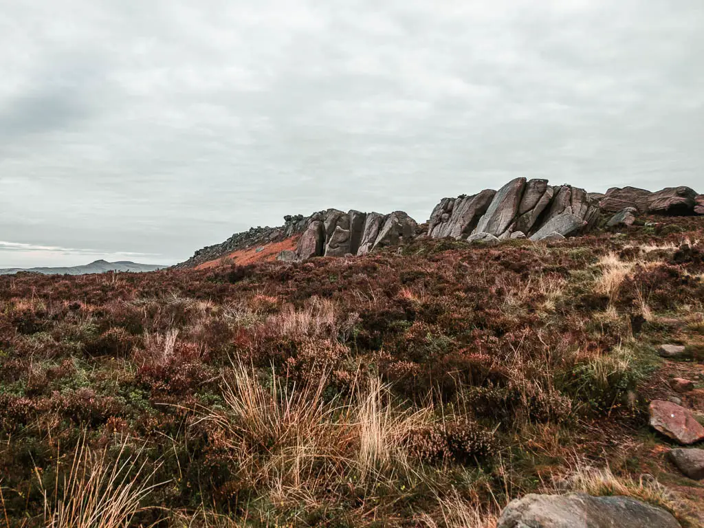
- In this guide I’m going to tell you a bit about what to expect on the walk, with full logistics, tips, and a route map for The Roaches. I will also include the optional extra route to Lud’s Church, which is nearby.
- Then I will describe the full walk with photos to show you the route.
- I will finish with suggestions/recommendations for other walks near The Roaches and in the Peak District National Park.
Read more about all the best hikes I recommend in the Peak District here
What to expect on the walk along the Roaches
The walk starts off near Hen Cloud (a big hill) on the south end of The Roaches. You will then walk along the bottom of the impressive rocky outcrop, before before a short but steep climb up to the top.
Once up the top, you will be rewarded with wild heather, and magnificent views across the Peak District. Apparently you can see as far as Snowden on a clear day. We did not see as far as Snowden. We could see the Tittesworth reservoir though.


Next you will walk along the top of The Roaches, on a gradual uphill to reach the trig point, after which it’s a gradual downhill. The terrain is quite rocky and rugged, much more so that along the top of Bamford Edge and Stanage Edge.
Up here you will also walk by a little pond thing called Doxey Pool. I didn’t know this at the time, but have since found out it is inhabited by a water spirit. The story goes, a mermaid fell into it on a foggy day, and she now entices her victims into it to die. Sounds like she is an evil mermaid now.
There I was thinking it was just flood water after the rain.
The Roaches is also known for its wildlife, and has been designated as a Site of Special Scientific interest. It is managed by the Staffordshire Wildlife Trust. One of the special birds of the area are Peregrine Falcons. These are one of the fastest birds on the planet, and can reach speeds of up to 124 miles per hour. You might also spot some red grouse about.
Lud’s Church?
You can keep the walk short and simple by sticking to The Roaches. Or you can extend the route to Lud’s Church. This is what I did, and what I will show you in the guide. I highly recommend adding in Lud’s Church. It’s a deep moss covered chasm, and provides a nice contrast to the grand views up on The Roaches.

To get there, you will descend off the Roaches to head into woodland (Back Wood). The terrain in the woods will start off a little rocky, then be a mix of dirt, wooden plank walkways, and mud to reach Lud’s Church.
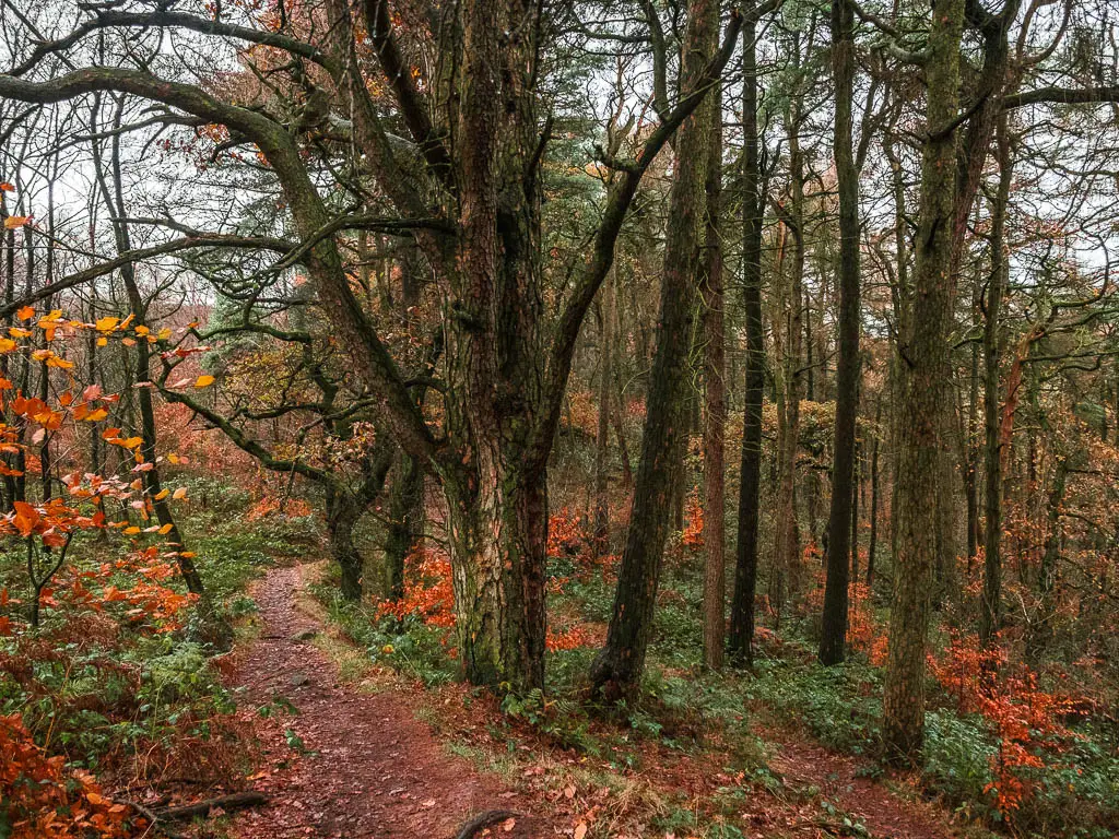

From there, you will mostly walk back to The Roaches the way you came (it changes a little at the end). I didn’t actually realise until the walk back, that I had walked a fair bit downhill to get here, which meant a lot of uphill to get back.
If you would like to keep the walk short and see Luds’ Church on a separate walk, then you can read about how to do that here.
How difficult is The Roaches Walk?
I would rate the Roaches walk as easy/moderate. Along the Roaches Ridge is pretty easy. To get up to the top is a little rocky and steep, but it’s a short walk up. If you include Lud’s Church, there are more hills and mud. It took me about 2h 30 min to complete the walk along the Roaches and then to Lud’s Church and back.
Is the route easy to follow?
Not much navigation is needed when walking along the top of the Roaches. So you can’t get lost. After you descend to head to Lud’s Church, you need to pay a bit more attention, as the way I go is different from the signpost. I take the more direct route.
Once in the woods, at all the junctions, there will be signs pointing the way to Lud’s Church.
The only difficult bit to follow, is the route I took when walking down off The Roaches when I got back. Rather than walking down off The Roaches the way I came, I tried something else, which involved a bit of scrambling, getting lost, following someone else, then unfollowing them because they decided to climb down a steep bit, finding another way down, and feeling relief at the end that I didn’t die….all will be explained later.

Parking for The Roaches
There are a number of places you can park to access The Roaches. Spaces can fill up quick, so it’s good to have a few options in mind, incase the parking you want is taken.
The easiest access will be either at Roach End or somewhere along Roach Road (where we parked). You can see where Roach End is in my walk guide below, under the header ‘Walk to Back Wood’. It’s not marked on Google Maps. It’s just by Bearstone Rock, which should be marked on Google Maps though. This isn’t an official parking area, but rather, a roadside where you can park.
We parked on Roach Road (which will be how I describe the walk below). All along the road, near the southern end of The Roaches, there are marked parking bays (free parking at the time of writing). We parked in the one just next to Hen Cloud.
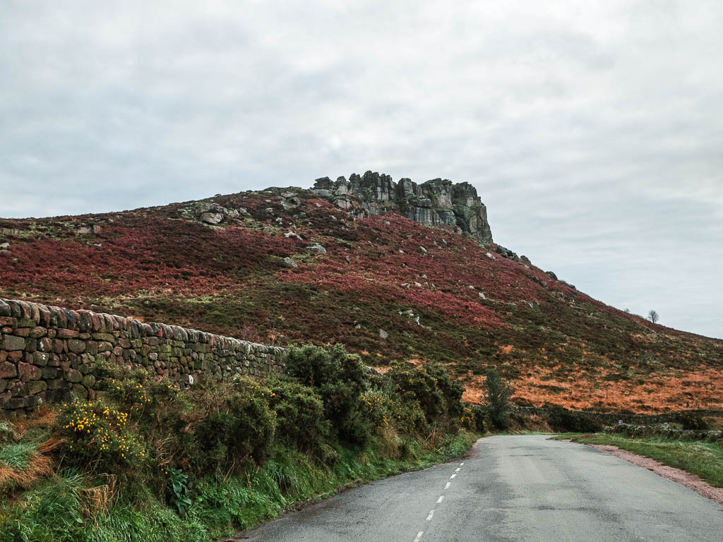
Or, you can actually park in a car park near to Lud’s Church, which is free (at the time of writing). You can see where the car park is in my Lud’s Church route guide here. This will only work if you are including Lud’s church in the Roaches walking route.
Logistics for The Roaches walk via Lud’s Church
- Start/Finish: Roach Road – In the bit between Hen Cloud and The Roaches. Postcode ST13 8UA.
- Where is it: The Roaches is located in the Staffordshire Peak District. Just north of the town of Leek.
- Alternate start: Any of the car parks mentioned above.
- Public Transport: The nearest bus is the 108 which takes you to Upper Hulme. It runs between Buxton, Leek, and Ashbourne. From Upper Hulme, it’s about a 15 min walk to reach Hen Cloud and the Roaches. The nearest train station is at Buxton.
- Distance: 6.5miles there and back
- Time: 2h 30min
- Difficulty: Moderate
- Terrain: Rocks, dirt, mud, optional scramble
- Time of year: We did this in winter
- Dog friendly: The area is open access land, and dogs must be kept on a short lead between 1st March and 31st July due to ground nesting birds. No stiles. No livestock spotted.
- Amenities: None along the route itself. Slightly further south along Roaches Road is the Roaches Tea rooms and restaurant.
Top Tips for the walk
- Windproof jacket for any wind attacks when up walking along The Roaches, as it’s quite exposed up there.
- Hiking boots for sure. If you just plan to walk The Roaches, you could get away with trainers. For the full route to Lud’s Church, you will want those boots. It can be extremely muddy in wet weather.
- It’s a popular place, so head out early to avoid the crowds. Especially during peak times such as the summer, or school holidays.
- Mark on Google Maps alternate parking spots, incase the one you want is taken, so you don’t have to faff about trying to figure out where to go next.
- If you don’t want to walk The Roaches and Lud’s Church in one go, then I recommend at least going to Lud’s Church on another day. It would be a shame to miss it out.
- If you want to make the walk longer, start at Ramshaw Rocks, then work your way along to Hen Cloud, and then the Roaches.
Map for The Roaches walk via Lud’s Church
You can find my more detailed route map for The Roaches walk on Alltrails
Route Description for the Roaches walk
Starting from our spot, there is a gate in the wall. Go through it and walk up towards the big rock formations you see ahead (AKA The Roaches). We chose the trail alongside the wall, and turned left onto the big wide grass trail when we reached the gate.
The big hill and rocks you will see to the left is Hen Cloud. If you want to go up to the top of Hen Cloud, go through the gate. We decided not to do that. We weren’t in the mood for making the walk harder than it needed to be.


Following the wide grass trail, it will lead you to another gate, and then up a trail surround by little rocks to get you to the bottom of the big boy.


At this point, follow the trail along the bottom of the rock face. It’s easy to loose it a little, but as long as you keep the rock face to your right, you should be good.


At some point, you should find yourself on a more obvious trail, then when you reach the junction, turn right for a short but steep walk up to the top of The Roaches. Once up the top, turn left and away you go.


Walk along the top of The Roaches
I was a little surprised by the terrain up here. I was expecting something similar to Stanage Edge and Bamford Edge. Instead, it’s a different kind of rugged and rocky, and you will continue to walk on a gentle incline until you reach the trig point further along. Just like the other edges though, there are fantastic views all around.
It was somewhere along here that Ollie and I went our separate ways. He wasn’t in the mood for a big walk. I was.


After the trig point, which is the highest point, you will start to walk downhill. First on a dirt rugged trail, then on a stone paved trail.

Walk to Back Wood
When you reach the road, cross over it, then go through a gap in the wall for small people. If you can’t fit through the gap, you can go left to walk around the wall.

Note: This is Roach End. You can park on the road here if everywhere else is full.
Through the wall, the sign will tell you to go straight for Lud’s Church. Don’t do that. Instead, take an immediate right to walk through the mini gate. Then follow the trail down alongside the wall, and this will lead you into the woods.


Through the woods
Once you enter the woods, the terrain will be a little rocky as you continue to descend. Then once you reach the wooden trail signpost, turn left to follow the directions to Lud’s Church.
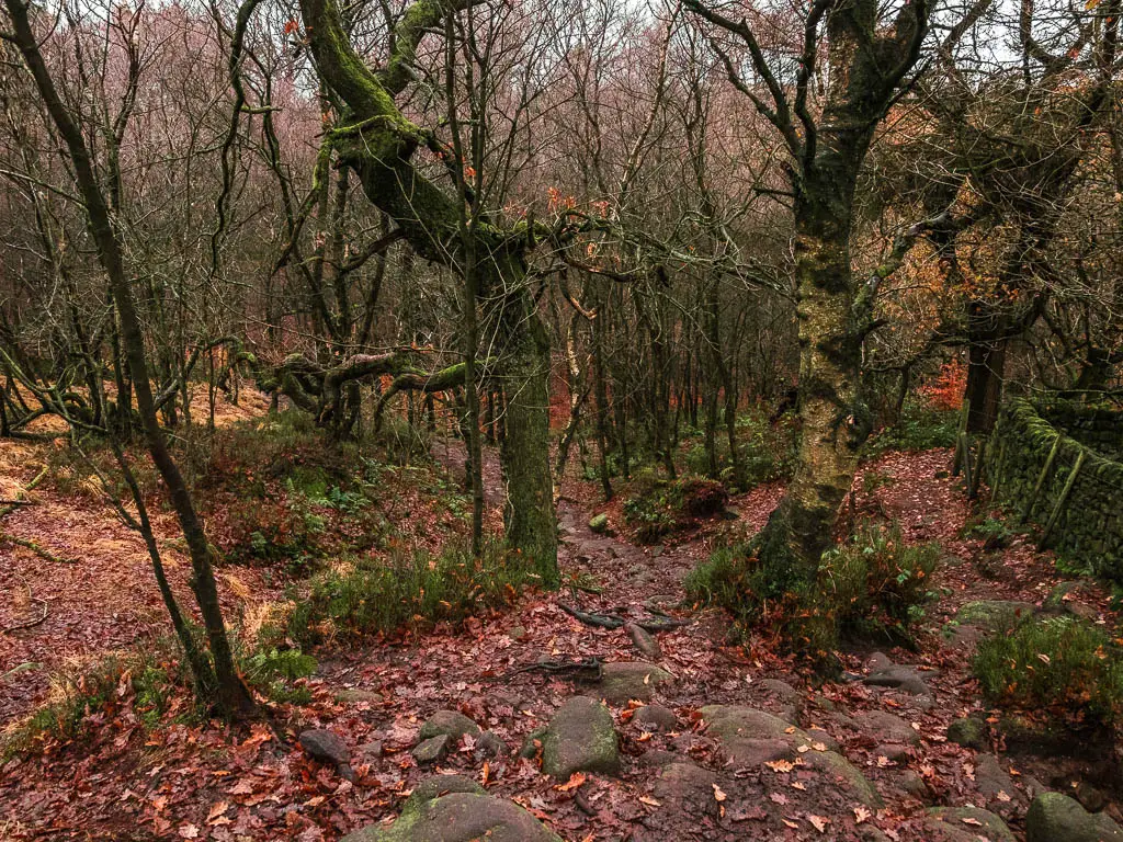


There is a little bit of uphill walking before the trail levels out. Then when you reach the next trail signpost, follow it left again. This will lead you to the wooden plank walkway.


Head to Lud’s Church
Follow the plank walkway which comes and goes, and you will know you have reached Lud’s Church when you see a big gorge below to the right.

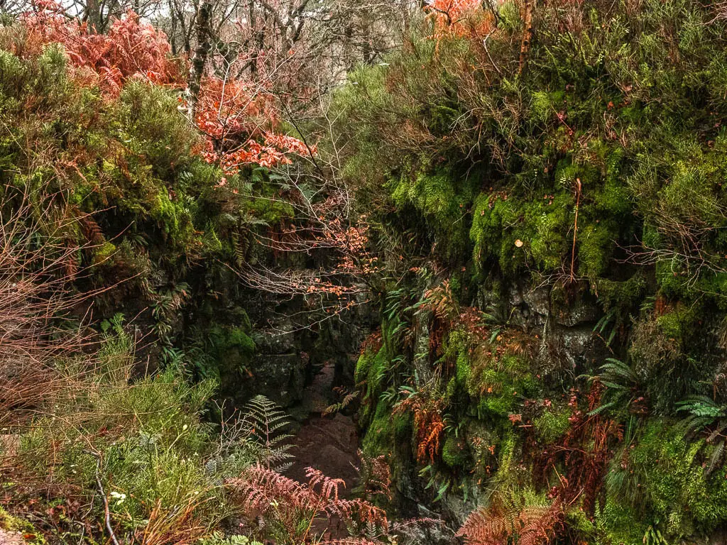
Now walk down and through it. There are some steep steps to get you down, then some more rocky bits and steps after. The direction you want to take when you are down there is left, to walk you through the deep chasm.


This was the second time I had been here, and just like last time, I was all alone. I had heard it can get busy here, so I really lucked out.
As you walk through, on the other side there is a section that can be quite muddy. Just a warning. Then once out the other end, turn right on the trail to start the walk back to The Roaches. Now another warning. This next bit can be very very muddy. More muddy than anything that has happened so far. So if you want to avoid that, turn around and walk back to The Roaches the way you came.
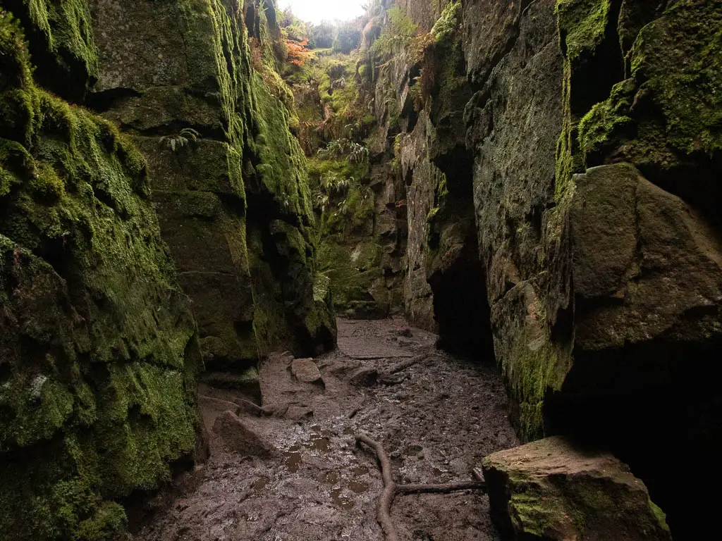
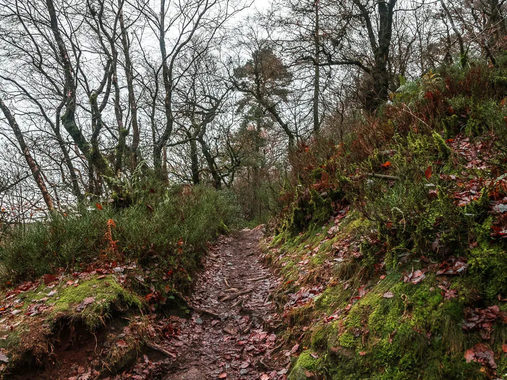
Walk back to The Roaches
If you are following my route, then turn right when out of Lud’s Church. There is only one trail, so just keep following it. With regards to the mud, for some parts, little trails have been formed around it, probably from other people trying to avoid it. So you can take those where possible.

When you reach the wooden trail signpost, continue straight following the direction for The Roaches. You will now be on the trail you got here on. Keep going, then at the next trail signpost turn right.


Good news, from here the route is easy to follow to get back to The Roaches. Bad news, it’s a big uphill. Bigger than I remembered when I walked down it.


Walk along the Roaches to Hen Cloud Viewpoint
Once back through the mini gate and small person gap in the wall, head back along the Roaches, and walk all the way to the other end. Past the point where you walked up onto The Roaches at the start.
I’d just like to point out, that it was noticeable much busier now. At 9am the road was lined with cars and the trail was a little more congested with walkers.

When you reach the very end, you will have a gorgeous view of the rocks below and to Hen Cloud ahead.

To get down from here, you need to now make a decision. If you don’t fancy rock scrambling, walk back and find the point where you walked up at the start. Otherwise follow me (kind of)….
Scramble down off the Roaches
Now, walk a little way back from the viewpoint to the junction in the photo below (I’m also standing facing the direction of Hen Cloud), and from there turn left, and if you squint a little, you should be able to see a trail past some of the rocks:


On my map, you may notice on offshoot red line. That’s because I went wrong here at first, and found myself on a sheer, steep rock face. I wasn’t about to attempt that so turned back.
Now, follow that trail over the rocks. At times it’s not obvious, and I did get a little lost. Then decided to follow some people who looked like they knew what they were doing….


That is until they started to climb down a sheer drop. I was not about to do that. Partly because at this point, my hands were so cold they were numb. I had no dexterity. My hands were useless, and were now placed down my pants trying to warm up.
Read more: Tips of keeping warm when winter hiking
The nice trail
I looked around and found another trail which seemed more user friendly. If you manage to find this nice trail, first of all, well done. Second of all, the hard part is over, and you can just follow it as it guides you first to the left, then around to the right, where you should be able to figure out where you are.


I must say, there was a moment up there where I was regretting not walking down off the Roaches the way I came. My hands were way too cold to deal with the rocky adventure. So I was very relieved when I got to this point. I also noticed up ahead, those girls who had climbed down that bit I bailed out of. They made it down alive.
More similar walks to The Roaches
If you like big rock faces, then you should check out Stanage Edge and Bamford Edge. Stanage Edge in particular is quite special. The landscape is unlike anything I have seen. Both of these I have done as a larger circular walk, however, you can keep them short if you wish, and just explore the trail on the top of the rocks.
Derwent Edge, located just across the reservoir from Bamford Edge is pretty cool, with lots of Tors and amazing views. Including down to the Ladybower reservoir, which has a pretty walking trail around it.
The Great Ridge from Mam Tor is wonderful, with a gorgeous view into the valleys on either side. Then later the walk takes you through the enchanting Cave Dale.
If you aren’t afraid of heights, then you should check out this Chrome Hill walk. It takes you along two hills, which look like a Dragon’s Back from the right angle. Scrambling is involved in this one.
For more from the Peak District, you can read about all the best walks I recommend here
Pin it for later: The Roaches walk guide in the Peak District National Park


For more ideas of things to do in the area, you can check out the Visit Peak District website.
